notification

Great News, From June 2025 Mount Kailash is open for individuals holding Indian Passports

Lukla Airport: The Ultimate Gateway to the Everest Region

A Comprehensive Guide to History, Thrills, and Sustainable Trekking

Nestled precariously on a cliff edge in the formidable Khumbu region of Nepal, Tenzing-Hillary Airport, universally known as Lukla Airport, is far more than just a strip of tarmac. It is a legend, a bottleneck, a nerve-wracking spectacle, and for thousands of adventurers each year, the unequivocal starting pistol for the journey of a lifetime to the foot of Mount Everest. This comprehensive guide delves into every facet of Lukla, from its heart-pounding aviation and rich history to its critical role as the gateway to the world’s most famous trekking routes, all while integrating the latest trends and keywords shaping the modern Everest trekking experience.

The Airport Itself – An Engineering Marvel and Adrenaline Primer

Lukla Airport is not merely an airport; it is an experience that begins the moment you board the tiny twin-engine aircraft in Kathmandu. Its reputation as one of the world’s most dangerous airports is both a source of trepidation and a badge of honor for those who traverse it.

Location and Topography: A Recipe for Drama
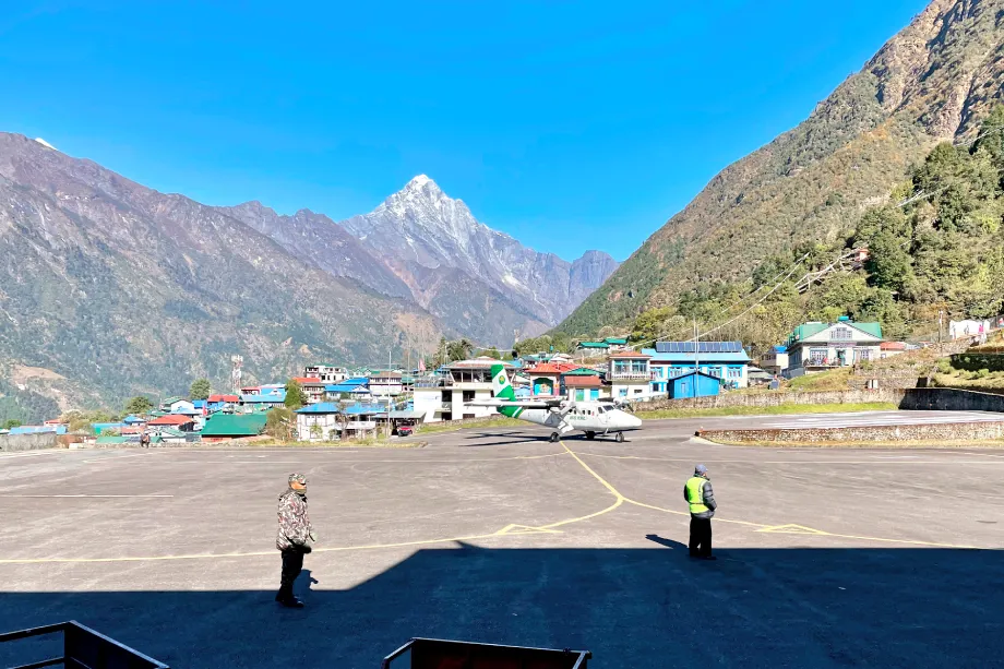
Situated at a dizzying elevation of 2,845 meters (9,334 feet), the airport is carved into the side of a mountain. The topography dictates its unique and challenging design:

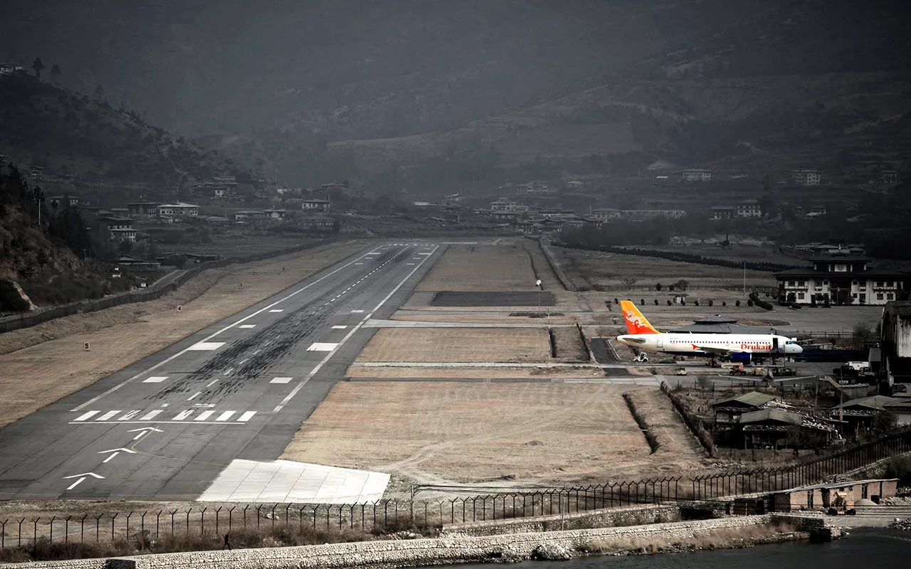
  • The Runway: It features a single runway, famously coded as 06/24, which is only 527 meters (1,729 feet) long and 20 meters (66 feet) wide. For context, a standard international airport runway is over 3,000 meters long. This brevity is non-negotiable.

  • The Gradient: The runway has a staggering 12% gradient. It slopes uphill for landings (from the 06 end) and downhill for takeoffs (from the 24 end). This ingenious design helps slow landing aircraft naturally and assists taking-off aircraft in gaining speed more quickly, acting as a mechanical assist for the thin mountain air.

  • The Drop: The northern end of the runway (06) terminates at a stone wall and the village of Lukla, while the southern end (24) drops off precipitously into a deep valley hundreds of meters below. There is no room for error—an overshoot on landing or an undershoot on takeoff has catastrophic consequences.

    Luggage Loaded at Plane in Luka
    Luggage Loaded at Plane in Luka

The “Lukla Experience”: Flying from Kathmandu
The flight from Tribhuvan International Airport (KTM) in Kathmandu to Lukla (LUA) is a bucket-list item in itself.

  • Aircraft: The route is exclusively served by small STOL (Short Take-Off and Landing) aircraft, primarily the De Havilland Canada DHC-6 Twin Otter and Dornier Do 228, operated by reputable Nepali airlines like Yeti Airlines, Tara Air, and Summit Air.

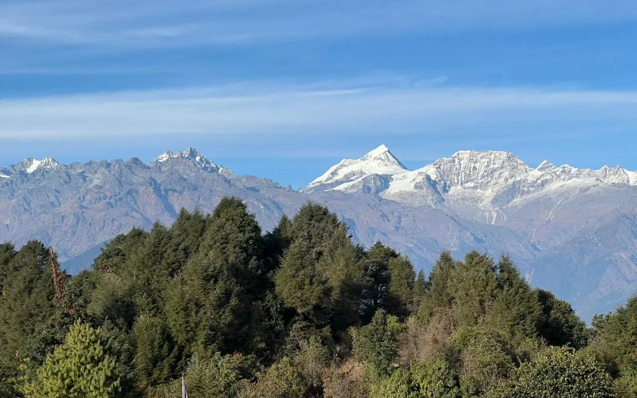
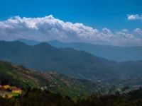
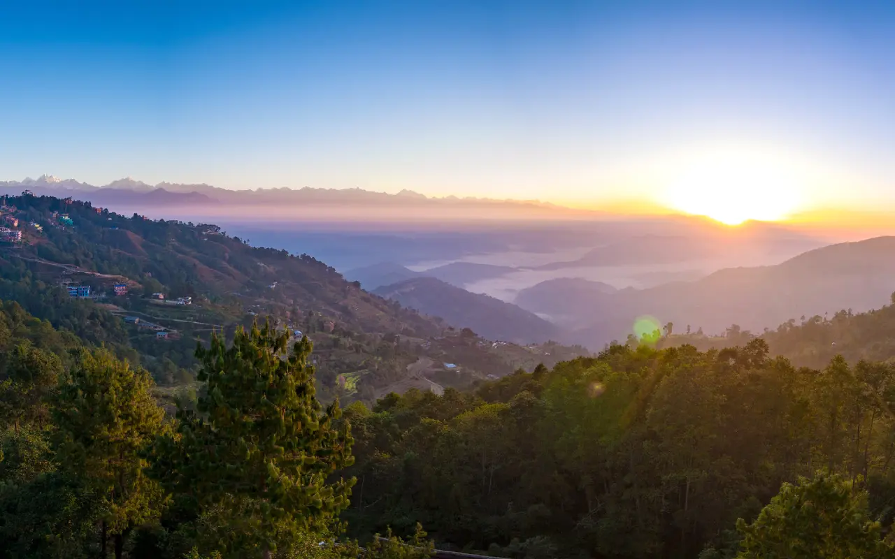
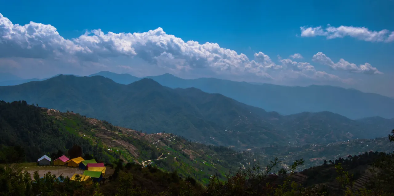
  • The Scenic Flight: On a clear day, the 25-35 minute flight offers unparalleled, jaw-dropping views of the Himalayan range. The sight of peaks like Langtang Lirung, Ganesh Himal, and eventually, the Everest massif itself, is a breathtaking prelude to the trek.

  • Weather Volatility: The keyword here is “Lukla weather forecast.” The weather in the mountains is notoriously fickle. Conditions can change in minutes, leading to frequent “Lukla flight delays” and “Lukla flight cancellations.” Pilots require visual flight rules (VFR) conditions, meaning they must be able to see the runway to land. Low cloud cover, high winds, or precipitation can halt all operations, sometimes for days. This inherent uncertainty is a critical factor for trekkers to build into their itineraries.

Safety Record and Modernization: Addressing the “World’s Most Dangerous” Tag
Lukla’s reputation, while dramatic, has been the focus of significant safety improvements.

  • Pilot Expertise: The pilots flying to Lukla are among the most experienced and highly trained in Nepal, undergoing rigorous certification specifically for this route.

  • Infrastructure Upgrades: Recent years have seen improvements, including the paving of the runway (it was previously gravel), enhanced drainage, and better perimeter fencing.

  • Technology: While still a visual approach, communication and navigation aids have been incrementally improved. The discourse around an “alternative to Lukla flight” is growing, primarily pointing to the road network and helicopter services.

  • Safety Statistics: It is crucial to contextualize the “dangerous” label. While accidents have occurred, the vast majority of the tens of thousands of annual flights operate without incident. The airlines and regulatory bodies treat this route with the utmost seriousness.

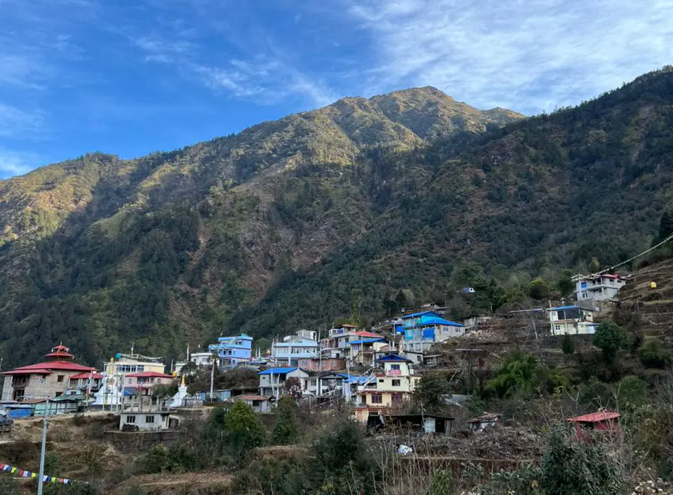
The Gateway to the Everest Region – Stepping into the Khumbu

Touching down in Lukla is a moment of pure elation and relief. You have arrived. The airport ramp is a chaotic, fascinating hub of activity—trekkers donning boots, porters loading impossible weights, and planes roaring in and out. From here, the adventure on foot truly begins.

Immediate Acclimatization: The First Step is in Lukla
Lukla’s altitude (2,845m) is your body’s first introduction to “high-altitude trekking.” It is strongly advised to spend at least one night in Lukla or a nearby lower village like Phakding to begin the vital process of acclimatization, a core principle of “AMS prevention” (Acute Mountain Sickness).

The Core Trekking Routes from Lukla
Lukla is the access point for a network of trails that cater to a wide range of ambitions, fitness levels, and timeframes.

  • The Everest Base Camp Trek (EBC Trek): The classic, world-famous journey. The standard itinerary is 12-14 days round-trip from Lukla. The trail winds through the Dudh Koshi valley, passing through villages like Namche Bazaar (the bustling Sherpa capital), Tengboche (with its iconic monastery), Dingboche, and Lobuche, before culminating at Gorak Shep and the final push to Everest Base Camp (5,364m). The side trip to Kala Patthar (5,645m) for the best panoramic view of Mount Everest is a non-negotiable highlight.

  • The Three Passes Trek: For the more adventurous and experienced, this is the ultimate Khumbu challenge. This demanding 18-20 day circuit crosses three high passes over 5,000m: Kongma La, Cho La, and Renjo La. It incorporates the EBC trail but offers a more complete, less crowded, and spectacularly rugged experience of the region.

  • The Everest View Trek: A shorter, less strenuous option ideal for those with limited time or who wish to avoid the highest altitudes. This 5-7 day trek typically goes as far as Namche Bazaar and the Everest View Hotel, offering stunning vistas of Everest, Lhotse, and Ama Dablam without the commitment to reach Base Camp.

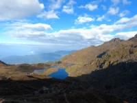
  • Gokyo Lakes Trek: A beautiful alternative to the classic EBC route, this trek leads to the turquoise, pristine Gokyo Lakes. It involves climbing Gokyo Ri (5,357m) for a different but equally magnificent view of Everest and the massive Ngozumpa Glacier.

    Everest Base Camp Trek is not an ordinary journey, and thus, you may have watched many films on YouTube about […]
    14 Days
    Moderate

    US$ 1300

    View Detail

The Evolution of the Trekking Experience
The experience of trekking in the Everest region has evolved dramatically, influenced by technology, comfort, and a growing awareness of sustainability.

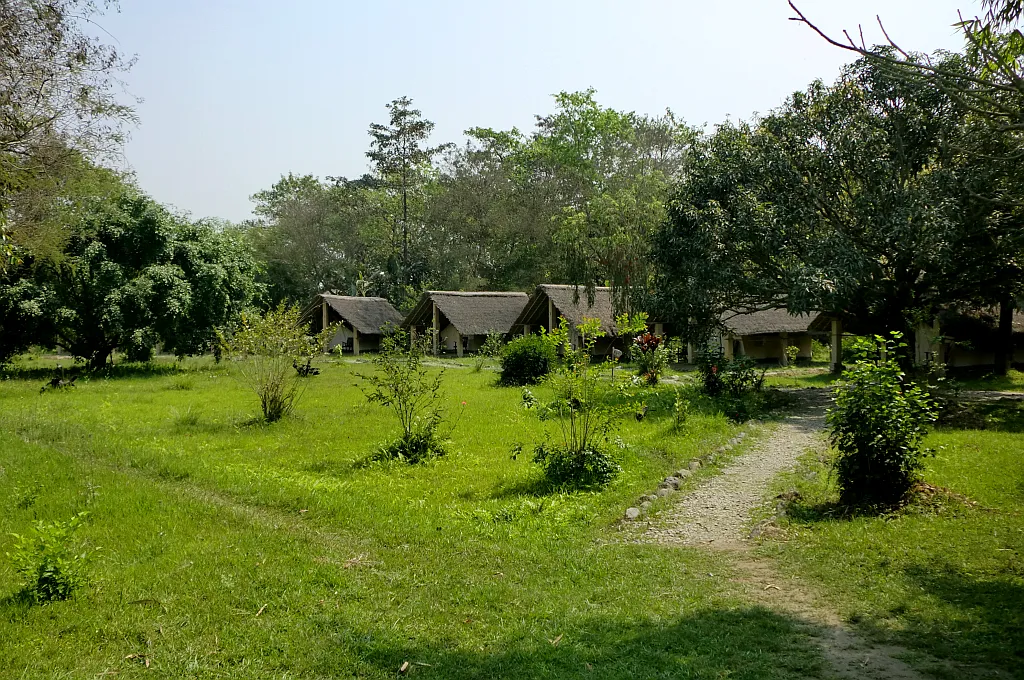
  • Teahouse Trekking: The classic “Everest teahouse trek” remains the standard. This involves staying in family-run lodges along the route, providing a bed and meals. The quality and comfort of these teahouses have improved significantly, with many now offering hot showers (for a fee), Wi-Fi, and extensive menus.

  • Luxury Trekking: The rise of luxury Everest Base Camp trek caters to those who want the adventure without sacrificing comfort. This involves staying in upgraded lodges (like the Yeti Mountain Home chain) or even on “Everest glamping” trips, where trekkers sleep in comfortable, heated pods or domes. These packages often include private bathrooms, finer dining, and more comprehensive support.

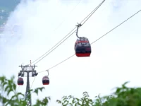
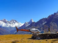
  • Helicopter Tours and Sagarmatha National Park: “Everest helicopter tour” has become a popular keyword. For those who cannot trek or wish to cap their journey with an unforgettable flight, helicopter services from Kathmandu or Lukla offer day trips to Base Camp or the Gokyo Valley. Furthermore, entering the “Sagarmatha National Park” (a UNESCO World Heritage Site) is mandatory, and the permit checkpoint is just beyond the entrance at Monjo.

  • Digital Connectivity: The question “Is there Wi-Fi on the Everest Base Camp trek?” is now commonplace. The answer is yes, but it comes at a cost. Services like Everest Link provide paid Wi-Fi cards at most teahouses, allowing trekkers to stay connected, albeit with limited bandwidth.

Beyond the Flight – Alternatives, Logistics, and Preparation

The Lukla flight is the primary gateway, but it’s not the only one. Understanding the alternatives and preparing for the logistics is crucial for a successful trip.

The Lukla Flight Alternative: A Ground-Based Approach
The uncertainty of Lukla flights has popularized an “alternative to Lukla flight.” The most common is to take a 4-5 hour drive from Kathmandu to Manthali Airport in Ramechhap during the peak trekking seasons (Spring and Autumn). From Manthali, the flight to Lukla is shorter and more reliable, as it is less prone to the morning fog that often blankets Kathmandu. This adds a logistical step but significantly increases the chance of flying on schedule.

For the ultimate adventurer, a “road trip to Jiri” or Salleri, followed by a multi-day trek to join the main trail at Phakding or Namche Bazaar, is possible. This was the original approach used by early expeditions before Lukla Airport existed and adds a week or more to the journey, but it provides a more gradual acclimatization and a deeper cultural immersion.

Helicopter Services: Rescue, Tours, and Transfers
Helicopters are an integral part of the Khumbu ecosystem.

  • Emergency Evacuation: In cases of “AMS” or other medical emergencies, helicopter rescue is often the only option. “Travel insurance” that covers high-altitude helicopter evacuation is not a recommendation; it is an absolute necessity.

  • Lukla Helicopter Transfer: For groups or individuals facing prolonged flight cancellations, chartering a helicopter to or from Lukla can be a time-saving, albeit expensive, solution.

  • Helicopter Return from EBC: A growing trend is the “Everest Base Camp trek with helicopter return.” This involves trekking all the way to Base Camp but then taking a helicopter from Gorak Shep back to Lukla or even Kathmandu, saving several days of return trekking and offering a phenomenal aerial perspective.

    Everest Base Camp Trek with Helicopter Return is a package that allows you to dive into the enormous nature of […]
    11 Days
    Moderate

    US$ 3600

    View Detail

Critical Pre-Trek Preparation

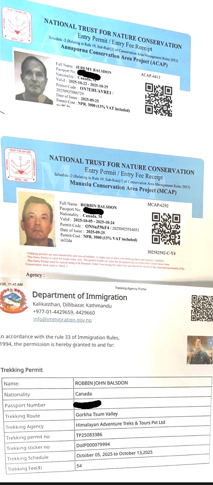
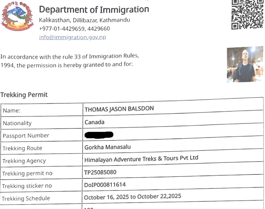
  • Permits: Two permits are required for the EBC trek: the “Sagarmatha National Park Entry Permit” and the “Khumbu Pasang Lhamu Rural Municipality Entrance Permit.” The latter can now be obtained in Lukla itself, simplifying the process.

  • Guides and Porters: The debate of “Everest Base Camp guide vs independent trek” is ongoing. While independent trekking is possible, hiring a local guide from a “reputable trekking agency in Nepal” is highly recommended. Guides provide invaluable support for navigation, acclimatization, cultural interpretation, and dealing with teahouses. Porters can carry your main bag, vastly improving your trekking experience and supporting the local economy.

  • Physical Fitness: The trek is demanding. A dedicated “Everest Base Camp training” regimen for 2-3 months prior, focusing on cardiovascular endurance and leg strength, is essential.

  • Packing List: A precise “Everest Base Camp packing list” is key. It must include broken-in hiking boots, a high-quality down jacket, a four-season sleeping bag, layered clothing, a comprehensive first-aid kit, and water purification methods.

The Human and Environmental Dimension – A Changing Khumbu

Trekking to Everest is not just about the mountain; it’s about the people and the fragile environment.

The Sherpa Culture: The Heart of the Himalayas
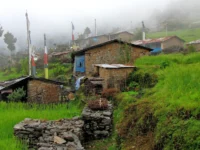
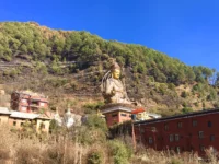
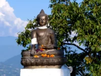
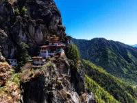
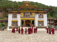
The Khumbu is the homeland of the Sherpa people. Their rich “Buddhist culture” is evident in the numerous “monasteries” (like Tengboche), “mani walls,” and “prayer flags” that line the trails. Respecting their traditions and religion is paramount. The term “Sherpa” itself refers to an ethnic group, not just a profession. Many Sherpas work as high-altitude guides and porters, and their unparalleled strength and knowledge of the mountains are the backbone of the trekking and climbing industry.

Sustainable Trekking and Environmental Concerns
The immense popularity of the region brings significant environmental challenges. The concepts of “sustainable tourism in Nepal” and “zero-impact trekking” are more critical than ever.

  • Waste Management: The issue of litter, particularly “plastic bottles on Everest,” is a major problem. Trekkers are strongly encouraged to use reusable water bottles and purification tablets/filters. “Packing out what you pack in” is a minimum standard.

  • Climate Change: The effects of “climate change on the Himalayas” are visibly accelerating. Glaciers like the Khumbu are receding at an alarming rate. This not only alters the landscape but also affects water sources for local communities.

  • Supporting the Local Economy: Choosing local teahouses, hiring local guides and porters, and buying local crafts are ways to ensure that tourism revenue benefits the communities that make the trek possible.

  • Social Initiatives: Many trekking companies now partner with or support “Sagarmatha Pollution Control Committee (SPCC)” and other local NGOs focused on clean-up, education, and sustainable development.

    Lukla Airport View
    Lukla Airport View

The Future of the Gateway – Challenges and Innovations

Looking ahead, Lukla Airport and the Everest region face a future shaped by increasing demand and the need for sustainable management.

  • Infrastructure Pressures: The single-runway airport at Lukla is operating at or near capacity during peak seasons. There is ongoing discussion about building a new, larger airport in the region, perhaps at a lower altitude like in Surkhe, to handle more traffic and larger aircraft. However, this is a complex and controversial proposition.

  • Managing Overtourism: The trails, especially to Namche Bazaar and around Gorak Shep, can become congested. Staggering trekking seasons, promoting alternative routes like the Gokyo Lakes or Three Passes, and implementing stricter visitor management policies may be necessary to preserve the wilderness experience.

  • Technological Integration: The continued improvement of “digital payment in Nepal” (like e-sewa and Khalti) is slowly making its way to the mountains, reducing the need for trekkers to carry large amounts of cash.

  • The Helicopter Question: The increasing use of helicopters for tourism, while economically beneficial, raises concerns about noise pollution, environmental impact, and a potential shift in the character of the trekking experience from a wilderness pursuit to a more commodified adventure.

Conclusion: More Than a Runway, A Rite of Passage

Lukla Airport is a symbol. It symbolizes the immense challenge and allure of the Himalayas. The white-knuckle flight, the short, sloping runway, and the sudden immersion into the thin, cold air of the Khumbu are a potent initiation ritual. It is the dramatic, unforgettable prologue to an epic story—a story of walking among giants, of pushing personal limits, of encountering a resilient culture, and of standing in the shadow of the world’s highest peak.

From the essential logistics of “Lukla flight booking” and “AMS prevention” to the modern trends of “luxury lodges” and “helicopter returns,” a journey through Lukla requires careful planning and a respectful approach. It is a fragile ecosystem, both environmentally and culturally, that demands responsible travel. To pass through Lukla is to become part of a long lineage of adventurers, and in doing so, to take on the responsibility of preserving this extraordinary gateway for the generations of dreamers who will follow.

Aama Yangri: The Holy Mountain of Helambu and Its Mythical Origins

Aama Yangri, or Ama Yangri, is a scenic hill over the green valley of Helambu. People living in the area feel that it safeguards their land. It lies about 80–90 km northeast of Kathmandu, in Sindhupalchok (Helambu). The path to Aama Yangri passes through serene Sherpa and Tamang villages around Helambu, which lies within or adjacent to the Langtang region; parts fall under Langtang National Park depending on the route.

Clear days usually show Langtang, Jugal, and Ganesh ranges; distant Annapurna, Manaslu, and even Everest are sometimes visible. It is called the Poon Hill of Kathmandu by many visitors due to its easy accessibility as well as its amazing views of the mountains. The name Aama Yangri itself tells the story. In the local language, “Ama” means “mother” and “Yangri” is a revered feminine title – together, the peak is the “Mother Protector” of Helambu.

Hyolmo tradition holds that the mountain is a concerned dakini (female deity), whose snowy form brings blessings and safety to those who dwell in her shadow. Sherpa villagers often begin journeys by gazing once more at Aama Yangri, believing even a last glimpse of the peak imbues them with long life and fortune.

Aama Yangri trek
Aama Yangri trek

Spiritual Significance to Helambu’s Sherpas

For the Sherpa (Hyolmo) and Tamang people of Helambu, Aama Yangri is not just a mountain peak – it is a living goddess. Everyone knows Aama Yangri as a protective mother figure: for them, she is a Dakini, “a goddess protector of the entire region” whose compassionate power shields the valley from misfortune.

In fact, a Sherpa guide once noted that “Yang” can mean “wealth” in their language, and “Ri” means “peak,” so Ama Yangri could also be read as the “Peak of Wealth and Prosperity.” Locals believe that as long as she watches over Helambu, the crops will grow, the weather will be gentle, and accidents will be rare.

This belief shapes daily life. Monasteries and stupas in the region often honor Aama Yangri as a local deity. Along the trail, colorful prayer flags and mani stones bear her name. Even the ordinary village festivals can have small offerings to the mountain.

The guides at Himalayan Adventure Treks underline the fact that respect and sacrifice to Aama Yangri is an entrenched idea: failing to serve her or righting the statues are said to invite bad weather and misfortunes, whereas incense and butter lamp offerings are said to bring good harvests and community good fortune.

This fusion of nature worship and Buddhism gives the trek a uniquely spiritual feel. The monks of local gompas (monasteries) occasionally lead pilgrims on morning-long pujas (prayers) dedicated to Aama Yangri, and villagers listen for her answer in the rising sun.

Simply gazing up at the mountain is considered a blessing – the Hyolmo say even the act of seeing Aama Yangri can grant you health and good luck. In brief, this is a holy mountain and the mother who takes care of Helambu in short ,and climbing to its top is more of a spiritual pilgrimage than a physical one.

Tradition and Mythical Tales

The experience around Aama Yangri is rich with myth. According to local legend, at the start, one myth tells of a mighty serpent dragon that lives in a small lake on the mountain’s western flank. Hyolmo storytellers describe it as a “fierce” creature, and indeed a mural in the Tarkeghyang monastery portrays Aama Yangri riding this dragon into battle. This story belongs to the Hyolmo oral tradition and appears in local community blogs and monastery folklore; it is not a verified historical event.

The dragon’s muddy lake supposedly fills only after the monsoon and is considered the goddess’s hidden water spirit. This tale echoes how the locals see Aama Yangri as powerful and protective – even the wildlife around her base is wrapped into mythology.

Locals say another legend centers on a weather frog at the summit. Local people tell this as a myth explaining sudden storms on the mountain, not a documented fact. Above the main chorten (stupa) atop Aama Yangri is a small meditation shrine set before a lone prayer-flagged bush. Encased within it is a stone said to form a frog shape. By legend, if a trekker were ever bold enough to touch this frog-stone, immediate storms and bad weather would descend to punish the act.

Aama Yangri

The villagers claim this stone’s water must never dry, or the rains will fail throughout the valley. These stories – of dragon guardians and mystical frogs – show how even the elements on Aama Yangri’s slopes are woven into its sacred aura. Centuries ago, local tradition tells of a monastery once standing at the summit.

According to Hyolmo oral legends, a tantric yogi named Meme Surya Seng-ge built a temple here around 1723, and lightning is said to have struck it seven times. These accounts come from oral history, not written records.

He and his followers consecrated the site, believing its energy so powerful that witnessing the rituals would free devotees from negative rebirth. Legend says that on the day of consecration, lightning struck the temple seven times, ultimately burning it down – but with the yogi still meditating unharmed inside.

The local stories suggest the mountain itself intervened to keep its powers pure. This lightning story is passed down in the Hyolmo oral tradition and is not supported by written historical records.

These mythical histories – protector dakini, dragon-entwined deity, living weather spirit – may sound fantastical, yet they embody Aama Yangri’s role in Helambu culture. They teach that this mountain is alive with its own spirit. Trekkers today may only see prayer flags and a crumbling chorten, but those symbols echo legends passed down through generations.

Pilgrimages and Rituals

To this day, Ama Yangri’s summit is a pilgrimage site. Every year on the full moon of Chaitra (around March/April), thousands of Sherpa and Tamang villagers make the trek to honor the “Mother Protector”. Predawn on that holy morning, torchlights snake up the mountain path as families carry butter lamps and offerings.

By sunrise, the summit is a festival: monks conduct hours-long pujas to greet Aama Yangri, and the community dances and sings in. Sherpa tradition pours out in local libations – chang (barley beer), raksi (corn or apple wine), and butter tea are shared freely as everyone soaks up the first rays of light. When the sun rises above the horizon, the mountain is bathed in gold, and the crowd cheers in unison, feeling the goddess’s blessing in the rosy dawn.

Even outside of the full-moon festival, the summit holds constant reminders of reverence. A white chorten (Buddhist shrine) crowns Aama Yangri’s highest point, circled by prayer flags left by pilgrims. Trekkers often add their own flag or kata (ceremonial scarf) before descending.

One local itinerary describes the summit chorten (shrine) – sometimes called Ama Yangri Zangdok Palri in local texts as a place “where the deity Ama Yangri protects the entire valley” and where wishes are believed to come true if prayed for at the top.

Through Himalayan Adventure Treks and local guides, visiting trekkers can sometimes participate quietly in these rituals – lighting incense or joining the morning chanting. Whether on festival day or a regular trek, the summit experience is solemn.

You might sip hot yak-tea as the sherpa owner tells tales of the mountain, or quietly stand among pilgrims in awe of the peaks. In either case, reaching Aama Yangri’s shrine feels like arriving at a natural temple, where the line between tourism and pilgrimage beautifully blurs.

Helambu trek is one of the most culturally rich and scenic destinations of Nepal, lying just north of Kathmandu. Helambu […]
9 Days
Moderate

US$ 800

View Detail

The Ama Yangri Trek: Route, Difficulty, and Highlights

The trek to Aama Yangri is often offered as a short 2–3 day trip from Kathmandu, making it accessible to many adventurers. Typically, day one begins early with a drive to Helambu. From Kathmandu’s Chuchhepati bus stand or KTM airport, travelers can take a jeep or local bus toward Melamchi.

The scenic 5–7 hour drive winds through terraced farms, villages of Sindhupalchok, the market town of Melamchi Bazaar, and finally to the Sherpa village of Tarkeghyang (2,600m). Many routes pause at Timbu, a halfway village, where one can trek in or catch a vehicle on a dirt road to Tarkeghyang. Tarkeghyang is the jumping-off point: it lies just under Aama Yangri and has lodges and tea houses for a night’s rest.

The core hike is usually done very early on day two. Start from Tarkeghyang (2,600 m); climb about 1,100–1,170 m to reach 3,771 m; allow 4–6 hours for the ascent depending on pace. It is a moderate to challenging climb: steep switchbacks gain roughly 1,100 meters over about 4–6 hours. The initial forest sections are cool and mossy, then above the tree line, you emerge into the open alpine zone.

Along the way, colorful prayer flags and chortens mark the path in true Himalayan style. By around mid-morning or noon, trekkers reach the bare summit ridge at 3,771m. Despite the strenuous final ascent, the reward is unforgettable.

From the peak, 360-degree panoramas stretch to the giants of the Himalayas. Langtang Lirung and the Langtang range dominate one side, Ganesh and Dorje Lakpa peaks lie another, and even distant Annapurna and Manaslu can be seen if clouds allow.

Many guides compare this view to the famed Poon Hill lookout, only closer to Kathmandu. At sunrise especially, the light dances on the snowy summits and prayer flags alike. After soaking in the scene, hikers usually circumnavigate the small summit chorten (completing the sacred kora) and spend a respectful moment by the shrine

Finally, the descent follows the same ridge back down to Tarkeghyang. Though your legs will be tired, the morning light will have illuminated trails and tea houses by then, making the return trip safe. By afternoon or early evening, you can retrace the drive back to Kathmandu. Overall, the trek is often listed as moderately hard, with a short but steep climb making it more challenging than a simple hike.

Good trekking shoes and sticks help here. But its short distance means many people turn it into a quick weekend getaway. Himalayan Adventure Treks notes that this trek’s “beginner-friendly” nature – unlike longer high-altitude climbs – still rewards with full Himalayan vistas and deep cultural immersion.

Highlights of the Ama Yangri trek include

  • Panoramic Himalayan vistas from the highest viewpoint near Kathmandu
  • A dawn sunrise over the peaks, often watched as a pilgrim
  • Dense rhododendron, oak, and pine forests that bloom with wildflowers in spring
  • Charming Tamang and Sherpa villages (like Tarkeghyang) with ancient monasteries and friendly locals
  • The summit chorten (shrine), prayer flags, and remains of earlier structures at the top — today, only a chorten/shrine stands on the summit; the monastery belongs to local oral history.
  • The land of Himalayan white browed rosefinch (Carpodacus thura)
  • A peaceful trail with fewer people than other popular treks

Flora, Fauna, and Scenic Beauty

Helambu’s forests and hillsides burst with natural beauty. The trail climbs through lush rhododendron groves and oak-pine forests, part of the Langtang National Park ecosystem. In spring (March–May), these rhododendrons blaze with red, pink, and white blossoms, making the woods glow.

Guides and locals say the trail looks unforgettable when the flowers are in bloom. Even outside of flowering season, the silent forest often reveals shy wildlife: Himalayan birds chorus in the morning, and one might glimpse a barking deer or langur monkey moving through the branches.

Because the trek skirts Langtang National Park, it’s an excellent chance to see exotic Himalayan fauna. Marvel Adventure notes that the region is home to red pandas, musk deer, Himalayan tahr, and even snow leopards.

While sightings of the rarer species are uncommon, trekkers often spot satyr tragopan pheasants darting through the underbrush or hear the wood snipe’s call. Himalayan Adventure Treks advises visitors to keep cameras ready and eyes peeled on the forest floor.

In late summer, the marshy pass below the summit can even attract yak herders with their herds feeding on alpine grasses. Above the tree line, the landscape turns to scrub and rocky slopes. Here, small shrubs, mosses, and the occasional juniper punctuate the granite.

The high ridge has its own stark beauty – rough ground strewn with prayer rocks and flags under an endless sky. From that height, on clear days, the view of Kathmandu Valley itself is almost surreal: the valley floor stretches southward. In all, Ama Yangri rewards not only with its peaks but also with the crisp mountain-air experience of Nepal’s highlands, where every turn offers a postcard vista of natural splendor.

Getting to the Trailhead from Kathmandu

Reaching Ama Yangri’s trailhead is an adventure in itself. Most itineraries start by heading to Timbu or Tarkeghyang on the Melamchi road. You can hire a jeep (shared or private) or take a local bus from Kathmandu to the outskirts of Helambu. The journey winds through the hills of Sindhupalchok: you drive past Khadichaur, over a ridge into the Melamchi Khola (river) valley, and then follow the river upstream.

About 5–6 hours out, the town of Melamchi Bazaar offers a lunch stop. Continuing uphill, you reach Timbu (1,600m), the last large village. From Timbu, the dirt road climbs more steeply and turns into a jeep trail through forests. Within 1–2 hours, you arrive at Tarkeghyang (also called Tarkeghyang) – a charming Sherpa village at 2,600m that sits below Ama Yangri’s western shoulder. Tarkeghyang is known for its red monastery and characteristic stone houses with prayer flags.

It has basic tea houses and lodges, making it a convenient base for trekkers. If you start early from Kathmandu (around 6 AM), you can comfortably reach Tarkeghyang by late afternoon, leaving time to explore the village and view nearby temples. For a bit more adventure, some groups choose to trek all the way from Timbu. A gentle footpath leads north from Timbu through terraced fields, offering a quieter, more scenic approach to Tarkeghyang over about 5 hours.

But regardless of whether by vehicle or foot, the key point is the same: Tarkeghyang is the jumping-off point. From here, your legs carry you up into the wilderness, and Himalayan Adventure Treks guides will have arranged permits like the Langtang National Park Entry Permit (foreigners NPR 3,000) + TIMS card. If entering via Shivapuri–Nagarjun NP, a separate entry fee applies.

A Spiritual and Visual Journey

Trekkers often describe the Ama Yangri experience as much a pilgrimage as a hike. Ascending the peak at dawn brings a quiet, otherworldly atmosphere. Below, the sleeping villages fade into mist; above, only the endless Himalaya. Many clients report feeling a palpable sense of calm and respect upon reaching the top.

At the summit, sticky prayer flags and the faded white chorten create a devotional shrine in the open air. Some close their eyes and offer silent wishes, mirroring the lamas they may have seen performing puja rituals. Visually, the trek is a constant succession of rewards. Walking through the bright forests, you catch glimpses of distant peaks framed between branches.

The steep slopes part to reveal sweeping valleys that seem to go on forever. Each ridge provides a grand vista – to the west the Annapurna range, to the north Langtang Lirung crowned in snow, to the east the Jugal and Gaurishankar massif. Trekkers with Himalayan Adventure Treks love to pause at these points for photos and to simply drink in the view.

One memorable highlight is the sunrise itself. If you time it right, you may reach the summit just as dawn breaks. The eastern sky turns pink and gold over the Himalayas, and the clouds lie low beneath you, transforming mountain peaks into islands in a sea of mist. Guides often remark that few places offer such a dramatic “motif” at sunrise, with prayer flags waving above the glowing clouds.

Down in the valley after sunrise, village rooftops and a winding river come into view as life wakes up. It is this blend of nature’s pageantry and spiritual calm that defines Aama Yangri: one moment you’re gazing at holy scripture in the sky, the next you’re snapping pictures of daisies underfoot on a quiet forest path.

The Panch Pokhari Trek is an easy and scenic trip into the Langtang Himalayas of central Nepal. It is a […]
7 Days
Moderate

US$ 700

View Detail

Best Time to Visit

The optimal seasons for Aama Yangri coincide with Nepal’s general trekking windows. Spring (March–May) and autumn (September–November) offer the clearest weather and most comfortable conditions. In spring, the days are warming, the skies are usually clear, and rhododendrons lining the trail burst into bloom.

This season is particularly magical for photographers, as wildflowers add color to the forest floor beneath the snowy peaks. Autumn brings stable skies and crisp air, ideal for unobstructed mountain views. Although autumn is slightly busier, Ama Yangri is still far less crowded than the big treks, so you usually feel like you have the trail to yourself.

Winter (December–February) is colder and riskier. The view can be stunning under fresh snowfall, but nights dip below freezing, and higher trails may accumulate deep snow. Only very experienced trekkers attempt Aama Yangri in winter.

Monsoon season (June–August) brings green lushness but frequent rain and fog, making the trail slippery and the summits often shrouded. For these reasons, Himalayan Adventure Treks recommends avoiding the monsoon for this trek.

In summary: plan the Aama Yangri trek for spring or autumn. Carry layers: days can be mild, but mornings on the summit are very cold. Guides advise plenty of sunblock and sunglasses (the sun is strong at altitude). Pack light rain gear even in drier seasons (mountain weather can change fast). Trek preparation and gear are keys to a smooth journey.

Gear Recommendations and Travel Tips

Packing wisely ensures your Ama Yangri trek is comfortable and safe. As a rule, Himalayan Adventure Treks suggests using good-quality trekking boots with a sturdy grip and breaking them in before the trip. Footwear is crucial when the trail gets steep or muddy. Trek poles are highly recommended for extra stability on the ascent and descent.

Bring layers for warmth: even if days are mild, early mornings and the summit can be well below freezing. A moisture-wicking base layer, a fleece or down jacket, and a waterproof outer shell are essentials. Don’t forget a warm hat and gloves, because you’ll likely be cold during the early-hour climb.

Sunglasses and a high-SPF sunscreen are also must-haves – the UV rays are intense with the snow glare. A compact water bottle or hydration system is important (stay hydrated on the trail), and consider water purification tablets if you’ll refill at streams. Energy snacks (nuts, chocolate, trail mix) will help on the steep parts.

For overnight stays, Himalayan Adventure Treks provides simple teahouses with basic bedding. However, it is a good idea to carry a sleeping bag that will withstand -5 o C at night, as mountain lodges are very cold. An additional layer of warmth and cleanliness may be a sleeping bag liner. Earplugs and a headlamp can come in handy during a stay at the lodges as well. A few practical tips:

Permits & Documents: Foreign trekkers need a Langtang National Park Entry Permit (USD 30, NPR 3,000 for adults; children under 10 free) and a TIMS card as per current Nepal Tourism Board rates. (See official NTB park-fee page for updates.). These will be assisted by Himalayan Adventure Treks. You should always have copies of permits and a passport.

Local Guide: Hiring a local guide is strongly recommended. Guides not only navigate, but they also explain cultural customs and translate Nepali terms. Our guides also arrange the festival timings if you hope to witness the full-moon ceremony.

• Respect Local Culture: Be Respectful to the Local Culture. Tarkeghyang and other villages are conservative. Wear plain (do not wear shorts), but seek permission to take photos of individuals, and graciously accept when one is invited to take tea or meals. Before, it was customary to take off shoes before entering monasteries. Keep it holy: remember that Aama Yangri is holy: be careful of noise on the summit, respect for prayer flags and shrines.

• Health & Safety: At 3,771 m, mild AMS is possible. Ascend slowly, stay hydrated, and consult a doctor before using acetazolamide (Diamox). Carry a basic first-aid kit. Action Excellent guide, heed his advice on paces and rests.

• Cash: There are no ATM in Helambu. Carry enough Nepalese rupees in small notes to feed, stay (tea houses take cash), and tip.

Connectivity: Limited mobile signal. It is helpful to have an offline map or notes of key landmarks. Electrical power is intermittent in the lodges – a power bank will be a savior.

By preparing well, you can focus on the trek’s joys. Himalayan Adventure Treks suggests packing light but smart: good clothing, reliable gear, and an open heart for the cultural immersion. And of course, don’t forget your camera (or smartphone)! You’ll want to capture the alpine skies, prayer flags, and that breathtaking peak sunrise.

Conclusion

Aama Yangri is not just a mountain; it is the holy Mother of Helambu, a living book of Nepali folklore. This hike combines beautiful Himalayan scenery with the vibrant Sherpa and Tamang culture. On your route, you will breathe mountain air fragranced with pine, be greeted with the laughter of the villages, and you will be where thousands of pilgrims have prayed.

Yamdrok Lake (Yamdrok Tso): One of Tibet’s Three Sacred Lakes

Introduction

Yamdrok Lake, also known as Yamdrok Tso, is one of the most beautiful and sacred lakes in Tibet. This turquoise lake is about 100 kilometers southwest of Lhasa and lies calmly between high mountains, and has a profound spiritual significance.

According to Tibetan Buddhists, Yamdrok Lake is an active goddess and a source of strong life force. The lake is known to guard the land and the people of Tibet. It is visited by monks and pilgrims who pray, meditate, and offer offerings to the lake.

Yamdrok Tso is one of Tibet’s three sacred lakes, alongside Namtso and Lake Manasarovar, which lies near Mount Kailash. The lakes are very religious and reach the believers to their religion, blessings, and their ancient tradition, which still shape life in Tibet to date.

Yamdrok Lake is not only a sacred site but also a source of inspiration for all who visit. It has an idyllic scenery with its serene blue water, mountainous snowy white summits, and miniature islands, making it the most visited destination for nature lovers, photographers or cultural voyagers.

Geography and Natural Beauty

Yamdrok Lake rests at an impressive height of about 4,441 meters above sea level, making it one of the highest and most extraordinary lakes in Tibet. Its vast shape spreads across the plateau, winding between dramatic mountain valleys.

The lake is brilliantly colored in a turquoise that transitions softly with sunlight, and that looks like the jewel of the Himalayas. The water is enclosed by snow-capped mountains, and an unbroken scenery of quiet yak grazing and open grasslands has a calming effect on the scene.

Traditional villages and nomadic settlements are located around the lakeshore, inhabited by Tibetan families with their herds and practicing the ancient traditions there. Kamba La Pass is also one of the most popular perspectives, which provides an unbelievable panorama of Yamdrok Tso and the winding road beneath it.

The Yamdrok Lake is charming in each season. During the summer months, the water shines through by blue skies, and in winter, the water is framed with white snow. Spring and autumn show soft colors and peaceful reflections.

Spiritual and Cultural Significance

Yamdrok Tso is an object of great reverence to Tibetan Buddhism, which is thought to be a living goddess and a source of life energy to Tibet. Most Tibetans hold that the existence of the lake guarantees peace, both fertility and security in the area.

The Buddhist lamas and pilgrims go to Yamdrok Lake in order to get blessed and make prayers. Monks usually undertake spiritual tours to the lake and recite mantras, offering butter lamps, to get purification, good luck, and spiritual power from the holy water.

According to the local legends, Yamdrok Lake was created by a goddess who turned herself into the water in order to defend the Tibetan land. Most people also think that the lake mirrors the life of Tibet.

The lakeside rituals and ceremonies are held all year round. Pilgrims are spinning prayer wheels, prayer flags of all colors, and laying stones or prayer scarves at the holy places along the shore, with an entreaty of blessings, peace, and longevity.

Local families go to the lake during special dates that are observed by religious people to give offerings of incense, grains, and prayer flags, as the lake is believed to be a source of good health and prosperity. These are the traditions that have been handed down through centuries and still help Yamdrok Tso to be spiritually alive and culturally significant.

The Short Tibet Tour is a unique journey that will take you through awe-inspiring holy sites, ancient monasteries, fantastic landscapes, […]
5 Days
Easy

US$ 2500

View Detail

Best Time to Visit Yamdrok Lake

The Yamdrok Lake is best visited between April and October when the weather is mostly clear, roads are open, and the lake is at its blue turquoise shade. These are the months of pleasant weather and splendid reflections of the nearby mountains.

Spring and fall are calm with gentle winds, soft light, and clear visibility, hence they are common times for photography and sightseeing. Summer is full of green meadows and warm days, but there are some rain showers that may occur in the plateau.

In winter, a different beauty is created at Yamdrok Tso, where some sections of the lake freeze, and the scenery is very silent and quiet. The views become clear and enchanted, with the temperature dropping sharply, and the wind can be strong.

For photography, sunrise and sunset are especially stunning moments, when golden light touches the snowy peaks and blue water. Pack warm clothes, sunglasses, and sunscreens since the weather is rapidly changing a high altitudes.

Yamdrok Lake

How to Get There

Yamdrok Lake is close to Lhasa at approximately 100 kilometers distance, thus an easy day trip for travelers. It normally requires two to three hours to get there, and the path goes through scenic mountain roads as well as traditional Tibetan villages along the route.

The road to Yamdrok Tso is also memorable at Kamba La Pass, which is a high point because of the panoramic view of the turquoise curves of the lake as well as its snow-covered mountains, and twisting roads. A lot of travelers visit this place in order to view and take pictures of the landscape.

The majority of tourists arrive by their own vehicle, or they join an organized group tour which has been organized by licensed Tibetan travel agencies. Those options are comfortable, reliable guides, and ensure that all necessary permits, all checkpoints are taken care of throughout the trip.

However, self-driving in Tibet is feasible, but it needs special permits, such as a Chinese driving license and vehicle permit. Due to the severe regulations and the road conditions in the mountainous areas, the majority of travelers choose to be guided by a vehicle in the mountain areas, which is safe and convenient.

Yamdrok Lake also needs official permits to travel to Tibet, including the Tibet Travel Permit. The foreign guests are not permitted to travel independently in Tibet and have to book permits with an authorized tour company.

Local Nomadic Way of Life around Yamdrok Lake

The nomadic families living near Yamdrok Lake rely on yak herding and seasonal mobility. Their way of life follows natural cycles, cattle rearing, religious land, and living in remote high-altitude grasslands with profound spiritual tendencies and low sophistication.

These nomads dwell in tents of yak wool and properly utilize natural resources. They make yak butter, cheese, and milk tea, hand-woven wool clothing, and safeguard grazing lands. Day-to-day work is centered on animals, weather, and religious practices.

The visitors can frequently observe the prayer flags near the nomadic tent, which indicate the unity of nature and faith. The encounter with these families provides an insight into the ancient life in Tibet. Their great hospitality, gentle smile, and tranquil rhythm portray the authenticity of their culture.

Photography and Viewpoints

The Yamdrok Lake is a paradise for photographers owing to its variable light, broad skies, and blue lake. The ideal natural frames are made up of snowy peaks, prayer flags, and winding roads. The sunrise and the sunset contribute warm golden tones.

Kamba La Pass provides glimpses of the lake winding through mountains in spectacular forms. Photographers tend to pause at this point to take prayer flags waving, vivid blue water in the bottom, and a boundary stretching to white mountains.

The cold due to high altitude would require warm clothes, a stable camera support, and additional batteries for the visitors. Won’t go in sacred places to take pictures, do not disturb animals, and be aware of pilgrims who may be praying or meditating before the water.

Wildlife and Ecology of Yamdrok Tso

Yamdrok Lake maintains an exclusive environment comprising transparent water, alpine grasslands, and mountain environments. There are free-roaming wild yaks, sheep, and numerous birds. The rare species, like the black-necked cranes and bar-headed geese, migrate there during migration seasons.

Although the lake is sacred, contemporary issues such as the littering of the lake by tourists and the environmental strain of road accessibility have been witnessed. The residents and guides encourage eco-tourism and prevent any form of pollution, harassment of the animals, and keep the surroundings of the sacred waters clean.

The delicate high-altitude ecosystem of the lake needs considerate actions among the visitors. By protecting the local environment, not using plastic, and keeping the natural habitats clean, it will be ensured that Yamdrok Tso will be clean, calm, and beautiful for generations to c, come and spiritual pilgrims.

The Kailash Manasarovar Tour 13 Days is not only a trip to the mountains, but also a religious journey. Mount […]
13 Days
Moderate

US$ 3000

View Detail

Top Things to Do at Yamdrok Tso

Kamba La Pass has been among the most recognized places to view the Yamdrok Lake, where travelers can appreciate the extensive turquoise lakes with the snowy mountains. The viewpoint is perfect for photography, prayer flags, and relaxing scenes over the lake.

Short strolls along the lakeshore allow you to wander through peaceful sceneries and uninhabited routes where you could experience fresh mountain air and see yaks grazing. Friendly local villagers sometimes offer small souvenirs and allow cultural experiences.

Another highlight in Yamdrok Tso is watching birds, particularly around spring and summer when the migratory birds come. Black-necked cranes, bar-headed geese, wild yaks, and occasional Tibetan antelope can be seen around the open grasslands of the lake.

An interesting cultural experience is gained by encountering nomadic herders around Yamdrok Lake. Several families keep yaks and sheep, and they usually receive the guests with smiles. You can also observe old-fashioned tents, prayer flags, and ordinary village life.

There are a few small villages near the lake, which provide the best Tibetan hospitality. Travelers can taste butter tea, listen to folk tales, and learn about the local culture. These visits provide more insight into life in the rural highlands of Tibet.

A spiritual touch is also added to your visit by Samding Monastery near Yamdrok Tso, which is referred to as the only Tibetan monastery that has been traditionally headed by a female reincarnated lama. It provides a serene environment, holy places, and reclining time.

Yamdrok Lake

Travel Tips and Practical Information

Since Yamdrok Lake is beyond 4,400 meters, one should be properly acclimatized in Lhasa. Spend at least two days in the city before you visit, drink lots of water, walk slowly, and avoid heavy physical activity until your body adapts.

Wear multiple layers since the weather might change at any time in the Tibetan plateau. Things that are important are a warm jacket, windproof outerwear, gloves, a scarf, sunglasses, and sunscreen. It might be cold in the morning and evenings toward the lake, even during summer.

Bring basic travel necessities such as snacks, a reusable water bottle, tissues, lip balm, and basic medicines. Sun rays are intense at high altitudes; thus, cover your skin and eyes. Comfortable walking shoes help during short trails and lakeside strolls.

Respect local beliefs by not handling religious items unnecessarily, no loud behavior or disturbance of the yaks and wildlife. Never litter or encroach upon sacred water territory because the locals believe that the lake is sacred.

The majority of the tourists spend their time in Lhasa and visit Yamdrok Tso in a day. The accommodation available in the city is of all kinds, including budget guesthouses and luxury hotels; all of these have provided the comfort and ease of access to the guided tours and transportation services.

Conclusion

Yamdrok Lake is one of the most valuable spiritual and natural marvels in Tibet, with turquoise beauty, snowy mountain ranges, and serene grasslands. Its divine power, ancient myth, and beautiful scenery make anyone who visits it inspired and overwhelmed.

Yamdrok Tso is a place that should be given a special spot in your trip to Tibet, whether it is spiritual peace, culture, or the beautiful Himalayan view. When spent at this sacred lake, one is connected with nature, and experiences moments that last a lifetime.

The serenity of the water, waving flags of prayers, and quiet mountains make one feel something unimaginable. According to Tibetans, sky and soul meet perfectly in harmony, inviting you to pause, breathe, and feel the beauty of this sacred place.

Phakding: The First Stop on the Everest Base Camp Trek

Introduction

Phakding is the first overnight stop on a famous trek, the Everest Base Camp, and it receives tourists with a peaceful environment. Placed strategically to break the initial journey, Phakding can be described as a gentle entry into the life of Himalayan trekking.

This village is found 2,610 meters above sea level. It is situated on the beaten trail between Lukla and Namche Bazaar, the entrance to the high delights of Everest, on the banks of the Dudh Kosi River.

Phakding plays an important part in trekking logistics, serving as an ideal location for acclimatization. Its natural scenery enables the hikers to adapt slowly to the relaxing sound of the flowing river along the charming lodges.

Trekkers will be able to enjoy the beautiful Himalayan scenery. There is also a good Sherpa culture and hospitality in the village, which is also a great introduction to the adventure, as it leaves a good first impression.

Reaching Phakding: The Start of the Adventure

The journey starts with the most exciting and dramatic mountain flight on a downward slope on a rough runway. The scenic flight is the beginning of the adventure of the trek that follows.

The initial trekking day will be the journey between Lukla (2,860 meters) and Phakding (2,610 meters). This is a 3-4 hour walk that is largely downward facing, and it is a good start to the trip that does not require much strain on altitude gain.

Through the 8-kilometer path, trekkers are able to cross suspension bridges that have prayer flags, pass walls with mani stones, and walk through green pine forests. The terrain is easy with numerous teahouses, which are ideal to have a rest and refreshments on the way.

Phakding village

The Charm of Phakding Village

Phakding is a small village that is located along the river Dudh Koshi and surrounded by green hills. It is situated in a natural environment which attracts calmness and scenic beauty, hence, a friendly place to be visited by trekkers who have already spent the first day on the trail.

The village has beautiful stone-paved roads that pass through conventional Sherpa houses. The hospitable owners of the tea houses welcome visitors with their warm welcome that creates a very friendly ambiance in the tea house, which is symbolic of Sherpa hospitality and culture, and adds to the real Himalayan experience of tourists.

The tranquility of Phakding welcomes a relaxing moment when one comes back at the end of a day of trekking. It is a perfect location to relax, rejuvenate, and associate with other trekkers. Trekkers tell a lot of stories at this place, and they form friendships and discuss some tips about the things that they are going to encounter.

Things to See and Do in Phakding

The trail of Phakding is decorated with Mani Walls and prayer wheels, which are religious signs and bring a spiritual atmosphere. Both pilgrims and trekkers take moments of reflection in the middle of Himalayan spirituality.

The village is linked to scenic suspension bridges that have amazing mountain and river views of the Dudh Koshi River. Passing through these bridges subjects the trekkers to traditional Himalayan scenery and adventure.

There is a brief excursion to Rimijung Monastery with a cultural excursion and breathtaking views. The river walks are calm and worth photographing and meditating. The banks have side paths through which one can have light acclimatization to extended high altitude walks.

Everest Base Camp Trek is not an ordinary journey, and thus, you may have watched many films on YouTube about […]
14 Days
Moderate

US$ 1300

View Detail

Accommodation and Food in Phakding

Trekkers usually experience the warm atmosphere with simple rooms and, relaxing environment after the hikes. Popular lodges such as Himalayan Lodge and Mountain View offer basic facilities, such as rooms equipped with beds, hot showers, and Wi-Fi.

The local food is fulfilling and warm, including dal bhat, soups, pasta, momos, tea, and coffee. The Sherpa hosts are very friendly, and the night at the trail is an enjoyable, relaxing one as one gets acquainted with the Himalayan beauty.

The Surrounding Landscape and Mountain Views

The natural beauty of Phakding is impressed by the running Dudh Koshi river, the thick pine trees, and the faraway Himalayan mountains such as Kusum Kanguru. This grandeur is one that washes away trekkers with its clean and bright scenery.

The air of this place is considerably colder, sweeter, and refreshes the breath. The soft murmur of the river brings serenity to the surroundings, such that the body and mind can rest after a day of trekking in the mountains.

Early mornings and evenings offer magical light to photographers. The river and the valley are bathed with warm golden colors by the sunrise and sunset, which is ideal for producing dramatic shadows and highlights in the Himalayan scenery.

Preparing for the Next Day: Phakding to Namche Bazaar

The second day walk from Phakding to Namche Bazaar is more difficult and longer. Trekkers go through continuous, gradual ascents on gorgeous sceneries, which prepare the body and mind for the high-level mountain town of Namche.

On the route, the hikers pass over the famous Hillary Suspension Bridge, a gripping location across the river Dudh Koshi. They also get inside Sagarmatha National Park at Monjo, where they check the permits.

Trekking people must make sure they get a good sleep, are well hydrated, and arrive early to prepare. These measures are meant to conserve energy and speed, which are important in arriving safely and comfortably at Namche before the afternoon weather change.

Phakding

Travel Tips for Visiting Phakding

Phakding is best visited in spring (March to May) and fall (September to November) when the weather is clear, and the temperatures are favorable. These seasons are the best trekking seasons that have great mountain sceneries and a rich local culture.

The trekkers must not overwork themselves by walking slowly to adapt to the altitude. Pack necessities such as a power bank, warm-up clothes, and water purification pills. This high-altitude journey is comfortable and safe with the help of proper preparation.

TIMS and the Sagarmatha National Park Permit are local permits that are needed and generally acquired before arriving at Phakding. Observe local traditions by circumambulating clockwise around mani stones and never touching prayer flags as a show of respect to the Sherpa traditions.

Why Phakding is More Than Just a Stopover

Phakding’s serene atmosphere creates a peaceful start, setting a calm tone for the arduous journey ahead. The silent beauty assists the trekkers to get acclimatized as they get lost in the serene beauty of the Himalaya and local Sherpa hospitality.

The village provides a great chance to experience Khumbu life, which brings the trekkers closer to the original heritage of the region. A flavor of the true Himalayan community life.

Phakding is not just a momentary destination, but the soul of the Himalayas. It has silent beauty, friendly people, and beautiful scenery that attracts trekkers, evoking respect and making them feel awe of the grand mountain ranges that characterize this marvelous place.

If visiting the Everest Base Camp and taking a photo against the backdrop of the Everest, the very top of […]
11 Days
Moderate

US$ 4200

View Detail

Conclusion

The appeal of Phakding is its serene environment and cultural diversity, where it is most suitable to have an introduction to the Everest Base Camp Trek. This village is very welcoming and authentically Himalayan to the trekkers.

Trekkers will be asked to slow down and enjoy the environment here. Spending some leisure time to enjoy and appreciate nature makes one stronger, and the attachment to the mountains and the local culture is greater.

Phakding leads you to every inch nearer not only to Everest, but to the very core of the Himalayas. It starts with awe, reverence, and the spirit of discovery that is felt throughout the journey.

Why Dingboche is the Perfect Acclimatization Stop on the Everest Base Camp Trek

Introduction

The Everest Base Camp adventure is considered one of the most classic adventures in the world, a dream challenge that leads the trekkers to the core of Nepal’s Khumbu region. This region is filled with mountains, old monasteries, and warm hospitality from Sherpas.

But as thrilling as it is, the trek also presents one of the greatest challenges of high-altitude trekking: altitude sickness. That’s why proper acclimatization is not just important; it’s essential. Among many villages on the trail to the Everest Base Camp, Dingboche stands out as one of the most important areas that can be used as an acclimatization zone.

Dingboche is located at 4,410 m and is commonly referred to as the summer valley of the Khumbu. It hosts very beautiful scenic views and cozy rest facilities. It stands between Tengboche and Lobuche and is the ideal spot for the trekkers to stop and rest. This enables their bodies to acclimatize to such an altitude before they get into the thinner air.

Dingboche is more than a stop as it has an amazing panorama of Ama Dablam, Lhotse, and Island Peak. This scenery helps trekkers restore their body and soul, then go on the way to the foot of the highest mountain in the world.

Where is Dingboche Located?

Dingboche is a village that is located in the higher area of the Khumbu region. This picturesque village sits at an elevation of 4,410 m (14,470 feet) above the tree line, surrounded by alpine meadows and rocky terrain.

The village lies in the Imja Valley, along the Imja Khola River, against the background of awe-inspiring giants: Ama Dablam, Lhotse, and Island Peak (Imja Tse). The climate of the area is dry and cool. The blue skies that you see on treks add to your experience, along with chilly nights reminding you of the fact that you are close to Everest itself.

Dingboche is commonly accessed by most trekkers through the route, Namche Bazaar -Tengboche -Dingboche, which is a smooth, gradual climb that gives the body time to acclimatize to the thin air. It is a dramatic opening in the landscape as you get to the village, and the thick rhododendron woods are replaced by plains, where the stone walls shield the barley and potato fields against the wind.

Dingboche

Importance of Acclimatization in Dingboche

One of the most important elements that defines the success of a trekker in the trek to the Everest Base Camp (EBC) is acclimatization. The number of oxygen atoms in the atmosphere reduces radically as you continue to climb upward, such that at 4,000 meters.

At 4,00,0m, the available oxygen is roughly 60% of that at sea level. Trekking without allowing the body some time to adapt may result in Acute Mountain Sickness (AMS) and dangerous complications or the need to abandon the climb. Their altitude is seen to be ideal in acclimatization as it is not going to be too low and it is not going to be too high, also causing an extreme strain to the body.

Trekkers usually follow the ‘climb high, sleep low’ principle during acclimatization hikes. It is a technique that stimulates the body to create more red blood cells that enhance oxygen uptake and stamina.

If visiting the Everest Base Camp and taking a photo against the backdrop of the Everest, the very top of […]
11 Days
Moderate

US$ 4200

View Detail

Things to Do in Dingboche During Acclimatization

Hike to Nagarjun Hill (5,050 m):

The climb up Nagarjun Hill is also one of the popular hikes for acclimatization that the trekkers can enjoy with panoramic views of Makalu, Ama Dablam, Lhotse, and Island Peak on clear days.

It is a challenging mountain to climb; however, one can achieve it in several hours. The best thing about the trek is the 3360-degreeviews of the Khumbu range, which involve standing on the ridge and enjoying a panoramic view.

Explore the Village:

Dingboche is full of traditional Sherpa houses, stone-walled fields, and grazing yaks. A stroll through the village provides the visitor with a preview of the daily life of the Sherpa people who have resided and spent their lives in the same village despite the very harsh conditions of the mountain.

See Local Bakeries and Teahouses:

Surprisingly, Dingboche boasts the best bakeries at high altitude. After a morning hike, a treat of freshly baked cake, hot chocolate, and warm coffee is a well-deserved one.

Photography & Relaxation:

Dingboche is a photographer’s heaven with the clear air and free valley, particularly at sunrise or sunset when the Ama Dablam is golden. Most of the trekkers take up the afternoon just to savor the beauty and calmness.

Interact with Fellow Trekkers:

Dingboche is a crossroad for people who are heading to the Everest Base Camp, Island Peak, and Makalu Base Camp. Telling tales and experiences of the trekkers based in various parts of the globe will provide a social and motivational component to the acclimatization day.

Pheriche

Accommodation and Facilities

Dingboche boasts teahouses and lodges that fit every taste of trekkers, so it is also a comfortable place to rest in, in spite of its elevated position. A majority of the accommodations are modest and comfortable, including warm beds, blankets, and shared bathrooms, while some high-end lodging has slightly better facilities.

Numerous teahouses offer Wi-Fi internet and access to hot showers, but it may be very scarce depending on the time of year and power supply, and often at an extra charge. Some lodges have bakery cafes, in which trekkers can have freshly baked bread, cookies, es and cakes, a luxury at altitudes of over 4,000 meters. With these facilities, one can rest, recharge, and view the scenery without fear of discomfort.

The lodges located in Dingboche are the most famous and are not only commended based on their services but also because of their uninterrupted views of Ama Dablam, Lhotse, and Island Peak through their windows. The accommodations provide a safe and comfortable acclimatization stop.

Weather and Best Time to Visit

Dingboche has an alpine cool climate, and the weather conditions and temperature may vary quickly. The knowledge of the weather is critical to your safety and comfort during an acclimatization stop.

Spring (March to May) and autumn (September to November) are the most appropriate seasons to go to Dingboche. In these seasons, the skies are clear, and it gives a magnificent view of the mountain with comfortable temperatures.

The spring has blooming rhododendrons and colorful scenery, whereas autumn is the time with fresh air and predictable weather that could be best for photography and hiking. The temperatures at Dingboche fluctuate. During the day, it may reach 5-12°C (41-54°F), and at night, it may fall much lower than 0°C (32°F) at the end of autumn or at the beginning of spring.

During winter, snow is usually experienced; therefore, trekking is more rigorous and colder, whereas during the monsoon season (June-August), it rains and there are landslides and poor visibility.

Dingboche vs. Pheriche – Which is Better for Acclimatization?

Altitude and Location:

Pheriche is at a height of around 4,200 m, which is a little below that of Dingboch, with 4,410 m elevation. These alternatives make Pheriche less strenuous on the initial evening of the stay above Namche Bazaar, whereas the higher altitude of Dingboche is just right for the last acclimatization before ascending to Lobuche and Gorak Shep.

Sun Exposure and Views:

Dingboche is warmer during the day as it has a better exposure to the sun, and can provide continuous panoramic views of Ama Dablam, Lhotse, and Island Peak. Comparatively, Pheriche is a valley story with fewer and smaller scenes.

Layout and Atmosphere in the Village:

Dingboche is more open, and the trekking rest days are conducted in a serene, scenic landscape, with fields and pastures being encircled by stone walls. Pheriche is smaller and more open to winds, offering fewer side-hike options.

Who Might Choose which:

Individual Trekkers fearing medical care should go to Pheriche because the place has a Pheriche Aid Post, which provides help due to altitude-related conditions. It is also a somewhat less challenging point for those who are just warming up to the enhancements in altitude.

In a nutshell, Dingboche is normally a choice in case of optimal acclimatization, along with the scenic pleasure. It strikes the correct altitude with breathtaking Himalayan panoramas as well as an energetic village setting, making it a major development and a resting stage during the trip to the Everest Base Camp.

Everest Base Camp Trek is not an ordinary journey, and thus, you may have watched many films on YouTube about […]
14 Days
Moderate

US$ 1300

View Detail

Health Tips and Safety Precautions

Recognizing AMS:

The symptoms include headaches, dizziness, nausea, fatigue, and shortness of breath. If you neglect such symptoms become more intense: extreme vomiting, confusion, unable to walk, etc., it can be a sign of a more serious problem, like High Altitude Pulmonary Edema (HAPE) or High Altitude Cerebral Edema (HACE), which must be managed with immediate descent and care.

Hydration and Diet:

It is also necessary to drink a lot of water, as dehydration may make altitude sickness even worse. Light, carbohydrate meals are good to keep the energy up and facilitate acclimatization. There should be no alcohol intake or heavy meal intake since this may hamper the use of oxygen.

Gradual Ascent and Rest:

It is better to ascend the mountain, sleep low, and have a two-night rest in Dingboche so that your body can also get used to it safely. The oxygen uptake caused by gentle increases on acclimatization days encourages oxygen uptake, but not to the point of overexertion.

Emergency Support:

Pheriche Aid Post offers medical assistance in case of illnesses caused by altitude, and the majority of lodges have trained staff to identify the symptoms of AMS. It is also recommended to carry medicine such as acetazolamide (Diamox) with a prescription from a doctor to use as prophylaxis or as emergency treatment. Use the medicines only under medical advice and avoid them as a substitute for proper acclimatization.

Dingboche

Cultural and Scenic Highlights

Dingboche is also the critical acclimatization point, as well as where trekkers can absorb the rich culture and scenery of the Khumbu region. Here, life is slower, more rock-rooted, and centuries-old Sherpa culture.

As you stroll around the village, you encounter stone-enclosed farmland that prevents the harsh Himalayan winds from attacking barley and potato crops. This is the symbol of the strength and innovativeness of the village residents who seem to fit well in very low temperatures.

The Dingboche Sherpa life produces a symbiotic interaction between life and spirituality. The landscape is covered with small Buddhist monasteries, chortens (stupas), and colorful prayer flags fluttering in the mountain air. Their presence will provide a soothing, almost meditative quality to the village, reminding the trekkers of the spiritual foundation on which life in the Himalayas thrives.

Interacting with the locals is also a unique insight into this mountain culture, with the people holding the values of hospitality, humility, and faith highly. In terms of scenery, the scenery of Dingboche has one of the most stunning Everest Base Camp trek sceneries. The village falls in the Imja Valley, which is in the center of the Himalayan giants, such as the Ama Dablam, Lhotse, and Island Peak.

The elegant pyramid shape of the top of Ama Dablam seen at Dingboche is also especially memorable- many hikers call it one of the most beautiful mountains in the world. The peaks are illuminated by morning light and evening light in shades of gold and crimson, which gives an incredible opportunity to have good photos.

Dingboche resembles a living postcard of the Himalayan lifestyle – a destination where nature, culture, and adventure combine harmoniously. Whether you are enjoying a cup of tea in a snug lodge, seeing the clouds drifting over Ama Dablam, or hearing the soft murmur of prayer wheels, the village will be an unforgettable experience for any traveler heading towards Everest.

Conclusion

Dingboche is not just any other destination on an Everest Base Camp trek list, but an essential station that will guarantee that the trekkers will arrive at their destination safely and successfully. The 4,410 meters also gives the village the best altitude at which the body can be acclimatized to the thinning of air and then proceed to greater heights.

In addition to its practical significance, Dingboche experiences the best part of the Himalayan adventure. All this, along with the breathtaking panorama of Ama Dablam, Lhotse, and Island Peak, the peaceful rhythm of the Sherpa villagelifestylee and the local goodwill, will create the atmosphere that is not only refreshing but also inspiring.

Spending time in Dingboche is not just about getting used to the high altitude, but rather taking a moment and enjoying the trip itself as experienced by trekkers. Dingboche is the ideal place to be acclimatized in all respects, a place that offers safety, beauty, and calmness in the core of the Khumbu region.

Manaslu Circuit Trek Permit Cost 2026: Fees and Requirements

What is the Manaslu Circuit Trek?

The Manaslu Circuit Trek is a spectacular Himalayan journey that circumnavigates Mount Manaslu (8,163m / 26,781ft), the world’s eighth-highest mountain. Located in the west-central part of Nepal, this trek is often considered a fantastic alternative to the more popular Annapurna Circuit, offering a more remote, pristine, and culturally authentic experience.

For years, it was a restricted area, requiring a special permit, which helped preserve its unique character. It was only opened to trekkers in 1991.

Why is it So Special? Key Highlights

  1. Stunning & Varied Landscapes: The trek takes you through an incredible diversity of scenery. You’ll pass through:

    • Lush, terraced farmland in the lower valleys.

    • Deep, dramatic gorges carved by the Budhi Gandaki River.

    • Vibrant rhododendron and pine forests.

    • Tibetan-style high-altitude villages with unique architecture.

    • The dramatic, high-altitude Larkya La Pass (5,106m / 16,751ft), the trek’s climax.

    • The barren, arid landscapes of the Tibetan Plateau are on the other side of the pass.

  2. Rich Cultural Immersion (Tibetan Buddhism): The Manaslu region is a stronghold of Tibetan culture. You’ll pass through villages with ancient monasteries, chortens (stupas), and mani walls (stone walls carved with prayers). The people are primarily of Tibetan origin (Nubri and Tsum peoples), and their traditions are deeply preserved.

  3. The Challenge of Larkya La Pass: Crossing the Larkya La Pass is a challenging but incredibly rewarding experience. It’s a long, high-altitude day that requires good fitness and acclimatization, but the panoramic views of the surrounding peaks like Manaslu, Himlung Himal, and Cheo Himal are absolutely breathtaking.

  4. A Sense of Remote Adventure: Compared to the Everest and Annapurna regions, the Manaslu Circuit sees significantly fewer trekkers. The infrastructure is more basic, and the feeling of being on a true wilderness adventure is much stronger. The Tsum Valley, a sacred side valley, can be added for an even more remote extension.

  5. Controlled Tourism: The restricted area permit system helps manage the number of visitors, ensuring the region’s environment and culture are better protected than in more commercialized trekking areas.

A Typical Manaslu Circuit Itinerary (12-14 Days)

A standard circuit trek typically takes 14 to 18 days, depending on your pace and any acclimatization days. Here’s a simplified 14-day outline:

  • Days 1-3: Drive from Kathmandu to Soti Khola or Machha Khola and begin trekking. The trail follows the Budhi Gandaki River, ascending through subtropical forests and villages like Jagat and Deng.

  • Days 4-6: The landscape becomes more alpine. You’ll pass through Namrung with its great views and enter the Nubri Valley. Key stops are Lho Gaon (with a stunning view of Manaslu’s North Face) and Samagaon, a major village where you’ll spend a crucial acclimatization day.

  • Day 7: Acclimatization in Samagaon. A day hike to Birendra Tal (a glacial lake) or Manaslu Base Camp (Pungyen Gompa) is highly recommended.

  • Days 8-9: Trek to Samdo, a high-altitude village very close to the Tibetan border. Another short acclimatization day here is useful.

  • Day 10: Larkya La Pass Day. A very early start to cross the Larkya La Pass (5,106m). This is the toughest but most rewarding day. After celebrating at the top, you descend to Bimthang on the other side.

  • Days 11-14: The descent continues through beautiful valleys and rhododendron forests. The trek typically ends at Dharapani, where you meet a road. From here, you drive back to Kathmandu via Besishahar.

Are you looking to touch the sky with your fingers and have the world stop completely? Are you longing for […]
14 Days
Moderate

US$ 1400

View Detail

Practical Information & Requirements

Aspect Details
Best Time to Trek Autumn (Post-Monsoon): October to November. Stable weather, clear skies, and excellent mountain views. Spring (Pre-Monsoon): March to May. Warmer weather, blooming rhododendrons, but hazier skies.
Permits (CRUCIAL) 1. Manaslu Restricted Area Permit (RAP): Must be obtained through a registered trekking agency. You cannot trek independently.
2. Manaslu Conservation Area Permit (MCAP)
3. Annapurna Conservation Area Permit (ACAP) (for the section after the pass).
Difficulty Strenuous to Challenging. The high altitude, the long ascent to Larkya La Pass, and the basic facilities make this a trek for those with good physical fitness and some prior trekking experience.
Teahouse Trek? Yes, but more basic. It’s a teahouse trek, meaning you stay in local lodges. However, the teahouses are more rustic than in Annapurna or Everest, with fewer amenities (e.g., shared bathrooms, limited menus, occasional solar-heated showers).
Guide & Porter Mandatory. Due to the restricted area permit, you must be part of an organized trek with at least a licensed guide. Hiring a porter is highly recommended to carry your main backpack, making the high-altitude crossing safer and more enjoyable.
Independent Trekking? Not Allowed. The rules are strictly enforced. You must book through a licensed Nepali trekking agency that will arrange your permits, guide, and logistics.
Manaslu Restricted Area Permit (RAP)

Manaslu Circuit vs. Annapurna Circuit

  • Manaslu: More remote, fewer trekkers, stronger Tibetan cultural influence, more basic teahouses, a single major pass (Larkya La), restricted area (guide mandatory).

  • Annapurna: More developed infrastructure, many more trekkers, greater variety of landscapes and cultures (Hindu lowlands to Tibetan highlands), more teahouse choices, can be done independently.

The Three Essential Permits for Manaslu

You cannot trek the Manaslu Circuit without these three permits, and you must obtain them through a registered Nepali trekking agency.

1. Manaslu Restricted Area Permit (RAP)

This is the most important and expensive permit. The cost is not fixed; it varies based on the season and the number of days you spend in the restricted zone.

  • Cost Structure (Per Person):

    • September – November (Autumn Season):

      • USD 100 per person for the first week (1-7 days)

      • USD 15 per person per day thereafter (e.g., 14 days = $100 + (7 x $15) = USD 205)

    • December – August (All Other Months):

      • USD 75 per person for the first week (1-7 days)

      • USD 10 per person per day thereafter (e.g., 14 days = $75 + (7 x $10) = USD 145)

  • When is it checked? The first checkpoint is in Jagat, and you will not be allowed to proceed beyond this point without it.

2. Manaslu Conservation Area Permit (MCAP)

This permit funds the conservation and maintenance of the Manaslu region.

  • Cost (Per Person):

    • SAARC Nationals: NPR 1,000 (approximately USD ~$8)

    • All Other Foreign Nationals: NPR 3,000 (approximately USD ~$23)

  • Validity: Single entry for the duration of your trek.

3. Annapurna Conservation Area Permit (ACAP)

You need this because the trek exits the Manaslu region and enters the Annapurna Conservation Area after crossing the Larkya La Pass (typically when you reach Dharapani).

  • Cost (Per Person):

    • SAARC Nationals: NPR 1,000 (approximately USD ~$8)

    • All Other Foreign Nationals: NPR 3,000 (approximately USD ~$23)

  • Validity: Single entry for the duration of your trek.

Total Estimated Permit Cost for a 14-Day Manaslu Trek (2026)

Let’s calculate for a typical 14-day itinerary in the peak season (Autumn):

  • Manaslu RAP (14 days in Autumn): USD 205

  • MCAP: USD ~23

  • ACAP: USD ~23

  • Total Estimated Cost: Approximately USD 251 per person.

For the same trek in the Spring (March-May), the cost would be lower because the RAP is cheaper:

  • Manaslu RAP (14 days in Spring): USD 145

  • MCAP & ACAP: USD ~46

  • Total Estimated Cost: Approximately USD 191 per person.

ACAP Permit
ACAP Permit

Mandatory Requirements & Process to Get the Permits

You cannot get these permits independently. The process is strictly regulated.

  1. Licensed Trekking Agency: You must book your trek with a government-licensed trekking agency in Nepal. This is non-negotiable for the Manaslu Restricted Area.

  2. Registered Guide: You must be accompanied by a licensed trekking guide. The agency will provide this guide.

  3. Minimum Group Size Rule (The Critical Rule):

    • As of now, a minimum of two trekkers is required to obtain the Manaslu RAP.

    • Solo trekkers cannot get the permit on their own. A solo traveler must either:

      • Join an existing group trek.

      • Pay for a second “ghost” permit, effectively doubling the cost of their RAP. Your agency will handle this, but it significantly increases the price.

  4. Required Documents for the Agency:

    • A clear, color copy of your passport.

    • Passport-sized photos (digital copies are usually sufficient).

    • Your Nepal visa copy (you get this on arrival at the airport).

    • Travel insurance details (sometimes requested).

    • Your trekking itinerary.

  5. The Process:

    • You provide the documents to your chosen trekking agency.

    • They apply for all three permits on your behalf from the Nepal Tourism Board in Kathmandu.

    • The permits are typically ready within a day.

    • Your guide will carry the original permits, which will be checked at various police checkpoints along the trail (Jagat, Dharapani, etc.).

Summary Table: Manaslu Trek Permits & Costs (2026 Projection)

Permit Name Cost (Foreign Nationals) Cost (SAARC Nationals) Mandatory Guide? Where to Obtain
Manaslu Restricted Area Permit (RAP) USD 100 (1st week Autumn) + $15/day after
USD 75 (1st week Other) + $10/day after
Same as Foreign Nationals YES Via Licensed Trekking Agency Only
Manaslu Conservation Area Permit (MCAP) ~USD 23 (NPR 3,000) ~USD 8 (NPR 1,000) YES Via Licensed Trekking Agency Only
Annapurna Conservation Area Permit (ACAP) ~USD 23 (NPR 3,000) ~USD 8 (NPR 1,000) YES Via Licensed Trekking Agency Only
MCAP Permit
MCAP Permit

Key Takeaway for 2026 Planning

  1. Budget: Allocate ~USD $250-260 per person for permits if trekking in the peak season (Autumn).

  2. Book with an Agency: Your first and most important step is to choose a reputable, licensed trekking agency. They will handle the entire permit process.

  3. Confirm the Group Rule: When getting quotes, explicitly ask the agency about the “minimum two trekkers” rule and how it applies to your situation, especially if you are a solo traveler.

  4. Provide Documents Promptly: Send clear copies of your passport and other required documents to your agency as soon as you book to ensure a smooth permit application process.

FAQ

1. What are the mandatory permits for the Manaslu Circuit Trek in 2026?
You need three permits:

  1. Manaslu Restricted Area Permit (RAP): The main permit for the restricted zone.

  2. Manaslu Conservation Area Permit (MCAP): For conservation efforts in the Manaslu region.

  3. Annapurna Conservation Area Permit (ACAP): Required as you exit the trek into the Annapurna area.

2. How much will the Manaslu permits cost in 2026?
Costs are projected based on current rates. For a typical 14-day trek:

  • Autumn (Oct-Nov): ~$250-$260 per person.

  • Spring (Mar-May): ~$190-$200 per person.
    This total includes the variable-cost RAP and the fixed-cost MCAP & ACAP.

3. Can I get the Manaslu permits independently as a solo trekker?
No. You must use a licensed Nepali trekking agency. Furthermore, the Manaslu RAP requires a minimum of two trekkers. Solo trekkers must join a group or pay a double permit fee.

4. Is a guide mandatory for the Manaslu Circuit?
Yes. A licensed guide is mandatory. The restricted area permit will only be issued to a registered agency that provides a guide for your trek.

5. Why is the Manaslu Restricted Area Permit (RAP) cost variable?
The RAP cost depends on the season and the number of days you spend in the restricted zone. It’s cheaper in Spring/Summer/Winter than in the peak Autumn season, and the cost increases for each day beyond the first week.

6. What documents do I need to provide to the agency for the permits?
You need to provide your trekking agency with:

  • A clear, color-scanned copy of your passport.

  • A digital passport-sized photo.

  • A copy of your Nepali visa (obtained on arrival).

  • Your travel insurance details.

  • Your trekking itinerary.

7. Where and when are the permits checked?
Your guide will carry the original permits. They are checked at official police checkpoints in Jagat (the entry point), Philim, Dharapani, and sometimes other villages along the route.

8. If I add the Tsum Valley, do I need an additional permit?
Yes. The Tsum Valley is a separate restricted area. Adding it requires an additional Tsum Valley Restricted Area Permit, which has its own fee structure, increasing the total permit cost.

9. Can I get a refund if my trek is cut short?
Generally, no. Permits are issued for a specific duration and are non-refundable if you leave the restricted area early.

10. What is the single most important rule for Manaslu permits?
The non-negotiable rule is that you must book through a licensed trekking agency and have a guide. Independent trekking is strictly prohibited in the Manaslu restricted area.

Conclusion

In summary, the Manaslu Circuit Trek stands out as a premier Himalayan adventure for those seeking a less-crowded trail. This journey provides an unparalleled blend of stunning landscapes and deep Tibetan Buddhist culture within a remote and authentic setting. Its status as a restricted area mandates that all trekkers use a licensed trekking agency and a mandatory guide, a regulation that supports controlled tourism. Success on this challenging trek, especially the crossing of the high Larkya La Pass, demands excellent physical fitness, careful acclimatization, and thorough preparation. For experienced trekkers looking for a true wilderness exploration away from the crowds, the Manaslu Circuit is an exceptionally rewarding choice, made possible by securing the necessary permits, including the crucial Manaslu Restricted Area Permit (RAP).

Nepal Trekking Permit and Fees (2026)

Nepal Trekking Permit and Fees (2026)

Nepal is a small, landlocked country in South Asia, nestled between the giants of India and China. But geographically and in the hearts of adventurers, it’s a giant itself. It is most famous for:

  • The Himalayas: Nepal is home to eight of the world’s fourteen highest peaks over 8,000 meters, including Mount Everest (Sagarmatha), the highest point on Earth.

  • Incredible Diversity: The terrain rises from the low, subtropical jungles of the Terai plains (as low as 60 meters) to the arctic conditions of the high Himalayas in just about 150 km, creating an astonishing range of ecosystems and cultures.

  • Rich Culture: It’s a multicultural, multi-ethnic, and multi-lingual country with a deep history of Hinduism and Buddhism, evident in its countless temples, monasteries, and festivals.

Trekking is the primary way to experience Nepal’s majestic mountains. Unlike hiking, trekking in Nepal often involves a multi-day journey from village to village, staying in teahouses (small mountain lodges), and immersing yourself in the local culture and breathtaking landscapes.

The “Why” Behind Trekking Permits

The fees you pay for permits are not just tourist taxes. They serve crucial purposes:

  1. Conservation: The funds from National Park and Conservation Area permits go directly towards maintaining trails, managing waste, and preserving the fragile ecosystems of the Himalayas.

  2. Local Development: Fees, especially the local municipality permits (like in Everest), are used for building schools, health posts, and infrastructure in remote villages that see thousands of trekkers but have limited resources.

  3. Trekkers’ Safety: The TIMS card was specifically created to maintain a database of trekkers. In case of natural disasters or emergencies, authorities know who is in the region, aiding search and rescue operations.

  4. Regulating Tourism: Restricted Area Permits control the flow of tourists into culturally sensitive and environmentally vulnerable regions, ensuring that tourism is sustainable and benefits the local communities.

A Detailed Breakdown of Nepal Trekking Permit Fees (2026)

Fees are generally stable, but always confirm with a registered trekking agency or the Nepal Tourism Board before your trip.

Category 1: The Standard Permits (For most major trekking regions)

Permit Name Required For Cost (Per Person) Where to Get It
TIMS Card
(Trekkers’ Information Management System)
Annapurna Region, Langtang, Rara Lake, etc.
*Not required for Everest.
Individual (FIT): NPR 2,000
With Agency (Group): NPR 1,000
Nepal Tourism Board (Kathmandu/Pokhara) or Trekking Agencies’ Association of Nepal (TAAN).
National Park Permit
(e.g., Sagarmatha, Langtang)
Entering specific national parks. ~NPR 3,390
(NPR 3,000 + 13% VAT)
Department of Tourism (Kathmandu) or at the park entrance gate.
Conservation Area Permit
(e.g., ACAP, KCAP)
Entering specific conservation areas. ~NPR 3,390
(NPR 3,000 + 13% VAT)
Nepal Tourism Board (Kathmandu/Pokhara) or at the entry checkpoint.

Example: Annapurna Circuit Trek
You need both an Annapurna Conservation Area Permit (ACAP) and a TIMS Card. Total cost: ~NPR 3,390 + NPR 1,000/2,000 = ~NPR 4,390 to 5,390.

Category 2: Special & Restricted Area Permits (Require a Licensed Guide)

These are for remote, culturally sensitive regions. You must book through a registered trekking agency, and a minimum of two trekkers is usually required. Fees are in USD.

Restricted Area Permit Cost (Peak Season: Sep-Nov) Permit Cost (Off-Season: Dec-Aug) Minimum Duration
Upper Mustang USD 500 (for 10 days) + USD 50/day after USD 500 (for 10 days) + USD 50/day after 10 Days
Manaslu Circuit USD 100 (for 7 days) + USD 15/day after USD 75 (for 7 days) + USD 10/day after 7 Days
Upper Dolpo USD 500 (for 10 days) + USD 50/day after USD 500 (for 10 days) + USD 50/day after 10 Days
Tsum Valley USD 35 (for 7 days) + USD 5/day after USD 25 (for 7 days) + USD 5/day after 7 Days
Kanchenjunga USD 100 (for 10 days) + USD 25/day after USD 100 (for 10 days) + USD 25/day after 10 Days

Category 3: The Everest Region Special Case

The Everest region has had its own unique system since 2018.

  1. Sagarmatha National Park Permit: Standard NPR ~3,390.

  2. Khumbu Pasang Lhamu Rural Municipality Permit: NPR 2,000 per person.

Important: The TIMS Card is NOT required for the Everest region. These two permits replace it. You can buy the local permit at the entrance gate in Lukla or Monjo.

Which Permit Do You Need?

Trekking Region Required Permit(s) Why It’s Needed
Everest Region 1. Sagarmatha National Park Permit
2. Khumbu Pasang Lhamu Rural Municipality Permit
The TIMS Card is no longer required for the Everest region. These two permits replace it.
Annapurna Region 1. Annapurna Conservation Area Permit (ACAP)
2. TIMS Card (Trekkers’ Information Management System)
The two classic, mandatory permits for this popular region.
Manaslu Region 1. Manaslu Restricted Area Permit (RAP)
2. Annapurna Conservation Area Permit (ACAP) (for the southern part)
A restricted area requiring a licensed guide and a minimum of 2 trekkers.
Upper Mustang 1. Upper Mustang Restricted Area Permit (RAP) A high-cost, restricted area preserving Tibetan culture. Requires a guide.
Upper Dolpo & Lower Dolpo 1. Dolpo Restricted Area Permit (RAP)
2. Shey Phoksundo National Park Permit
Very remote and expensive permits, especially for Upper Dolpo.
Kanchenjunga Region 1. Kanchenjunga Restricted Area Permit (RAP)
2. Kanchenjunga Conservation Area Permit (KCAP)
Remote eastern trek requiring a guide and two trekkers.
Langtang Region 1. Langtang National Park Permit
2. TIMS Card
An easily accessible trek from Kathmandu.

Breakdown of Permits and Fees

1. TIMS Card (Trekkers’ Information Management System)

Required for: Annapurna, Langtang, and other general trekking regions. Not required for: Everest and any Restricted Area.

  • Purpose: To ensure trekkers’ safety and maintain a database.

  • Cost (2026 Expected – in NPR):

    • Individual Trekkers (Free Independent Trekkers – FIT): NPR 2,000 per person

    • Trekkers with a Licensed Guide/Agency (Group): NPR 1,000 per person

  • Where to Get It:

    • TAAN Office in Kathmandu or Pokhara.

    • Nepal Tourism Board (NTB) Office in Kathmandu or Pokhara.

  • Documents Required: Passport, 2 passport-sized photos, a copy of your Nepal visa, and insurance.

2. National Park & Conservation Area Permits

These are entry fees for protected areas.

  • Sagarmatha NP (Everest), Langtang NP, Shey Phoksundo NP (Dolpo), etc.

    • Cost: NPR 3,000 per person (plus 13% VAT, so total ~NPR 3,390).

    • Available at: DoT in Kathmandu, or the park entrance gate.

  • Annapurna Conservation Area (ACAP), Kanchenjunga Conservation Area (KCAP)

    • Cost: NPR 3,000 per person (plus 13% VAT, so total ~NPR 3,390).

    • Available at: DoT in Kathmandu, NTB in Pokhara, or the entry gate in Besisahar or Dunre.

3. Restricted Area Permits (RAP)

These are the most expensive and regulated permits. They require you to be with a licensed trekking agency and a guide. A minimum of 2 trekkers is usually required.

Restricted Area Permit Cost (September – November) Permit Cost (December – August) Minimum Days
Upper Mustang USD 500 per person (for 10 days) + USD 50 per day thereafter USD 500 per person (for 10 days) + USD 50 per day thereafter 10 Days
Manaslu USD 100 per person (for 7 days) + USD 15 per day thereafter USD 75 per person (for 7 days) + USD 10 per day thereafter 7 Days
Upper Dolpo USD 500 per person (for 10 days) + USD 50 per day thereafter USD 500 per person (for 10 days) + USD 50 per day thereafter 10 Days
Lower Dolpo USD 100 per person (for 10 days) + USD 25 per day thereafter USD 100 per person (for 10 days) + USD 25 per day thereafter 10 Days
Kanchenjunga USD 100 per person (for 10 days) + USD 25 per day thereafter USD 100 per person (for 10 days) + USD 25 per day thereafter 10 Days
Humla (Lim Valley) USD 100 per person (for 7 days) + USD 25 per day thereafter USD 100 per person (for 7 days) + USD 25 per day thereafter 7 Days

4. Khumbu Pasang Lhamu Rural Municipality Permit

Required for: All treks in the Everest region (replaces the TIMS requirement here).

  • Cost: NPR 2,000 per person.

  • Where to Get It: This can be purchased at the Lukla Entrance Gate or the Nepal Tourism Board office in Kathmandu. It’s very easy to get upon arrival in Lukla.

How to Obtain the Permits: A Step-by-Step Guide

  1. For Independent Trekkers (Non-Restricted Areas like Annapurna/Langtang):

    • Go to the NTB or TAAN office in Kathmandu or Pokhara.

    • Fill out the TIMS and ACAP/Langtang NP forms.

    • Provide your passport, photos, visa copy, and cash.

    • Receive your permits on the spot.

  2. For Trekkers with an Agency (All Areas, including Restricted):

    • This is the easiest and recommended method.

    • Your chosen trekking agency will handle all permit paperwork.

    • You need to provide them with a clear copy of your passport, Nepal visa, and travel insurance.

    • The agency will get the permits a day or two before your trek starts.

Essential Tips for 2026

  • Carry Multiple Copies: Have at least 2-3 photocopies of your passport, visa, and all permits. You will need to show them at various checkpoints.

  • Cash is King: Permits are paid in Nepalese Rupees (NPR) for TIMS, National Park, and Local Permits. USD is used for Restricted Area Permits, but the agency will usually handle this. Have small bills for entry gates.

  • Check for Updates: Rules, especially for the Everest region, have changed recently. Confirm the latest requirements before you go.

  • Guide Mandatory for Restricted Areas: You cannot get a Restricted Area Permit without a licensed guide. This is a non-negotiable safety and regulation rule.

  • Keep Permits Accessible: Do not pack them in your main duffel bag. Keep them with your passport in a waterproof bag or your daypack.

    Summary and Key Takeaways

    • Not One-Size-Fits-All: The permits you need depend entirely on where you are trekking.

    • Guide Mandatory for Restricted Areas: You cannot enter regions like Manaslu, Upper Mustang, or Dolpo without a licensed guide and a trekking agency.

    • Cash in Local Currency: Have Nepalese Rupees (NPR) for standard permits and TIMS. Your agency will handle the USD payments for restricted areas.

    • The Easiest Method: For any trek, the simplest way to get permits is to hire a reputable local trekking agency. They will handle all the paperwork, saving you time and hassle.

    • Carry Copies: Always carry multiple photocopies of your passport, visa, and permits, as you will need to show them at checkpoints along the trail.

    By paying these permit fees, you are directly contributing to the preservation of the incredible Himalayan environment and supporting the local communities that make trekking in Nepal such a unique and rewarding experience.

    FAQ: Nepal Trekking Permit and Fees (2026)

    1. What trekking permits are required in Nepal?

    Most trekkers need a TIMS (Trekkers’ Information Management System) card and a specific National Park or Conservation Area Permit, depending on the trekking region.

    2. What is a TIMS card?

    The TIMS card is a registration system managed by the Nepal Tourism Board and trekking agencies to ensure trekkers’ safety and record their details.

    3. How much does a TIMS card cost in 2026?

    For foreign trekkers, the TIMS card generally costs around NPR 2,000–3,000, depending on whether you trek independently or through an agency.

    4. Do I need a permit for Everest Base Camp Trek?

    Yes, you need the Sagarmatha National Park Permit and a local Khumbu Municipality permit for trekking in the Everest region.

    5. What is the permit fee for Annapurna region?

    Trekkers in the Annapurna region must obtain the Annapurna Conservation Area Permit (ACAP), which costs around NPR 3,000 for foreign nationals.

    6. What is a Restricted Area Permit (RAP)?

    A Restricted Area Permit is required for special regions like Upper Mustang, Upper Dolpo, and Manaslu, and must be arranged through a registered trekking agency.

    7. How much does the Manaslu Restricted Area Permit cost?

    The Manaslu RAP fee varies by season but generally starts from USD 100 per person for the first 7 days during peak season.

    8. Where can I obtain trekking permits in Nepal?

    You can get permits from the Nepal Tourism Board office in Kathmandu or Pokhara, or through a registered trekking agency.

    9. Are SAARC nationals eligible for discounted permit fees?

    Yes, trekkers from SAARC countries usually receive discounted rates for national park and conservation area permits.

    10. Do children need trekking permits?

    Yes, children generally require permits, but some conservation areas may offer free or discounted permits for minors.

Best Hiking Places in Kathmandu Valley for Nature Lovers and Weekend Adventurers

Introduction

Kathmandu Valley is a pleasant combination of ancient history, green hills, and the distant Himalayan peaks such as Langtang and Ganesh Himal. It is a perfect place to visit for nature enthusiasts and hiking lovers to have scenic escapes near the city.

Locals and travelers prefer day hikes and short walks, as it is the best combination of natural beauty and cultural abundance. These are the ways to have a refreshing break, without any long planning or long distance.

The paths offer serene escapes from the city life of Kathmandu, making the hikers experience the serene forest trails and terraced fields. The mountain views are panoramic and vary according to the season, and offer eye-pleasing visual feasts at every step.

There are the best hiking places in Kathmandu that combine accessible rough outdoor fun with traditional village tours. These are the best destinations to visit on the weekend as a nature and culture enthusiast.

Why Go Hiking Near Kathmandu

Kathmandu areas have many hiking spots that provide an excellent outing out of the city, and the peace and calm are within an hour’s drive. This availability makes the locals and tourists find it easy to refresh their minds and bodies.

The tracks use a mixture of forest trails with the ancient temple visit, and traditional villages. This combination offers a balance between cultural diversity and natural beauty and makes the hiking process richer and full of valuable local experiences and history.

Champadevi Hiking
Champadevi Hiking

Such hikes are also good in terms of fitness, and they will be useful in building stamina and power in nice outdoor environments. Frequent hiking in these areas also maintains the body in better condition since it trains the hikers physically for tougher mountain hikes.

Kathmandu has some of the best hikes around in case one wants to do longer expeditions to the Himalaya. The slow increase in altitude and contact with natural scenery is a secure means of adaptation to the approaching higher elevations.

Top Hiking Destinations Around Kathmandu

Nagarkot Hike

Nagarkot hike is among the best hiking places in Kathmandu, which is usually initiated either through Changunarayan or Sankhu villages. These old roads have cultural experience as well as naturalized beauty, which combines the past with the new mountain air.

Nagarkot is also known as the place of beautiful sunrises, which attracts hikers who are keen on seeing the Himalayan range. On exceptionally clear mornings, distant Everest can sometimes be seen along with Langtang and Dorje Lakpa ranges.

It is a medium-level hiking trail with satisfying mountain views. It is ideal for day adventurers who would like to have a scenic getaway near the urban center of Kathmandu; thus, it is among the best places to go hiking around the valley.

Guided Trek Chisapani Nagarkot is a popular travel destination near the Kathmandu valley, offering the huge nature and refreshing scenery […]
3 Days
Easy

US$ 500

View Detail

Shivapuri Peak Hike

Shivapuri Peak Hike (2,732 meters) is another popular hiking spot in Kathmandu and starts close to the Budhanilkantha Temple. Getting into the Shivapuri National Park, hikers get enveloped in the preserved forest, which is a rich addition to the trek itself.

The trail traverses oak and rhododendron shrubs, which are in top bloom during spring. Nature lovers and photographers would enjoy this natural environment, which offers mountain breeze as well as shade and tranquility.

At the summit, the Langtang range scenery is observed, and the battle is compensated for by breathtaking snow-white landscapes. The trek has a combination of forest peace, Himalayan magnificence, and it is popular among people who want to find a way of solace near Kathmandu.

Shivapuri Day Hike is one of the best hiking experiences in Kathmandu, is the which is very short and enjoyable. […]
1 Day
Easy

US$ 100

View Detail

Champadevi Hike

Champadevi Hike (2,285 meters) is an accessible hike in Pharping or Hattiban. The trail is beautiful, going through greenery, where a person can enjoy a quiet escape from the city and have a great time as a weekend traveler.

The most outstanding one is the 360 panorama at the top, which reveals Kathmandu Valley below, and huge snow mountains in the distance. This panoramic shot describes the beauty of the Himalayas from a cultural perspective.

This hike is appropriate for moderately fit people and offers a fulfilling blend of nature, culture, and breathtaking views. Champadevi is still a favorite tourist and local destination when one wants to find an available mountain adventure easily.

Champadevi hiking is a one-day adventure in Kathmandu valley that provides an ideal escape to nature and culture. This is […]
1 Day
Easy

US$ 100

View Detail

Phulchowki Hill Hike

The best hiking spot in Kathmandu is the Phulchowki Hill Hike, which begins at the Godavari Botanical Garden and goes up to the 2,760-meter peak. The path goes through the various plants and serene nature.

Phulchowki, being the tallest hill in Kathmandu, has become a place of interest to the birdwatchers and botanists because of the immense biodiversity it has. This hike is worth hiking for nature enthusiasts and researchers because of rare birds and unique plant species.

The hike is both a demanding and enjoyable endeavor that gives one a chance to view the landscape and enjoy the mountain air. It is also a good alternative to those who want to get in touch with nature in a quiet and near Kathmandu city.

Chandragiri Hill Hike

Thankot is the starting point of the Chandragiri Hill Hike, which is considered to be a good hiking area in Kathmandu because it is not very challenging. After visiting the peak, hikers will be able to travel via a cable car down, and this will give them flexibility and convenience.

The historic Bhaleshwor Mahadev Temple is at the top, which is a significant spiritual place of worship for visitors and worshippers. The region encompasses both cultural and awe-inspiring Himalayan sceneries, which form a special trek.

On a clear day, you can see Mount Everest in the east, though visibility depends on the weather. It is what has endeared the hike to several photographers and mountain lovers interested in having a large Himalayan landscape around Kathmandu.

The Chandragiri Day Tour, also called the Chandragiri Cable Car Day Tour, is one of the most refreshing and rewarding […]
4-5 hours
Easy

US$ 75

View Detail

Namobuddha Hike

Namobuddha Hike, which is considered to be among the best hiking places in Kathmandu, begins at Dhulikhel or Panauti towns. The monastery lies at about 1,750 m and is 40 km southeast of Kathmandu. The pathways take one to a serene Buddhist monastery on a forested hill, which is good for reflecting on spirituality.

The hike passes through a monastery and traditional villages that are known to be hospitable to locals. This culture adds value to the trekking trip, linking the hikers with the community and the ancient culture.

The peace and the picturesque scenery have contributed to Namobuddha being the more preferred destination of people who would like to have a relaxing nature walk with some spiritual background. Additionally, this hike is not too distant compared to Kathmandu city life.

Kathmandu is always viewed through the lens of its famous landmarks such as Swyamabhunath, Boudhanath, Durbar Square, and Pashupatinath. But […]
1 Day
Easy

US$ 100

View Detail

Kakani Hike

The Kakani Hike is a short forest walk that is acknowledged as the best hiking spot in Kathmandu for getting away quickly into nature. It is about 23km northwest of Kathmandu and is elevated to around 2,030 meters. The hike offers spectacular views of Ganesh Himal and the Trishuli Valley, giving it a stunning visual aspect.

The easy trails in Kakani are excellent for sunset hikes when hikers can enjoy the colorful skies that the Himalayas have to offer. The setting is also a popular picnic destination, which is a nice and easy place for families and casual hikers alike.

This nearby location puts nature away from Kathmandu easily, making it a perfect hike for those who want to get out into the hills and valleys surrounding Kathmandu but only have a bit of time to go.

Best Time to Hike in Kathmandu Valley

Spring (March to May) is considered the most appropriate period to hike in Kathmandu Valley. The trails are covered with colorful flowers, and the weather is mild and pleasant, which means that there is no extreme heat or cold to explore nature.

The temperature drops, and the Himalayan ranges give breathtaking scenery in autumn (September to December). The season is known to provide the stunning snow-covered mountains, and the weather is stable, thus a lot of hikers and photographers come to Kathmandu to hike to the nearby trails.

Hiking in Kathmandu Valley during winter provides solitary and quieter trails; few people visit the valley. Cooler temperatures, but clear skies make it a beautiful sunrise and sunset in the area, where one can enjoy the time as there is no one to disturb the tranquility and peace of the environment.

During the monsoon between the months of June and August, the scenery changes into green vegetation. But the rains make the trails more dangerous since they are more hazardous; therefore, hiking is more appropriate at this time of year for experienced trekkers and nature enthusiasts.

Sunrise View of Nagarkot

What to Expect on a Typical Day Hike

A normal day hike in the best hiking place in Kathmandu takes between 4 to 7 hours. The trails are of different elevations, lasting between 1,200-2,800 meters in well-marked trails.

In the hiking paths, teahouses and local cafes are usually around, offering refreshments and rest to hikers. Such comfortable places will provide traditional food and warm beverages, which will make the trekking day more comfortable and convenient.

It is a good idea to explore the colorful local culture during hiking, where one has to cross small villages and communicate with hospitable inhabitants. Such cultural interactions make the experience richer as they provide an idea of the life and customs of the people living close to the hills of Kathmandu.

In these hiking places in Kathmandu, monasteries and ancient temples are common on the trails. The spiritual sites will provide peaceful resting areas and an opportunity to enjoy the religious legacy of the region in the environment of natural beauty.

Essential Tips for Hikers

Wake up early in the morning and have a nice view of the sunrise and a cool morning. Evening starts enable one to avoid afternoon crowds, unexpected weather, and make the hike an enjoyable and rewarding experience throughout the day.

Always bring at least some amount of water to ensure that you remain hydrated during the hike, as well as energy-giving foodstuffs. A rain jacket is necessary, particularly on a rainy day or even in a rainy season, to ensure that the person on the trail remains dry and comfortable.

Be respectful of local customs. When visiting temples and villages on the way, respect the local customs. Dress decently, observe the regulations in sacred places, and never take photographs without the owners’ seeking to respect their cultures and ensure they make good relationships.

Avoid littering on the hiking trails to keep the environment in its natural beauty. Carry your trash back to assist in maintaining the hiking destinations in Kathmandu, clean and welcoming to visitors in the future.

Think about hiring a local guide to stay safe, find the way, and understand cultural peculiarities. Guides are also a good source of information concerning the trail, the nature, and the places that are hidden, improving the complete hiking experience through a collection of valuable insights and useful assistance.

Kathmandu is also variable in weather, and the right footwear and clothes should be used. You should wear strong hiking shoes and wear layers so that you can easily adjust to the change in temperature and feel comfortable on various parts of the trail.

Kathmandu Day Hike Packing Checklist

  1. Key items
  • Small day pack (20–30 L)
  • Bottle for water or hydration bladder (very minimum of 1.5–2 liters)
  • Light snacks or energy bars
  • Trekking permit or entry ticket to a park (if required)
  • Actual cash (small notes for food, tips, or monastery donations)
  • ID card/passport copy
  1. Clothing
  • Comfortable, quick-dry hiking trousers or leggings
  • Breathable T-shirt or base layer
  • Light fleece windproof jacket
  • Rain jacket or poncho (especially if you are trekking during the monsoon)
  • Hat or cap (for sun protection)
  • Lightweight gloves (only in winter might they be useful)
  1. Footwear
  • Sturdy hiking shoes (Trail runners, with good grip)
  • Comfortable hiking socks
  1. Safety and Navigation
  • Map, GPS app, or offline navigation, such as Maps.me.
  • Mobile Phone fully charged with a power bank.
  • Small first aid kit (band-aids, antiseptic, pain reliever, etc.)
  • Sunscreen and sunglasses
  • Whistle (optional for safety)
  1. Extras for Comfort
  • Trekking poles (good for steeper and uneven trails)
  • Lightweight scarf, or buff
  • Camera or binoculars (for mountain and bird views)
  • Reusable trash bag
Shivapuri Day Hike
Shivapuri Day Hike

Short Multi-Day Extensions

For those looking for longer excursion options, the best hiking locales of Kathmandu provide choices to do day hikes and combine them into short multi-day hikes. Some of the most popular extensions are the Nagarkot to Dhulikhel trail, which has stunning trekking landscapes and cultural sites.

Another great option to consider is a route from Shivapuri to Chisapani, which goes through dense forests and scenic viewpoints. This multi-day trek allows hikers to get into a more remote area while being close to the urban city center of Kathmandu.

There are basic lodges and home-stays along these routes, which provide overnight stays. They are simple yet comfortable and welcoming; they also provide unique experiences of authentic local meals and a chance to rest before embarking on a further hike in the morning.

Weekend getaways with overnight stays in the area can maximize time on exploration of the best hiking places in Kathmandu. Plus, they are perfect for travelers who want to combine excursions from multiple trails into longer treks so that they can explore deeper into the culture and nature of the valley.

Conclusion

There are good hiking choices around the Kathmandu Valley for all levels of fitness, so whether you’re new to hiking or an experienced trekker, you can enjoy a hike that suits you. The range of trails in the Valley means you can find hiking routes that fit your level of fitness and the type of hiking experience you would like.

Kathmandu Valley offers some of Nepal’s most accessible and rewarding hikes, perfect for weekends or short nature escapes. Each trail offers something unique to see, quaint traditional villages to explore, and peaceful places to enjoy time outdoors and be close to the city.

These hikes are relatively close to Kathmandu, so they can serve as good, healthy places to get out of the hustle of the city. No matter if you are hiking for exercise, taking photos, or hiking for spiritual reasons, hiking in Kathmandu will always give you a great hiking experience in the beautiful scenery of the Himalayas.

Paro Airport: The World’s Most Dangerous Yet Beautiful Airport

Introduction

The Paro Airport in Bhutan is frequently listed among the world’s most dangerous and challenging airports to land at. Located in a narrow valley in the Himalayas, it requires excellent pilotage and precision.

Only a small number of pilots (who are professionally certified) are permitted to make flights here. The airport’s geography demands rigorous flight tests; it is vital to count on the expertise of the most skilled Pilots during sharp descents and tight maneuvers.

The flight to Paro offers stunning views of soaring Himalayan peaks. The approach is a thrilling yet nerve-testing ride due to those stunning mountains, and it is unlike most other airports that you end up passing through.

This airport is a unique place to be, combining both danger and natural beauty. Its spectacular setting accentuates the stunning landscapes of Bhutan and makes for an unforgettable arrival that highlights the beauty of human talent in conjunction with the grandeur of nature at one of the world’s highest altitudes.

Overview of Paro International Airport

The Paro International Airport is in a tranquil setting in Paro Valley, merely 6 kilometers from Paro town in Bhutan. This distant location contributes to the peculiarity of the airport and the difficulty landing of pilots to land.

Paro is one of the highest airports in the world, with an elevation of about 2,235 meters (7,332 feet) above sea level. The high altitude and thin air make aircraft performance more demanding during take-off and landing.

One of the fun facts about Paro Airport is that it is the only international airport in the state of Bhutan. It is the main entry point of foreigners into this Himalayan kingdom through which Bhutan is connected with its neighbors and the whole world.

The airport authority is also coordinated by the Department of Air Transport under the Ministry of Information and Communications (MoIC) to make sure that safety standards and working conditions are maintained. There are stringent rules and further training of experts in piloting that ensure the Paro airport has brought about the reputation of a secure and awe-inspiring airport.

Paro Airport
Paro Airport

Why Paro Airport Is Known as the World’s Most Dangerous Airport

Geography and Terrain

The airport of Paro is surrounded by high mountains of the Himalayas up to 5,500 meters. These massive mountains make the surroundings a lot dramatic and challenging, and the surroundings demand a very precise means of navigation and have minimal room for error when landing or taking off.

The approach-departure routes of the airport are restricted to a narrow valley. Pilots have to be good enough to turn sharply and make steep descents that can fit safely into the runway amid the mountainous areas.

The single runway is just 1,964 meters long, requiring precise control during both take-off and landing. The short runway requires a well-managed speed and precision of the pilots to make sure of safe landings and non-excessive takeoffs.

Weather and Visibility

Paro Airport is subject to sudden weather such as heavy wind, changes in cloud formation, and poor visibility. Unpredictability in severe weather conditions further complicates the act of flying in the area and poses challenges even to the most experienced pilots.

The flights at Paro are conducted from sunrise to sunset under very stringent visual flight rules (VFR). This implies that good weather and good visibility are predominant when the pilots can fly safely, restricting the flight schedule and improving safety measures.

Unfavorable weather conditions happen frequently, whereby delays or cancellations are made as the utmost consideration is safety. The terrain of the mountains also increases the weather problems in the airport, making its scenario one of the hardest to be in terms of landing and taking off.

Pilot Expertise

There are fewer than 25 pilots allotted globally to land at Paro Airport. This is a cool group attending to which tough evaluations take place, as the airport is highly challenging and requires professional skills to facilitate safe processes.

The training of these pilots is very intensive, with the use of simulators that reflect the tough conditions found on Paro Island. The training can help them get used to the steep landing or runway, sharp turns, and specific landings needed at the airport.

Training also encompasses in-country experience training under Drukair and Bhutan Airlines that the pilots are able to know the role geography and weather patterns of the region firsthand. This is a massive cumulative program necessary to ensure the safety record of Paro Airport.

The Glimpse of Bhutan Tour is a culturally rich, short, crafted journey that introduces the traditions, beliefs, natural beauty, landscapes, […]
5 Days
Easy

US$ 1300

View Detail

The Beautiful Side of Paro Airport

Scenic Landing through the Himalayas

Passengers can enjoy breathtaking aerial views of Himalayan giants such as Everest, Kanchenjunga, and Jomolhari before descending over Paro Valley. These grand mountains form a beautiful scenery, with the dramatic approach to the airport.

The plane, as it slowly goes down, gives exciting air scenes over Paro Valley to the passengers. The countryside is dotted with old monasteries, twisted streams, and green meadows, which complicates the time before the suspense touchdown to the last moments, making the scenery exceptionally memorable and emotionally beautiful.

A great deal of natural beauty and a high level of adventure reward are found in this remarkable landscape. Approaching the flight is also an experience one can never forget, as it introduces one to the rugged setting of Bhutan and the mountain setting at its best.

Traditional Bhutanese Architecture

The terminal at Paro Airport has an authentic Bhutanese architecture that has highly carved wooden structures and colorful traditional paintings. The design corresponds to the rich cultural background of Bhutan, and the country offers a feeling of belonging, which provides value to a traveler.

The artistic fine details and craftsmanship reflect both Bhutan city spiritually and aesthetically. Tourists can be given a cultural overload the moment they arrive, with a message that Bhutan has consistently embraced of maintaining its own distinct culture.

A hospitable environment is created by this type of architecture. It connects the contemporary role of an airport to the historical and cultural background of Bhutan in a very beautiful and purposeful manner.

Serene Environment

Paro Airport is located in a provincial landscape between pine trees and hills and is devoid of any traffic and congestion. The airport’s peaceful surroundings reflect Bhutan’s philosophy of harmony with nature, offering travelers a rare sense of tranquility.

The serene atmosphere adds a spiritual touch that is typical of this airport. The beauty of the natural environment encourages rest and reflection, and this tendency is welcomed beyond Bhutan’s nature culture in harmony with nature.

The peaceful nature of Paro is relaxing and cleansing to the tourists. It provides a unique feeling of relaxation and touch with the surroundings, as it is not simply a transit center.

Paro Airport

What Makes Flying to Paro a Once-in-a-Lifetime Experience

Flying to Paro is an unmatched experience of excitement and beauty that is fascinating to all travelers. The adrenaline rush of going through rough terrain is completely blended with the serene landscape of the Himalayas and makes the journey incomparable to any other.

Each landing in Paro is an act of excellence, almost like a ballet act. Pilots have to make perfect maneuvers that will ensure they land safely on the short runway, and those maneuvers demonstrate professionalism, which leaves passengers with not only admiration but also respect.

Pilots often describe the descent as “threading a needle” through the mountains — a combination of precision, beauty, and controlled adrenaline unlike any other airport approach in the world. This is the metaphor that portrays the impossibility and delicateness of the challenges faced by a pilot on the single-path valley and mesmeric hills surrounding the landing airstrip.

Such a combination of natural magnificence and the technology of flying to Paro makes it an experience of a lifetime. It questions and entertains simultaneously and provides the visiting travelers with picturesque memories of the magnificent gateway of Bhutan.

Practical Travel Tips for Flying Into Paro Airport

Best Time to Fly: March to May and September to November are the best months that one can effortlessly fly to Paro. These days have the best skies and the best conditions under which to fly.

Airlines flying to Paro: Only Drukair and Bhutan Airlines operate scheduled international flights to Paro. They are competent and long-time serving at the airport.

Flights To: Flights are received at Kathmandu, Delhi, Bangkok, Dhaka, and Singapore. These are the principal foreign ports to Bhutan.

Landing Instruction: Seat on the left side when flying into Paro from Kathmandu for the best mountain views. This offers the most desirable landings of the Himalayan Mountains.

Entry Requirements: Visitors must have a Bhutan visa in order to travel to this country. Furthermore, it is mandatory that a ticket purchased by Drukair or Bhutan Airlines is needed to fly.

Extra Tip: No night landings are allowed; all flights operate in daylight hours only.

Nearby Attractions after Landing

After landing, visitors can explore iconic landmarks such as Rinpung Dzong, the cliff-side Tiger’s Nest Monastery, and the ancient Kyichu Lhakhang temple — each offering insight into Bhutan’s timeless culture. Its giant walls and intricate architecture symbolize Bhutan’s spiritual and artistic heritage.

Tiger Monastery or Taktsang Monastery stands greatly perched on a cliff. The visit to this most significant spiritual site is recommended in a short drive, after which a rewarding hike, along with the stunning view of the mountain vistas, will come to the visitors of Paro.

Kyichu Lhakhang is among the oldest but most sacred temples of Bhutan. It also reflects the ancient religious life in Bhutan, and the serene environments also give the opportunity for one can reflect and contemplate the cultural heritage.

Paro town is small yet lovely. It offers an ideal place to go on a leisurely walk once the landings are complete, with small shops and cafes, and the local cultures that immerse the visitor in the peaceful conditions of Bhutan.

Many visitors to Bhutan often limit their journey to Paro, Thimphu, and Punakha, but there is a whole lot more […]
6 Days
Moderate

US$ 3000

View Detail

Conclusion

Paro Airport is a combination of risk and attraction that is going to be tough on piloting, but also presents a spectacular view of the Himalayas. One of the most incredible environments to challenge competence and compensate with breathtaking scenery makes every takeoff an unforgettable harmony between human skill and natural grandeur.

The attitude of aviation in Bhutan is minimal and mindful at the same time, as it is part of the Bhutanese culture. The nation puts safety and environment in the first place and tries to operate flows to experienced pilots to save the peaceful and spiritual atmosphere, which is the signature of the kingdom.

Traveling to Bhutan through Paro Airport is not merely a flight; it’s a breathtaking introduction to the Kingdom’s serenity and splendor. To the tourists interested in this amazing adventure, by reserving Bhutan tours with us, you will receive professional guidance on the adventures to experience and have hassle-free transportation plans.

Exploring Koshi Tappu Wildlife Reserve: Nepal’s Birdwatcher’s Paradise

Introduction

Koshi Tappu Wildlife Reserve is a wetland location in southeastern Nepal. Koshi Tappu Wildlife Reserve is credited with high biodiversity. It has river flood plains and grasslands, which are important in the conservation and study of wildlife.

Koshi Tappu is declared the first Ramsar site of Nepal, and at the global level, the wetland ecosystem is considered significant. The reserve supports a variety of plants and animals, helping maintain ecological balance in a dynamic riverine landscape.

This reserve is home to more than 480 species of birds, some of which are rare and migratory. The flood plain reserve is the best place to watch wildlife, ride a boat, and take photos of nature.

In addition to birds, the reserve can be found to be unique with wild water buffalo, deer, and otters. Koshi Tappu offers nature enthusiasts a memorable wildlife experience. The reserve features untouched landscapes with a unique cultural ambiance.

Location and Accessibility

Koshi Tappu Wildlife Reserve is found in eastern Nepal, which lies between the massive floodplains of the Koshi River. It is located in Sunsari and Saptari districts. It provides a good habitat for wildlife in the Terai lowlands along the India border.

To reach Koshi Tappu Wildlife Reserve, you can take a flight from Kathmandu to Biratnagar via domestic flight or by road. Road travelers can use long-distance buses to travel from Kathmandu to the eastern districts of Nepal (such as Dharan and Biratnagar).

Biratnagar is the closest large city and transportation center that receives tourists. Then, they use the services of local buses or private vehicles to get to Koshi Tappu, riding through the countryside. It normally takes 1 to 2 hours to travel between Biratnagar and the reserve.

Coming to Dharan, for Koshi Tappu, you can take a bus or a jeep heading southeast to the Sunsari district. Flights, buses, and jeeps give flexibility to this remote wildlife destination, as it has the ability to cater to the varying budgets and traveling tastes.

Koshi Tappu Wildlife Reserve

Biodiversity of Koshi Tappu

Koshi Tappu Wildlife Reserve is a reserve with numerous species of birds and, therefore, a leading bird-watching location. Migratory Siberian birds, beautiful storks, beautiful herons, and powerful eagles make it rich in avians, becoming the attraction of nature lovers all over the planet.

The reserve has special wildlife, which includes endangered wild animals like water buffalo. It provides ecological abundance. The mammals, such as wild boars and hog deer, are flourishing in its sheltered habitats, displaying natural wealth.

The landscape of Koshi Tappu is characterized by large expanses of grasslands that support foraging by many species of animals. Such open flood plains are home to a range of flora that are necessary for maintaining the ecosystem equilibrium and also nurturing the life of the animals.

These grasslands are bound by marshes and riverine forests that create shelter and breeding grounds for many animals. This rich wetland habitat forms a complicated habitat network, which is important in sustaining biodiversity and ecological wellbeing in the reserve.

Birdwatching Experience

Koshi Tappu Wildlife Reserve is regarded as the best birdwatching place in Nepal because it houses a large wetland environment. It has one of the highest concentrations of birds, so it draws bird lovers and researchers annually from across the world.

Among the popular birds, the endangered Bengal florican, Sarus crane, Siberian migratory birds, different storks, herons, and eagles can be seen. There are also unique species that can be found in the reserve, such as the spotted wren babbler and olive ground warbler, which make this reserve attractive.

The optimum period to watch birds is during the seasonal migration between September and February. Migratory ducks and waders are common in winter, while in the spring and fall, you can observe transit birds that are of various plumage and behaviors.

The Koshi Tappu offers wetlands and grasslands that are readily available to provide great photography of birds. Mornings and evenings are best when one is trying to capture vivid things that the birds do, their flight behavior, and the beautiful light created by nature to complement the image.

The peaceful setting of the reserve enables it to offer immersive safaris to watch birds either by jeep, boat, or on foot. Knowledgeable guides will help visitors discover hidden locations of birds that can be observed in the wild, providing a good wildlife experience consisting of sightseeing and shooting.

Activities in Koshi Tappu

Koshi Tappu Wildlife Reserve has vast marshes and grasslands, so walks are organized to view the different bird species in their natural habitats. Tourists also find boat trips on the Koshi River so that they can closely observe water birds and aquatic life.

The Jeep safaris travel through the thick jungles along with riverbanks within the reserve, where travelers get to see wildlife such as the wild water buffalo and deer. Such facilitated tours increase the wildlife viewing experiences and provide easy access to areas with less access to the reserve.

Some of the most interesting walks to offer effective knowledge of the nature and culture of Koshi Tappu involve guided nature walks led by local naturalists. The naturalists exchange knowledge about flora, fauna, and conservation activities, which enhances visitor knowledge as well as enables contact with secluded wildlife sites.

You can go fishing in the Koshi River, where you can relax in touch with nature. Also, exchange of cultures with nearby Tharu villages brings the traveler into the traditional ways of life, arts and crafts, cuisines, and various other forms of the native life in the area.

These activities are combined to make a package of diverse wildlife and cultures. Tourists enjoy a mix of nature and cultural experiences. It is therefore a complete destination for nature lovers as well as those visiting the place with the objective of going on a trip to have a cultural experience.

Trip not found.

Best Time to Visit

The best time to visit Koshi Tappu Wildlife Reserve is in winter (November to February) because this is the season when the region is ideal for watching birds, as many migratory birds come to the area. The climate is also cool and dry, which increases the visibility of wildlife and outdoor comfort.

The weather is pleasant during the spring with a temperature ranging between mild and warm. The scenery is also colorful, and flowers grow there, forming a colorful environment that goes hand in hand with a variety of wildlife that has been seen. The reason why this season is good for nature lovers is that it enhances the activity of resident and migratory birds.

There is heavy rain during the monsoon season (June to September) that both gives showers to a lush green land but also poses problems such as floods, damp trails. It is a disadvantageous time as access becomes challenging, wildlife is increasingly visible, and regular travel interruptions are frequent.

Visiting during the dry season is more comfortable and safer. Mornings and evenings in the winter and spring are the best times to take pictures and view wildlife since they offer a great deal of light. Hence, these are the most ideal times to have immersive visits.

Accommodation Options

Koshi Tappu Wildlife Reserve has different accommodation facilities, which include lodges and eco-resorts at the reserve. A popular selection will be Koshi Tappu Wildlife Camp, boasting safari tents with good facilities, exhibits, and hot showers, providing an immersive nature experience.

Simple homestay is also available, through which tourists get the chance to share a local life and culture. These homestays provide basic facilities and homely services that best suit a tourist who prefers a homestay that is less expensive but authentic near the wild animal reserve.

Staying in the reserve at wildlife camps offers direct access to nature with guided activities. If, instead, you prefer to stay in a lodging in the nearby town, you will have more access to restaurants, shops, and transportation hubs.

The selection of staying indoors or just outdoors is based on the preferences for traveling. The travelers who enjoy peace in nature usually prefer staying in a lodge or camp at the reserve or close to the reserve, while other people who prefer to remain accessible to nature choose hotels in Biratnagar or in Dharan.

Koshi Tappu Camp
Koshi Tappu Camp

Travel Tips

The cost of the Koshi Tappu Wildlife Reserve permit is NPR 100 for Nepalese, NPR 750 for SAARC countries, and NPR 1,500 for foreigners. There are NPR 300 per vehicle entrance fees. Permits are available at the reserve entrance.

The visitor must also carry necessities like binoculars, a camera with more batteries, light clothes, and sun protection, including a sun tan screen and sunglasses. Variable weather conditions suggest a light jacket in addition to comfortable walking shoes.

Health and safety preparations include the use of mosquito repellent and drinking bottled or treated water to prevent water-borne diseases. Carrying a first aid kit for minor discomfort during excursions.

Employing local guides can also improve the experience because it provides knowledgeable professionals with information about the wildlife and habitat of Koshi Tappu. Guides help in the identification of difficult-to-see animals, explain conservation issues, responsible wildlife viewing, and nature walks.

Of course, the Himalayas and the remote trekking adventures are enchanting, but Nepal also has a wealth of other remarkable […]
3 Days
Easy

US$ 215

View Detail

Conservation Importance

Koshi Tappu Wildlife Reserve in Nepal was declared the first Ramsar site in 1987. That status underscores its importance in the preservation of a wide variety of species of wetlands and ecology-specific environments that play some of the most crucial roles in global species richness.

The reserve is important in conserving the extinct species, such as the wild water buffalo (Arna), the last mammal found in Nepal. Habitat protection and controlled grazing as conservation activities have slowly built up the buffalo population and preserved their vulnerable ecosystem.

Koshi Tappu eco-tourism is very effective in promoting local lives. It offers sustainable sources of income through guided tourism, homestays, and cultural engagements, which motivate the community towards conservation and empower the locals, such as the Tharu people.

Combining conservation and sustainable tourism means continued protection of the wildlife and habitats, in addition to economic and social benefits to local communities. Koshi Tappu is an event that demonstrates the fact that the protection of nature, along with human welfare, can co-exist in the environment.

Conclusion

Koshi Tappu is indeed a birdwatcher’s dream destination, with over 480 species of birds, including rare resident and migratory species. Its variety of wetland habitats creates unique opportunities to experience abundant bird and wildlife viewing and photography.

Visitors are invited to explore Koshi Tappu to experience the distinct combination of numerous wildlife and rich cultural experiences. The reserve’s environmental splendor, with the local communities, will make for a terrific experience in nature and culture for any traveler

Free Travel Guide
Your Perfect, Personalized Journey Awaits
profile
Bhagwat Simkhada Seasoned Travel Expert with Years of Experience