notification

Great News, From June 2025 Mount Kailash is open for individuals holding Indian Passports

Annapurna Short Treks: A Comprehensive Overview of Routes and Experiences

Annapurna Region of Nepal: A Trekking Microcosm

Nestled in the heart of the Nepal Himalayas, the Annapurna Conservation Area is the most popular trekking destination in the country, attracting over 60% of Nepal’s trekkers. While epic journeys like the Annapurna Circuit Trek (18-21 days) capture much of the glory, the region is equally renowned for its accessible, shorter treks. These “Short Treks” offer a concentrated dose of Himalayan majesty, rich cultural encounters, and diverse landscapes, all within a timeframe of 3 to 10 days. They are perfect for those with limited time, families, first-time trekkers, or anyone seeking a less strenuous but equally rewarding Himalayan experience.

This overview will dissect the most popular and iconic short treks in the Annapurna region, detailing their routes, highlights, logistical requirements, and the unique experiences they offer.

Introduction to the Annapurna Region & Trekking Fundamentals

Geography and Environment:
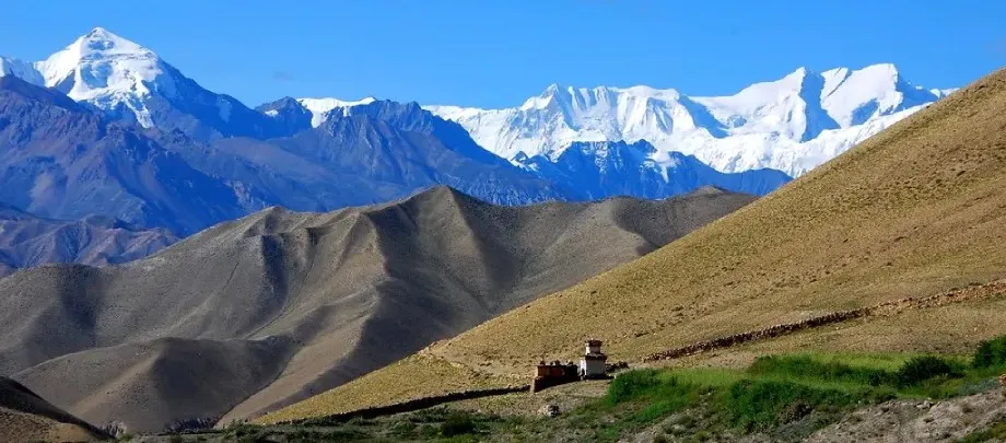
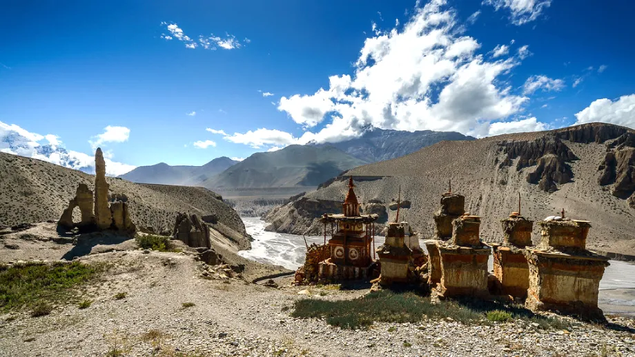
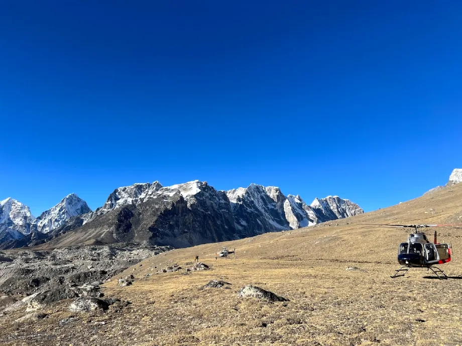
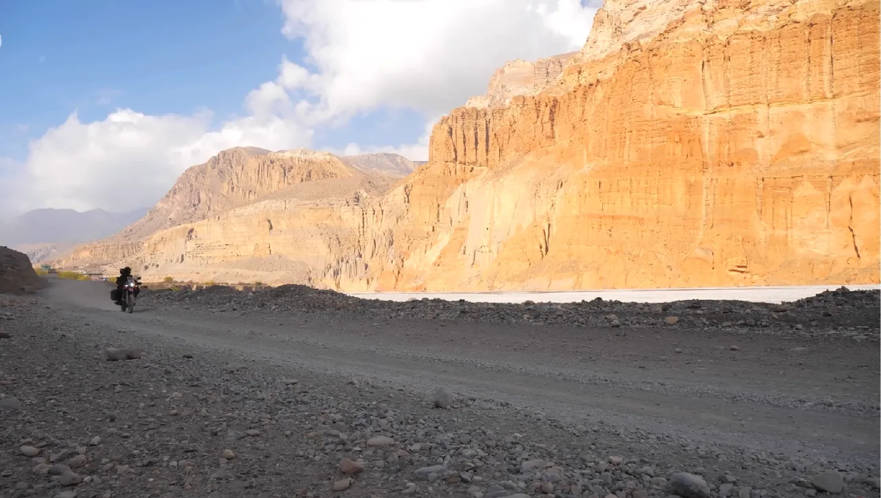
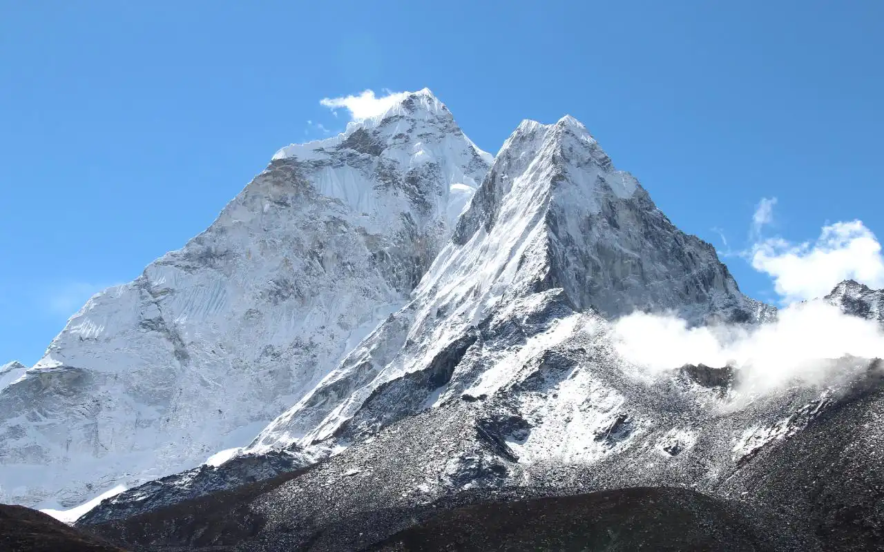
The Annapurna massif is a colossal mountain range containing one peak over 8,000 meters (Annapurna I at 8,091m), thirteen peaks over 7,000m, and sixteen over 6,000m. The conservation area spans 7,629 sq. km., encompassing a breathtaking variety of ecosystems: from tropical lowland forests and bamboo groves to alpine meadows and the arid, high-altitude desert reminiscent of Tibet. The Kali Gandaki Gorge, which runs through the region, is considered the deepest gorge in the world.

Cultural Tapestry:
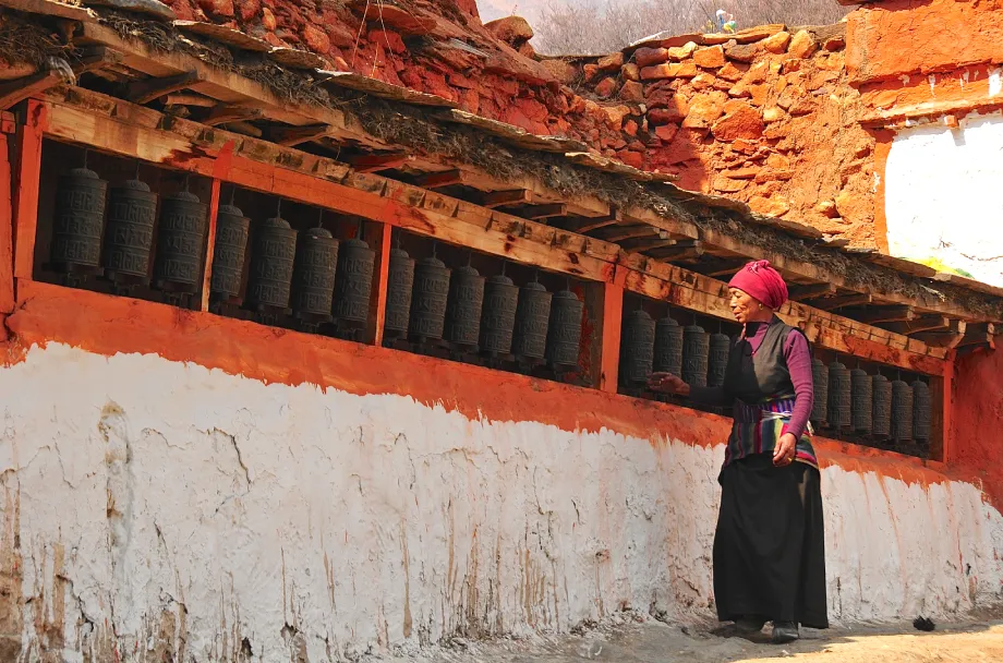
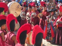
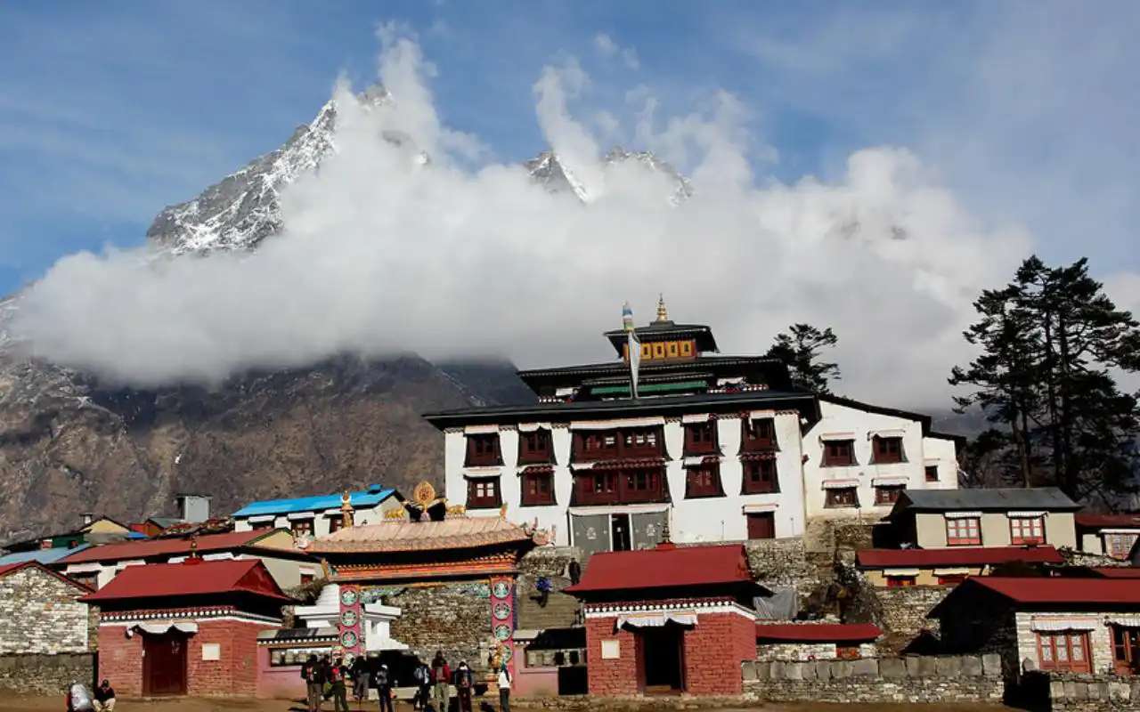
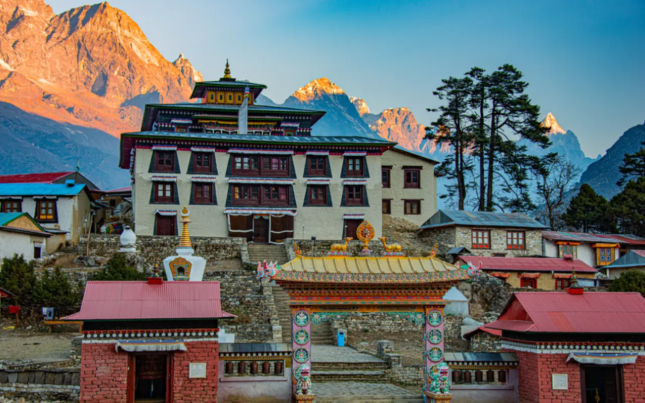
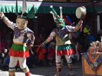
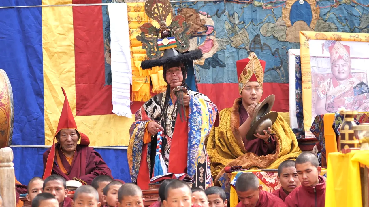
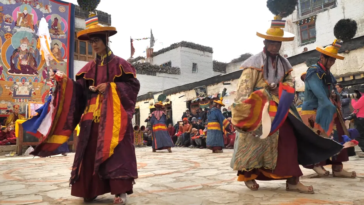
The trails wind through a mosaic of ethnic communities. In the lower hills, you’ll find the Gurung and Magar villages, with their distinctive stone houses, terraced farms, and rich traditions of hospitality. As you ascend, Thakali communities dominate, renowned for their entrepreneurship and cuisine. Tibetan Buddhism influences the region strongly, manifested in prayer walls, spinning prayer wheels, and ancient monasteries like Braga and Muktinath. Hinduism is also prevalent, especially at the sacred site of Muktinath, a pilgrimage destination for both Hindus and Buddhists.

Trip not found.

Best Seasons for Trekking:

  • Autumn (Mid-September to Late November): The premier season. Stable weather, clear skies, moderate temperatures, and excellent mountain views.

  • Spring (March to May): Second-best season. Warmer weather, blooming rhododendron forests (especially spectacular in April), and lush landscapes. It can be hazier than autumn.

  • Winter (December to February): Cold, especially at night and higher elevations, but days can be clear and sunny. Some high passes may be closed.

  • Monsoon (June to Early September): Persistent rain, leeches, cloudy skies obstructing views, and landslides make trekking challenging and less recommended.

Permits:
All trekkers in the Annapurna region require two permits:

Annapurna Conservation Area Permit (ACAP): Funds conservation and community projects.

Trekker’s Information Management System (TIMS) Card: A registration card for safety and data management.
These are arranged by trekking agencies for guided treks or can be obtained independently in Kathmandu or Pokhara.

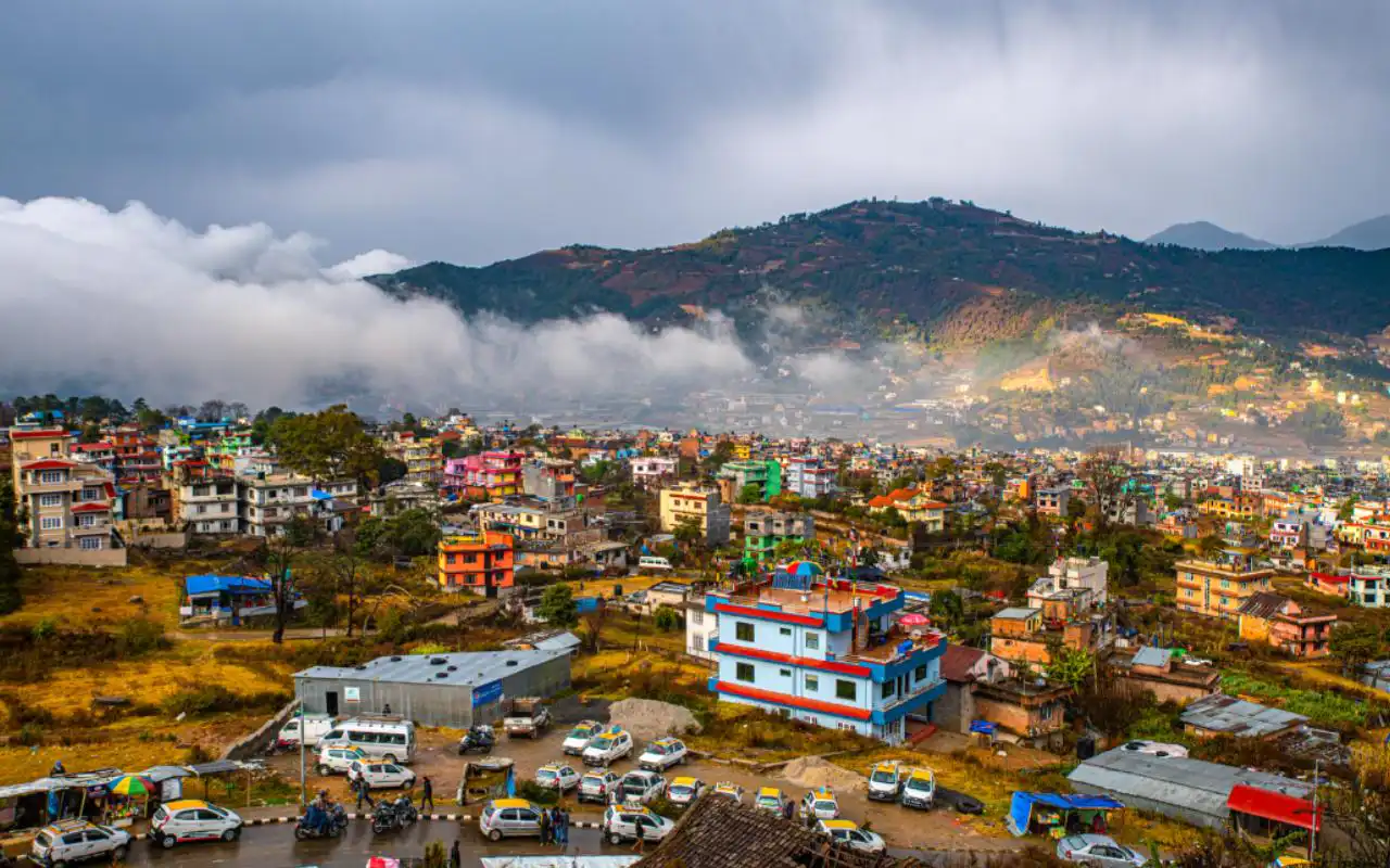
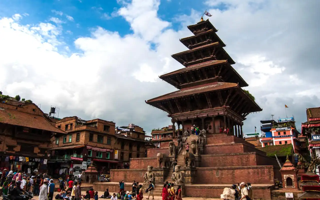
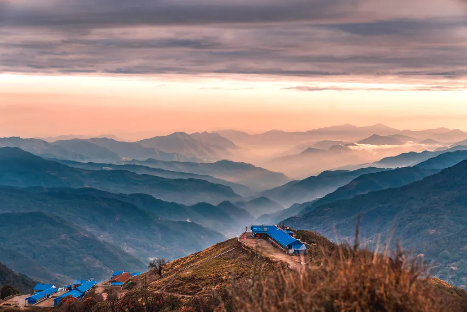
Access Hub – Pokhara:
All short treks originate from the lakeside city of Pokhara (820m). A 25-minute flight or a 6-7 hour scenic drive from Kathmandu, Pokhara serves as the perfect staging ground with its abundance of hotels, gear shops, restaurants, and stunning views of the Annapurna range across Phewa Lake.

Detailed Route Breakdowns of Major Short Treks

The Ghorepani Poon Hill Trek (4-5 Days)

The Classic Introduction

Overview: The most popular short trek in Nepal, often called the “gateway to the Himalayas.” It combines manageable daily hikes with one of the most famous viewpoints in the world—Poon Hill.

Standard 4-Day Itinerary:

  1. Pokhara to Tikhedhunga (1,540m) via Nayapul: A 1.5-hour drive from Pokhara to Nayapul, the trailhead. The trek begins with a gentle walk along the Modi Khola, passing through Birethanti (checkpoint for permits) and ascending through villages and terraced farms to Tikhedhunga. (Drive: 1.5 hrs; Trek: 3-4 hrs).

  2. Tikhedhunga to Ghorepani (2,860m): The most challenging day features a steep ascent of over 3,300 stone steps to Ulleri village, offering the first major mountain glimpses. The trail then climbs more gradually through magnificent rhododendron and oak forests (spectacular in spring) to the large village of Ghorepani. (Trek: 5-6 hrs).

  3. Ghorepani to Poon Hill (3,210m) to Tadapani (2,630m): Pre-dawn start for the 45-60 minute climb to Poon Hill. The 360-degree panoramic sunrise view is the trek’s crown jewel, encompassing the entire Annapurna and Dhaulagiri massifs—Dhaulagiri I (8,167m), Annapurna I (8,091m), Annapurna South, Himchuli, Machhapuchhre (Fishtail), and more. Return to Ghorepani for breakfast, then trek through forests to Tadapani. (Trek: 6-7 hrs).

  4. Tadapani to Ghandruk (1,940m) to Pokhara: A descent to the beautiful Gurung village of Ghandruk, a model village with slate-roofed houses, a fascinating Gurung museum, and close-up views of Annapurna South and Machhapuchhre. Explore the village before descending to Kimche or Syauli Bazaar for a drive back to Pokhara. (Trek: 3-4 hrs; Drive: 3-4 hrs).

Key Highlights:

  • Poon Hill Sunrise: Unparalleled panoramic vista.

  • Rhododendron Forests: A sea of red, pink, and white in spring.

  • Cultural Immersion: Gurung villages of Ulleri and Ghandruk.

  • Accessibility: Suitable for most fitness levels.

Variations:

  • Extended Loop (5-6 days): Continue from Ghandruk to Landruk, descend to the Modi Khola, and trek up to Jhinu Danda for its famous natural hot springs, then exit via Nayapul.

The Mardi Himal Trek (5-7 Days)

The Hidden Gem & Off-the-Beaten-Path Adventure

Overview: A relatively new and rapidly growing trek that offers a more intimate, less crowded experience with stunning alpine scenery. It ventures close to the iconic Machhapuchhre (Fishtail) and the towering south face of Mardi Himal.

Standard 5-Day Itinerary:

  1. Pokhara to Kande (1,770m) to Forest Camp (2,520m): Drive to Kande (1 hr). The trail climbs through forests to Australian Camp (2,060m) for excellent views, then continues through villages like Pothana and Deurali before entering deep forest to Forest Camp (also called Kokar). (Drive: 1 hr; Trek: 5-6 hrs).

  2. Forest Camp to Low Camp (2,990m): A steady climb through enchanting, moss-covered forests of oak, maple, and rhododendron. The tree line begins to thin, offering occasional glimpses of Machhapuchhre. Low Camp is a small settlement with basic teahouses. (Trek: 4-5 hrs).

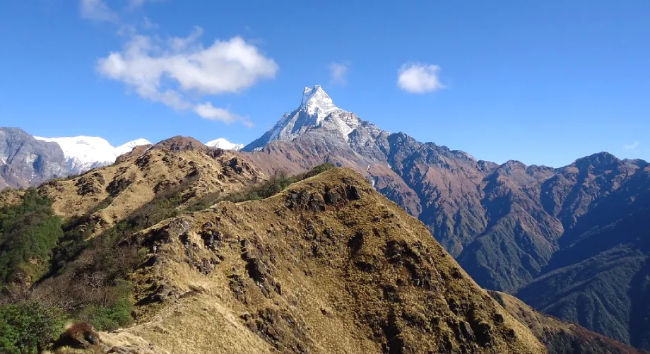
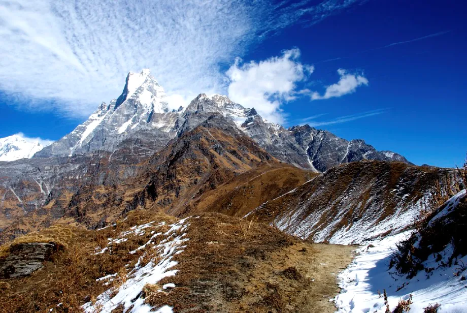
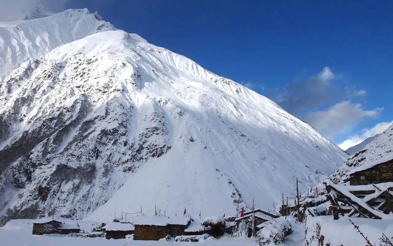
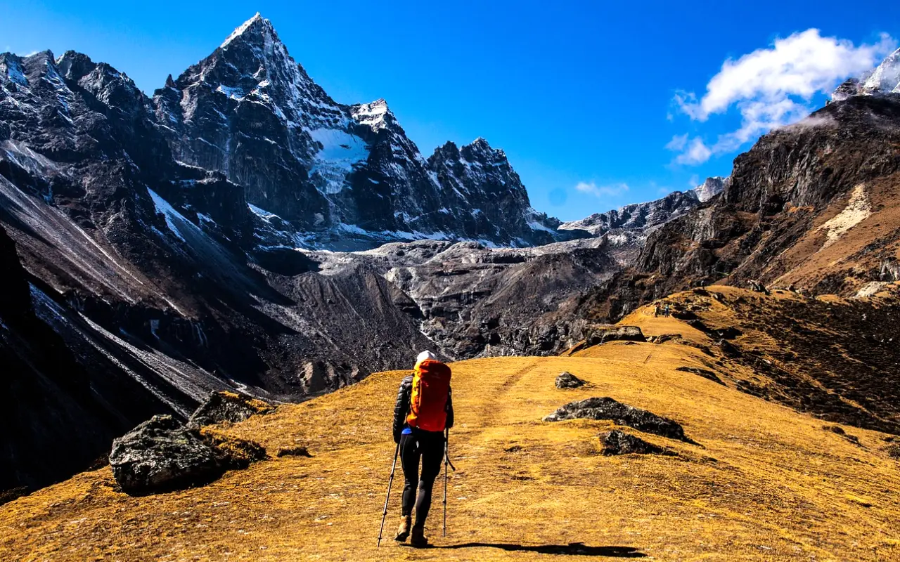
  3. Low Camp to High Camp (3,580m): A spectacular day. The trail emerges above the tree line into alpine meadows with jaw-dropping, unobstructed views of Machhapuchhre, Mardi Himal, and the Annapurna giants. The path is steep and rocky at times. High Camp is a dramatic location perched on a ridge. (Trek: 4-5 hrs).

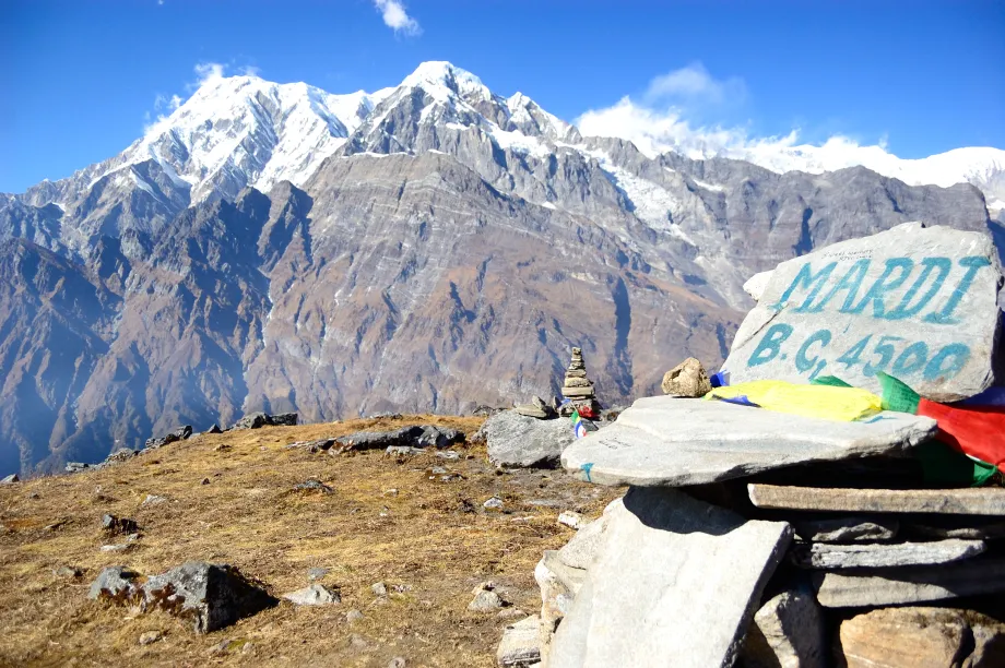
  4. High Camp to Mardi Himal Base Camp (4,500m) and back to High Camp/Low Camp: An early, challenging ascent to the Mardi Himal Base Camp. The final stretch is a steep, often snowy climb along a narrow ridge, culminating in one of the most breathtaking viewpoints in Nepal—right at the foot of Machhapuchhre and Mardi Himal. Return to High Camp or descend further to Low Camp. (Trek: 6-8 hrs round trip).

  5. High Camp/Low Camp to Siding Village (1,750m) to Pokhara: A long descent through forests and terraced farms to the ethnic village of Siding (or Lumre). From there, a drive back to Pokhara. (Trek: 5-6 hrs; Drive: 2-3 hrs).

Key Highlights:

  • Proximity to Machhapuchhre: Arguably the closest and most dramatic views of the sacred Fishtail mountain.

  • Alpine Experience: Feels more remote and rugged than Poon Hill.

  • Less Crowded: For those seeking solitude.

  • Dramatic Landscape Transition: From dense forest to high alpine ridge walking.

Variations:

  • Combine with the Australian Camp start for easier initial days and great initial views.

  • Side Trip: From Low Camp, a detour can be made to the beautiful Badal Danda (“Cloud Hill”).

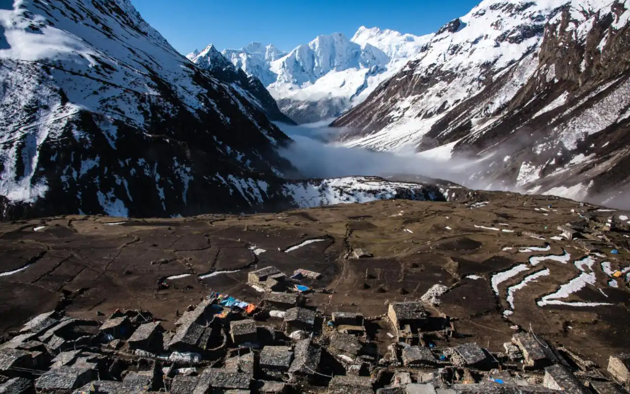
The Annapurna Base Camp (ABC) Short Approach (7-10 Days)

A Direct Ascent to the Sanctuary

Overview: While the full ABC trek often takes 10-12 days, a direct and shorter route allows fit trekkers to reach the heart of the Annapurna Sanctuary—a breathtaking amphitheater surrounded by a ring of colossal peaks—in a compressed timeframe.

Standard 7-Day Itinerary:

  1. Pokhara to Ghandruk (1,940m) by drive/trek: Drive to Nayapul or Kimche and make the short ascent to Ghandruk. Acclimatize here with magnificent views. (Drive: 2-3 hrs; Trek: 1-2 hrs).

  2. Ghandruk to Chhomrong (2,170m): Descend to the Kimrong Khola, cross a suspension bridge, and make a steep ascent to the large, terraced village of Chhomrong, the gateway to the Sanctuary. (Trek: 4-5 hrs).

  3. Chhomrong to Bamboo (2,310m): A steep descent on stone steps to the Chhomrong Khola, cross a bridge, then an ascent through forest to Sinuwa. A further descent and walk through bamboo and rhododendron forests leads to Bamboo. (Trek: 4-5 hrs).

  4. Bamboo to Deurali (3,230m): The trail climbs steadily through lush, damp forest (prime habitat for wildlife) to Himalaya Hotel and Dobhan, following the Modi Khola gorge. The vegetation starts to thin as you approach Deurali. (Trek: 4-5 hrs).

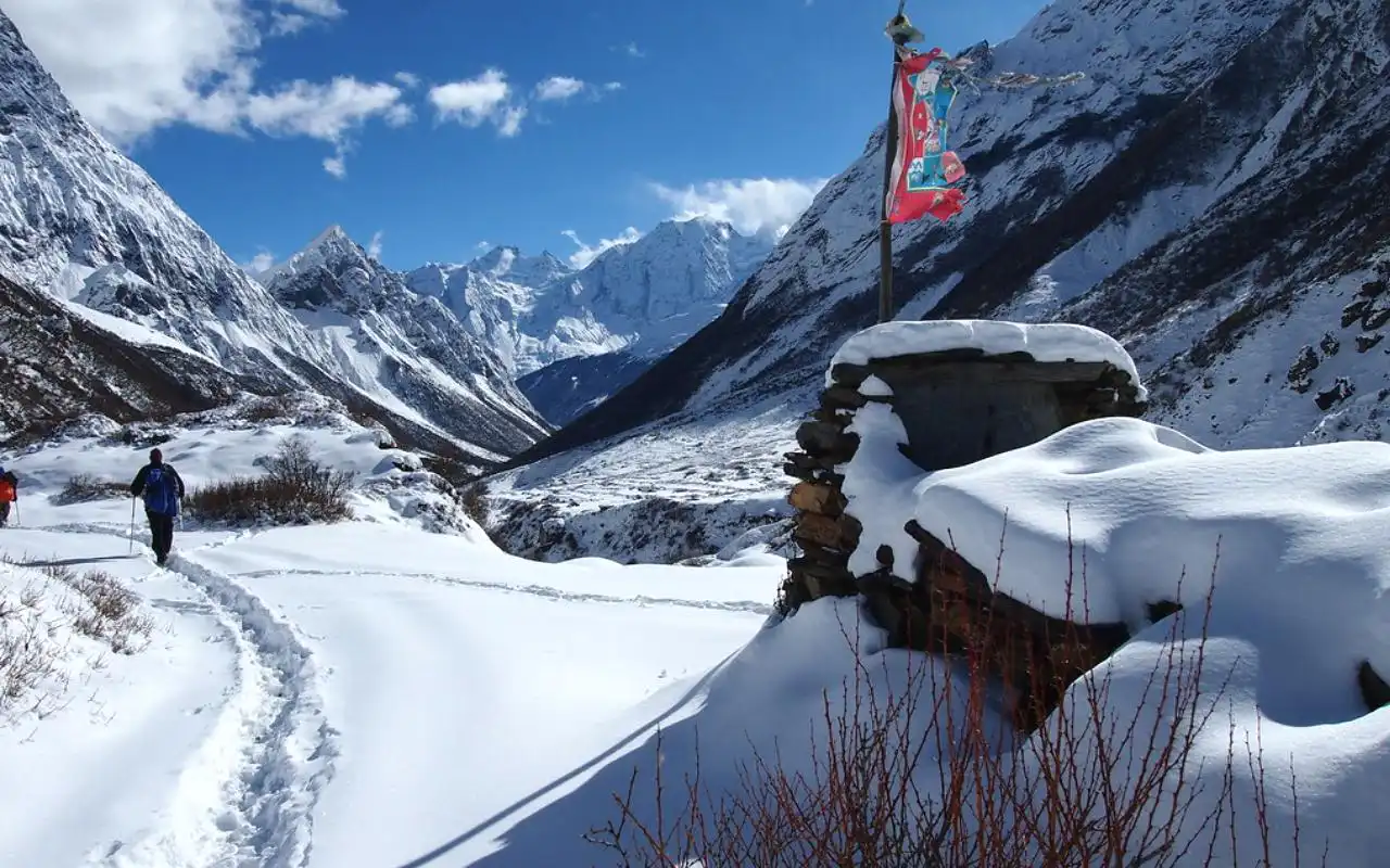
  5. Deurali to Annapurna Base Camp (ABC) (4,130m) via Machhapuchhre Base Camp (MBC) (3,700m): A dramatic day. The valley opens up into the Sanctuary. Pass the “Baggage” area (avalanche risk zone, best crossed early) to MBC for incredible views. The final climb to ABC reveals the staggering 360-degree panorama: the south face of Annapurna I, Annapurna South, Himchuli, Machhapuchhre, Gandharvachuli, and more. (Trek: 5-6 hrs).

  6. ABC to Bamboo or Sinuwa: An early morning for sunrise on the peaks, then a long descent back through MBC and Deurali to lower elevations. (Trek: 6-7 hrs).

  7. Bamboo/Sinuwa to Jhinu Danda (1,780m) to Nayapul/Pokhara: Descend to Chhomrong, then take a side trail down to Jhinu Danda for a rewarding soak in its natural hot springs by the river. A final descent to Nayapul and a drive to Pokhara. (Trek: 5-6 hrs; Drive: 2 hrs).

Key Highlights:

  • The Sanctuary Itself: The awe-inspiring, immersive experience of being surrounded by Himalayan giants.

  • Cultural Start: The vibrant Gurung culture of Ghandruk and Chhomrong.

  • Diverse Landscapes: From subtropical forests to glacial moraine.

  • Natural Hot Springs: Perfect for soothing muscles after the descent.

Key Consideration: This is a more strenuous trek due to rapid altitude gain. Acclimatization days (e.g., in Chhomrong or Deurali) are highly recommended, extending the trek to 8-9 days.

The Short Annapurna Base Camp Trek is an ideal way to start the Himalayas since it is a mixture of […]
8 Days
Moderate

US$ 850

View Detail

The Khopra Danda Trek (6-8 Days)

A Community-Based, Ridge-Walking Alternative

Overview: Also known as the Khopra Ridge Trek, this is a community-based tourism initiative that offers Poon Hill-style views with a fraction of the crowds. It uses a combination of teahouses and community-managed lodges.

Standard 6-Day Itinerary:

  1. Pokhara to Ghandruk (1,940m): As per ABC/other treks.

  2. Ghandruk to Tadapani (2,630m): A beautiful forest walk, joining the Poon Hill route.

  3. Tadapani to Dobato (3,420m) via Bayeli Kharka: Diverging from the main trail, the path climbs through forests to the open grazing area of Bayeli Kharka and on to Dobato, with stunning sunrise/sunset views from nearby Muldai viewpoint.

  4. Dobato to Chistibung (3,020m) to Khopra Danda (3,660m): Traverse to Chistibung and then make the final climb to the main goal: Khopra Danda (Ridge). The vista is phenomenal, encompassing Dhaulagiri, the Annapurnas, and the deep Kali Gandaki Gorge.

  5. Khopra Danda to Swanta Village (2,270m): A descent through forests to the charming, traditional village of Swanta.

  6. Swanta to Ulleri (2,080m) or Ghorepani, then descend to Tikhedhunga/Nayapul and drive to Pokhara. Can optionally include Poon Hill.

Key Highlights:

  • Spectacular, Crowd-Free Vistas: Khopra Ridge view rivals Poon Hill.

  • Community Focus: Supports local village cooperatives.

  • Optional Side Trek: A demanding day trip from Khopra to the sacred Khayer Lake (4,600m) near Annapurna South Base Camp.

  • Cultural Authenticity: Visits less-commercialized villages like Swanta.

The Mohare Danda Trek (5-6 Days)

The Eco-Trek with Stunning Dhaulagiri Views

Overview: Another excellent community-based trek, south of the main Annapurna range, focusing on sustainability and offering breathtaking views of Dhaulagiri and the Annapurnas from a different angle.

Route: Starts from Galeshwor (drive from Pokhara), ascends through villages to Mohare Danda (3,300m), the main viewpoint, often compared to Poon Hill for its panorama but without the crowds. Continues to another viewpoint at Khopra Danda (different from the one on the Khopra Ridge Trek) before descending to Tikot and driving back to Pokhara. Known for its eco-lodges and strong community management.

Comparative Analysis & Choosing Your Trek

Feature Ghorepani Poon Hill Mardi Himal Annapurna Base Camp (Short) Khopra Danda
Duration 4-5 days 5-7 days 7-10 days 6-8 days
Max Altitude 3,210m (Poon Hill) 4,500m (MBC) 4,130m (ABC) 3,660m (Ridge)
Difficulty Easy to Moderate Moderate to Challenging Moderate to Strenuous Moderate
Crowds High Moderate (Increasing) High near ABC Low
Key Scenery Panoramic sunrise views, villages, rhododendron forests Intimate alpine views, ridge walking, Machhapuchhre close-up Glacial amphitheater, 360-degree high mountain walls Broad ridge panoramas, Kali Gandaki Gorge views
Cultural Focus Strong (Gurung villages) Moderate Strong (Gurung villages at start) Strong (Community-based, authentic villages)
Best For First-timers, families, photographers, limited time Those seeking a quieter, more alpine feel, good fitness Dedicated trekkers wanting a classic high-mountain goal Trekkers wanting views & culture without crowds, community tourism supporters

Choosing Your Trek:

  • For First-Timers & Families: Ghorepani Poon Hill is the undisputed champion. It’s well-serviced, manageable, and delivers incredible rewards.

  • For an Alpine Adventure with Fewer People: Mardi Himal is the current favorite for those looking beyond Poon Hill. It feels more rugged and remote.

  • For the Ultimate Mountain Immersion: If you have the time (7+ days) and fitness, the direct Annapurna Base Camp route is a life-changing experience.

  • For a Culturally-Immersive, Community-Focused Journey: Khopra Danda or Mohare Danda offer incredible value, stunning views, and the satisfaction of supporting local initiatives.

Practical Considerations & Responsible Trekking

Guided vs. Independent: All these treks can be done independently (FIT) by experienced trekkers, as the trails are clear and teahouses are abundant. However, for first-timers, a guided trek through a reputable agency is highly recommended. Guides handle logistics, provide cultural interpretation, ensure safety, and help with acclimatization. Porter services are also available to carry your main bag, making the trek significantly more enjoyable.

Teahouse Trekking: This is the standard style. You stay in family-run lodges (teahouses) that offer basic private rooms (twin beds, sometimes with attached bathroom) and serve meals (dal bhat, noodles, pancakes, etc.) in a communal dining hall.

Packing Essentials: Layered clothing (moisture-wicking base, insulating mid-layer, down jacket, waterproof shell), sturdy broken-in trekking boots, sleeping bag (4-season recommended), trekking poles, water purification (tablets/filter), sun protection (hat, sunglasses, high SPF sunscreen), basic first-aid kit, headlamp, and a good daypack.

Health & Safety:

  • Acclimatization: Ascend slowly, especially on ABC and Mardi Himal. The rule of thumb is not to sleep more than 300-500m higher than the previous night, once above 3,000m. Listen to your body.

  • Water: Stay hydrated. Use purified water only. Avoid single-use plastic bottles; carry a reusable bottle and purification means.

  • Insurance: Mandatory. Must cover emergency helicopter evacuation and medical treatment at high altitude.

Leave No Trace & Responsible Trekking:

  • Support Local: Buy local food, use local guides/porters, and shop in village stores.

  • Minimize Waste: Carry out all non-biodegradable waste. Use refillable water bottles. Many teahouses now offer boiled/filtered water for a small fee.

  • Respect Culture: Ask permission before photographing people. Dress modestly. Respect religious sites (circumambulate chortens and mani walls clockwise).

  • Environmental Care: Stick to established trails. Do not disturb wildlife or pick plants.

FAQs about Annapurna Short Treks

1. What is the best short trek in Annapurna for first-timers?

The Ghorepani Poon Hill Trek (4-5 days) is the best for first-timers, offering manageable hikes, teahouse comforts, and a spectacular Himalayan sunrise view.

2. What permits do I need?

For Annapurna Short Treks, you need two permits: the Annapurna Conservation Area Permit (ACAP) and the Trekker’s Information Management System (TIMS) card.

3. When is the best time for Short Annapurna Treks?

The best seasons are Autumn (Sept-Nov) for clear skies and Spring (Mar-May) for blooming rhododendron forests and warmer weather.

4. Do I need a guide for a short trek?

While the popular routes like Poon Hill can be done independently, a local guide is highly recommended for safety, cultural insight, and logistical support.

5. How difficult are Annapurna short treks?

They range from Easy-Moderate (Poon Hill) to Moderate-Challenging (Mardi Himal, ABC), depending on the route, your fitness, and the pace you choose.

6. What is the accommodation like?

You stay in teahouses—basic, family-run lodges offering private rooms (twin beds) and shared dining halls serving meals like dal bhat, noodles, and pancakes.

7. What is the maximum altitude on these treks?

For the most popular short treks: Poon Hill (3,210m)Mardi Himal Base Camp (4,500m), and Annapurna Base Camp (4,130m).

8. Can I trek if I have limited time (e.g., 3 days)?

Yes. A 3-day version of the Poon Hill trek is possible by driving further to/from the trailhead, or you can opt for an even shorter trek to Australian Camp.

9. How do I get to the trek starting point?

All treks start from Pokhara. You take a short drive (1-3 hours) from Pokhara to trailheads like Nayapul, Kande, or Phedi.

10. What should I pack?

Essentials include sturdy trekking boots, layered clothing (including a down jacket), a daypack, water purification, sun protection, a headlamp, and a sleeping bag.

Conclusion

The short treks of the Annapurna region are a testament to the incredible accessibility and diversity of the Nepal Himalayas. They prove that one does not need to embark on a multi-week expedition to experience the soul-stirring majesty of the world’s highest mountains, the warmth of its indigenous cultures, and the profound sense of accomplishment that comes from journeying on foot through such legendary landscapes.

Whether you choose the classic panorama of Poon Hill, the intimate ridge walks of Mardi Himal, the awe-inspiring sanctuary of ABC, or the community-focused paths of Khopra and Mohare, you are guaranteed an unforgettable adventure. Each step on these ancient trails is a step into a world where nature’s scale is overwhelming, human resilience is inspiring, and the memories forged will last a lifetime. With careful planning, respect for the environment and culture, and a spirit of adventure, your Annapurna short trek will be far more than just a hike—it will be a transformative journey into the heart of the Himalayas.

Where to Stay in Kathmandu: Best Areas & Hotels for Every Type of Traveler

Kathmandu Valley
Kathmandu Valley

Kathmandu is a city of extreme contrasts. Some of the ancient temples and royal squares are located near major highways, contemporary cafes, and trekking agencies.

The main question that is very easy to ask many first-time visitors is the question of where to stay in Kathmandu. The city is broad and congested, and each space is a bit different. It may create confusion in the options, and it also provides you with an opportunity to make your trip your way.

There are sections of the city that are entirely filled with music, bars, and backpackers. The other areas are relaxed and religious, with monasteries, stupas, and narrow streets. There are historic towns with brick streets and carved windows, and there are modern zones with large hotels and shopping streets.

In this guide, you will see how the main areas of Kathmandu Valley are arranged, what kind of mood each one has, and what type of traveler may enjoy it most. You will also find simple hotel suggestions for different budgets in each place. The goal is to help you choose a neighborhood that feels right for you, so your days in Kathmandu start and end in comfort.

Kathmandu Overview: Geography, Culture & Vibe

Kathmandu is located in a deep valley with the shape of a bowl at a height of approximately one thousand four hundred meters above sea level. The valley is encircled by green hills, and when it is clear in the mornings, you might be able to see snowy Himalayan peaks on the horizon.

The city of Kathmandu is a constituent of a greater urban city that comprises the historic cities of Patan and Bhaktapur, too. To visitors, the entire valley can be considered a large cultural zone with a number of significant centers.

Within the city, there will be a blend of the old and the new. The older quarters are built on narrow streets of tall brick buildings. Little shrines are placed on crossroads, and people come to make a quick prayer or to light a lamp. In the other areas, there are modern glass buildings, intersections, cell phone shops, and coffee chains.

Kathmandu is a busy and even aggressive place to be. Motorbikes pass around buses, vehicles, and pedestrians. Fruits, clothes, tea, and snacks are sold by street vendors who have their carts or little shops. There are numerous scents in the air at the same time: incense in the temples, some spice in the kitchens, dust on the streets.

Religion is an important part of life. The main religion in the valley is Hinduism, but Buddhism is also very strong. Many families follow both traditions in a natural way.

The Newar community, who are native to the valley, has created a rich culture of art, dance, festivals, and food. Tibetan influence is also clear, especially in areas like Boudha, where you will see prayer flags, butter lamps, and people walking around stupas in meditation.

Even though the city can feel chaotic, local people are usually friendly and welcoming. There is a common idea that a guest should be treated with deep respect. You can feel this in many hotels, guest houses, and small restaurants, where staff often go out of their way to help. The city may shock your senses on the first day or two, but most visitors grow to enjoy its rhythm and warmth.

How the City is Laid Out

The international airport lies on the east side of the city. From there, the main tourist areas and heritage sites spread out in a rough circle toward the center and west of the valley.

Thamel is the main tourist district and sits close to the old royal square of Kathmandu. Lazimpat and Durbar Marg are just to the north. Boudha lies further east on the way to the airport. Patan is to the south across the Bagmati River. Bhaktapur is a separate town further east along the main highway out of Kathmandu.

Distances on the map may look small, but traffic is often slow. A drive of only a few kilometers can take a long time at busy hours. Because of this, it is wise to choose a place to stay that matches your main interests, instead of spending many hours each day in taxis.

Best Areas to Stay in Kathmandu

Thamel – Traveler Hub for Nightlife & Shopping

Thamel’s Colorful Streets

Thamel is the classic tourist hub of Kathmandu. It is usually the first answer people give when you ask where to stay in the city. The area is a compact maze of streets full of hotels, guest houses, hostels, tour agencies, trekking gear shops, money exchange counters, bars, cafes, and restaurants.

If you want to meet other travelers, find group tours, or enjoy a busy evening scene, Thamel is a perfect base. In the day, you can walk through the small lanes and shop for warm clothes, sleeping bags, hiking boots, singing bowls, prayer flags, T-shirts, or simple souvenirs.

You will also find bakeries, coffee shops, and rooftop restaurants. Kathmandu Durbar Square is just a twenty-minute walk, and taxis can be easily found to travel to other locations around the valley.

During the nighttime, Thamel is filled with music and lights. Live bands, sporting bars, and spots where the trekkers end their journey are available. It is fun as well as exciting to some individuals.

To other people, it might be noisy and tiresome. The streets are even narrower, and the motorbikes sometimes drive very near the pedestrians. Sellers might come to you frequently to take you on a tour, to a taxi, or so on.

In case you are a light sleeper, then you should select a hotel that occupies a less bustling street or the rooms have an inner yard. This reduces the sound of traffic and music.

Suggested places in Thamel:

  • Budget: Zostel Kathmandu. A social hostel with dorm beds and simple private rooms. The rooftop and common spaces are good for meeting other travelers.
  • Middle price: Kathmandu Guest House. A historic property in the heart of Thamel with a large garden that feels peaceful and green. It is a famous meeting point for trekkers and still one of the top central choices.
  • Higher comfort: Aloft Kathmandu Thamel. A modern full-service hotel with a pool, gym, and comfortable rooms, located in a shopping complex in the middle of the district.
  • Practical tips: Book a pick-up at the airport in case of late arrival at night, and also perform a recent review so as not to get a room above a loud music restaurant.

Boudha (Boudhanath) – Spiritual & Peaceful Haven

Boudhanath Stupa
Boudhanath Stupa

Boudha is centered on the Boudhanath Stupa, which is among the biggest Buddhist Stupas in the world and the spiritual center of the Tibetan community in Nepal. The atmosphere here is quite different from Thamel. The primary area surrounding the stupa is relatively traffic-free, peaceful, and concentrated.

In the morning and the evening, you can find people going round the stupa very slowly in a clockwise direction, making the prayer wheels and counting beads. Monks wearing red robes are whispering, and old Tibetans are sitting on benches talking to their friends.

Butter lights are lit in front of shrines, and the air is filled with incense. Many shops sell religious items, thangka paintings, books, and simple clothes. Cafes and rooftop restaurants look down on the stupa, giving wonderful views at sunset.

Staying in Boudha is ideal if you want a gentle, spiritual base. It is also good if you enjoy quiet early mornings and evenings, and do not care about nightlife. The area is about twenty to thirty minutes from Thamel by taxi, depending on traffic.

Once you are in Boudha, you might not feel much need to go elsewhere in the evenings, as the local restaurants and cafes give enough choice for dinner and a relaxed time.

Suggested places in Boudha:

  • Budget: Shechen Guest House. A simple, clean guest house inside a monastery compound, with gardens and a vegetarian cafe. It is perfect for travelers who want to be near monastic life and do not need luxury.
  • Middle price: Hotel Tibet International. A comfortable hotel with Tibetan-inspired design, only a short walk from the stupa. Rooms are spacious, and the rooftop restaurant gives a nice view over the area.
  • Higher comfort: Hyatt Regency Kathmandu. A large resort close to Boudha with extensive gardens, a big pool, spa, and sports facilities. There is a special path from the grounds that leads toward Boudhanath Stupa, which makes it very convenient for guests who want both quiet and easy access to the sacred site.

Patan (Lalitpur) – History, Artistry & Laid-Back Charm

Patan Durbar Square
Patan Durbar Square

Patan, also known as Lalitpur, lies just south of central Kathmandu across the Bagmati River. It used to be a separate royal city, and it still retains a strong sense of identity. It has some of the most beautiful heritage sites in the valley, which include the Patan Durbar Square, a cluster of temples, courtyards, and a museum exhibiting good local art.

Patan is like a living museum. The old town is characterized by small streets that lead to neglected lanes, old-fashioned houses, and ancient monasteries. Metalworkers, woodcarvers, and painters are employed in small workshops, making statues, windows, and religious art.

The rate is usually not as high as in Thamel, and the tourist traffic is less the further one gets out of the centre. Patan is perfect for culture lovers, photographers, and travelers who enjoy wandering through historic neighborhoods.

Rooftop cafes and small restaurants overlook the temples and provide quiet spots to rest and watch daily life. Nightlife is soft, with a few nice bars and live music spots, but the overall feeling is more relaxed than party-focused.

Suggested places in Patan:

  • Budget: Newa Chen. A three-century-old Newar residence that has been carefully restored and turned into a small guest house near the main square. Rooms have carved wood columns, old-style windows, and traditional decor, along with modern bathrooms.
  • Middle price: Summit Hotel. A long-established hotel on a small hill with a garden, pool, and wide views over the city. It is popular with families and long-term visitors who enjoy space and greenery.
  • Higher comfort: The Inn Patan. A stylish boutique hotel in a restored heritage building just a few steps from Patan Durbar Square. Rooms open onto a peaceful courtyard and balance old brick and wood with modern comfort. It is especially suited to couples. Hotel Himalaya, a larger four-star property with a garden and pool, is another option in the broader Patan area if you prefer a more classic city hotel style.

Durbar Marg – Modern City Life & Upscale Stays

Durbar Marg, sometimes called King’s Way, is a broad avenue that runs past the former royal palace, now a museum. The area around this street is one of the most modern and upmarket parts of Kathmandu.

You will find international brand stores, banks, coffee shops, and popular restaurants here. The roads are a little wider, and the sidewalks a little smoother, than in many other parts of the city.

Durbar Marg is a good choice for travelers who like comfort and convenience. It is quite near Thamel, yet it is more refined and arranged. It is only a short walk there to the Garden of Dreams, the gorgeous historic garden where people go to relax, read, and have a peaceful, traffic-free break off the traffic.

The location is good in relation to business travelers or users who desire the convenience of easy access to cars, high levels of comfort, and good services, including internet access, and modern bathrooms. The local feel is less traditional than in Patan or Bhaktapur, but after a long day of sightseeing or trekking, many guests enjoy returning to a calm, clean, and modern hotel.

Suggested places near Durbar Marg:

  • Budget: Hotel Jampa in the nearby Jyatha area. It has modern, clean rooms with air conditioning and good sound control, and offers strong value while still being close to both Durbar Marg and Thamel.
  • Middle price: Hotel Royal Singi. A well-known four-star hotel just off the main street, with comfortable rooms, a decent breakfast, and a central location that makes it easy to reach many parts of the city.
  • Higher comfort: Hotel Yak and Yeti. A famous hotel that combines a historic palace building with a modern wing. It has gardens, a pool, tennis courts, and even a small casino. The interior has an old-world charm, while the rooms provide modern comfort and service. Nearby, Kathmandu Marriott in Naxal offers a very modern luxury experience with a rooftop pool and city views. Dwarika’s Hotel in Battisputali, a little further away, is built like a traditional palace with carved wood and brick and is often chosen for romantic or special stays.

Lazimpat – Quiet Comfort Close to the Action

Lazimpat lies just north of Thamel and Durbar Marg. In walking terms, it is quite close to both, yet it feels calmer and more residential. Many embassies, foreign offices, and international organizations are based here, and a number of top-end hotels sit along the main road and in the side streets.

The main Lazimpat road carries steady traffic, but once you step into the smaller lanes, you find a quieter world with trees, wall-enclosed houses, and cafes used by locals and expatriates. Because of the diplomatic presence, the area has a safe and orderly feeling.

Lazimpat is a great base if you want to enjoy the restaurants and shops of Thamel and Durbar Marg but prefer to sleep in a quieter place. You can walk or take a short taxi ride to the busy areas, then come back to gardens, pools, and peaceful rooms. Nightlife in Lazimpat itself is limited and tends to be low-key.

Suggested places in Lazimpat:

  • Budget: Lazimpat Guest House. A basic hotel with simple, clean rooms. It is fairly affordable for travelers who do not want to spend on larger hotels but still wish to stay in the Lazimpat area. The rooms are small and comfortable enough to stay, and the location is near shops and restaurants.
  • Middle price: Tings Tea Lounge and Hotel. A creative boutique bed and breakfast with individually designed rooms, a leafy courtyard, and an attached cafe. It feels like a small home rather than a formal hotel and suits travelers who enjoy art, books, and relaxed conversation.
  • Higher comfort: Hotel Shanker. A former royal residence from the nineteenth century that has been turned into a heritage-style hotel. It has a large facade with columns, an attractive interior, a garden pool, and comfortable rooms. It offers a touch of royal history with modern amenities. Other higher comfort options in Lazimpat include Shangri La Hotel, which is known for its garden, and Ambassador Hotel, which has a more modern design.

(Bonus) Bhaktapur – Medieval Atmosphere Outside the City

Bhaktapur
Bhaktapur

Bhaktapur is a separate town about twelve kilometers east of central Kathmandu, but it is one of the most rewarding places to stay if you love heritage and traditional life. The old city has three main squares filled with temples, courtyards, and historic buildings, and many of its streets are paved with stone or brick.

In the center, cars are limited, and many lanes are reserved for pedestrians. You can wander among tall brick houses, carved wooden windows, hidden courtyards, and small shrines. Potters dry their work in the sun, and locals carry offerings to shrines early in the morning.

Many tourists visit Bhaktapur for a few hours during the day. However, if you stay overnight, you see a quieter side of the town. Early mornings bring fresh light, temple bells, and local people going to market. Evenings are calm once day visitors leave, and the town takes on a soft, almost timeless mood.

The main drawback is distance. A drive between Bhaktapur and the center of Kathmandu can take forty minutes or more when traffic is heavy. Because of this, Bhaktapur is best used as an extra stay at the start or end of a Nepal trip, or as a special stop for travelers who focus mainly on culture and do not need to visit other parts of the city every day.

Suggested places in Bhaktapur:

  • Budget: Cozy Guest House Bhaktapur. A family-run guest house in a traditional house in the old quarter, with simple, clean rooms and very friendly hosts.
  • Middle price: Peacock Guest House. A beautifully restored house in Taumadhi Square, famous for its detailed carved windows. The rooms feel like part of a museum, and there is a good cafe on the ground floor.
  • Higher comfort: Hotel Heritage Bhaktapur. A boutique hotel on the edge of the old city, built in a traditional style with modern comfort. Spacious rooms, a quiet garden, and careful decoration make it a very pleasant base for exploring the town.

Tips for Choosing Accommodation in Kathmandu

Location and transport

Traffic in the valley can be slow and unpredictable, so location matters. If you want to visit many sites and join tours, staying in Thamel, Durbar Marg, or Lazimpat will reduce time in taxis. If you care more about peace and culture, you may be happier in Boudha, Patan, or Bhaktapur and accept a short ride when needed. Always think about how you will move around each day.

Safety and security

Kathmandu is generally safe, but small theft can happen in crowded streets and buses. Choose places that have good locks, twenty four hour reception, or security staff. Use room safes or lockers when available. In all areas, avoid flashing expensive jewellery or large amounts of cash. At night, use main streets or take a taxi if you feel unsure.

Power and water

Power cuts are less common than in the past, but they can still occur. Many middle and high-range hotels have backup systems for electricity and hot water. Lower-priced guest houses sometimes do not. If constant power or hot showers are important to you, check recent reviews or ask the hotel about backup arrangements and water storage.

Comfort and facilities

Think about what you truly need. Some travelers are happy with a basic clean room, while others want air conditioning, a strong shower, and a good mattress. If you plan to work online, you will need reliable internet and maybe a quiet space. If you want a pool, spa, or gym, you will be looking at larger international-style hotels. If you prefer character and local flavor, heritage guest houses in Patan and Bhaktapur or small boutique hotels in Boudha and Lazimpat may suit you better.

Read recent guest feedback

Hotel quality can change with time. Management may change, buildings may be renovated, or new construction next door may create noise. Reading recent guest comments will give you the latest picture of cleanliness, staff attitude, noise, and comfort. Reviews from the same season as your planned visit are especially useful.

Booking and prices

Room rates vary with the season. Spring and autumn are busy trekking months, so prices can rise and popular places may sell out. Winter and the rainy season are quieter, and you often find better deals. Booking in advance is wise for your first night, especially after a long international flight. Once you are in Nepal, you can sometimes compare places in person during the low season for better value.

Where to Stay in Kathmandu for Every Traveler Type

Solo travelers and backpackers

If you want company, easy tour bookings, and many food options, Thamel is the natural base. Hostels and budget guest houses here make it simple to meet others, share treks, or find last-minute deals. If you prefer a quieter solo experience with more reflection and spiritual energy, then a guest house in Boudha will feel better, with calm evenings around the stupa and peaceful cafes.

Couples and honeymooners

For romance and charm, Patan is a wonderful choice. Boutique heritage hotels near the main square allow evening walks among temples and rooftop dinners with views of old buildings and soft lights.

To spend a luxurious couple’s stay, you should consider hotels such as Dwarika, Hyatt Regency, or Kathmandu Marriott, as they have spa, wide beds, and quiet places where you can have a rest after you have spent time exploring the city.

Families

Families tend to value the space, the silence, and close proximity to shops and health facilities. Lazimpat can be used to fulfill such needs. The bigger hotels that have gardens and pools allow the children to play, and the area is secure and well planned. Patan also works for families who enjoy culture and are comfortable walking through historic streets with children.

Spiritual and wellness visitors

If your main focus is meditation, yoga, or spiritual study, Boudha is the best base. You can stay near monasteries, join classes or teachings, and eat simple, healthy food. A few days in places like Pharping or Nagarkot, which are outside the main city, can add quiet time with views of hills and mountains.

Culture and history lovers

Patan and Bhaktapur are the top choices if you love heritage, traditional art, and local life. Staying in a restored Newar house lets you experience living history every day. You can watch ceremonies in temples, see craftspeople at work, and take photos of streets and squares that look almost unchanged for centuries.

Luxury and business travelers

If you want smooth modern comfort, strong internet, and good meeting facilities, then Durbar Marg, Naxal, and Lazimpat are ideal. Hotels such as Yak and Yeti, Marriott, Radisson, and similar properties offer all the services you expect from international brands. They also provide an easy base for visiting offices, embassies, and main tourist sites.

Final Thought

Whatever your travel style, there is a corner of Kathmandu Valley that matches your needs. The busy lanes and bright lights of Thamel, the calm circle around Boudhanath Stupa, the brick temples of Patan, the modern comfort of Durbar Marg, the quiet streets of Lazimpat, and the timeless charm of Bhaktapur all show different sides of the same valley.

If you choose your area with care, based not only on budget but also on the experience you want, your stay in Kathmandu will feel smoother and more enjoyable. With this guide, you can now decide more confidently where to stay and look forward to stepping out of your door each morning, ready to enjoy this vivid and fascinating city.

Mardi Himal Trek: The Hidden Gem of Annapurna

Overview

Mardi Himal Trek is an emerging and exceptional short-to-moderate trekking route situated just east of the iconic Annapurna Base Camp trail in the heart of Nepal’s Himalayas. Often celebrated as the “Hidden Gem of the Annapurna Region“, this journey offers a pristine and crowd-free alternative for trekkers seeking an authentic Himalayan experience without the prolonged duration or dense traffic of its more famous counterparts.

The trek’s unique appeal lies in its spectacular and intimate vantage points. It unfolds on a ridge line that runs directly towards the formidable Machhapuchhre (Fishtail Mountain), providing trekkers with unobstructed, face-to-face views of its razor-sharp summit. The panorama expands to include the entire Annapurna South wall, the elegant Hiunchuli, and the trek’s namesake, the majestic Mardi Himal (5,587m), from whose base camp (4,500m) the trek derives its climax.

Geographically and culturally, the trail is a journey through dramatically shifting ecosystems. It begins in the subtropical foothills near Pokhara, ascends through enchanting old-growth rhododendron and oak forests (vibrant with color in spring), and emerges into serene high alpine pastures known locally as “kharka. The final push traverses a rugged, moon-like landscape to the foot of the glacier below Mardi Himal. Along the way, trekkers pass through traditional Gurung and Magar villages like Siding and Lwang, offering glimpses into a rural mountain lifestyle that remains closely tied to the land.

What sets Mardi Himal apart is its sense of solitude and discovery. The teahouse infrastructure, while established and comfortable at lower camps, is less developed than on major routes, which preserves a sense of adventure. The trek is highly achievable for fit beginners yet deeply rewarding for seasoned hikers, perfectly balancing physical challenge, breathtaking scenery, and cultural immersion in a compact 5 to 7-day itinerary. It stands as a testament to the fact that some of Nepal’s most profound mountain experiences are found not on the most trodden paths, but on the quiet trails that run alongside them.

Often called the “hidden gem” due to its quieter trails and raw, unspoiled beauty, this trek is perfect for those seeking a shorter, moderately challenging Himalayan experience without the crowds.

Highlights

  • Breathtaking Mountain Views: Unobstructed, close-up views of Annapurna South, Hiunchuli, Machhapuchhre (Fishtail), and Mardi Himal.

  • Less Crowded Trails: Experience solitude and tranquility compared to busier routes like ABC or Everest.

  • Diverse Landscapes: From lush rhododendron and oak forests to alpine meadows and rugged high-altitude terrain.

  • Rich Culture: Interact with Gurung and Magar communities in traditional villages.

  • Mardi Himal Base Camp (4,500m): Stand at the foot of the majestic Mardi Himal with panoramic Himalayan vistas.

  • High Camp Sunrise: Spectacular sunrise over the Annapurna range from High Camp (3,580m).

  • Wildlife Spotting: Possible sightings of langur monkeys, deer, and various bird species.

  • Relatively Short Duration: Typically completed in 5–7 days, ideal for those with limited time.

Mardi Himal Base Camp

Classic Itinerary (6–7 Days)

Day 1: Drive from Pokhara to Kande (1.5 hours) → Trek to Forest Camp (Deurali) via Australian Camp (2,600m) – 5–6 hours.
Day 2: Trek from Forest Camp to Low Camp (3,150m) – 4–5 hours.
Day 3: Trek from Low Camp to High Camp (3,580m) – 3–4 hours.
Day 4: Early morning hike to Mardi Himal Base Camp (4,500m) → Return to High Camp → Descend to Low Camp or Siding Village – 7–8 hours.
Day 5: Trek from Low Camp/Siding to Lwang Village or Lumre – 4–5 hours → Drive back to Pokhara (1.5 hours).

Variations: Some itineraries include a night at Badal Danda (Cloud Hill) for sunset/sunrise views or extend via Landruk for a loop route.

Cost Breakdown (2026-2027 Estimates)

Costs vary based on style (independent vs. guided), season, and comfort level.

  • Independent Trekker (without guide): $400–$550 per person
    Includes: Food, accommodation, permits, transport. Excludes gear rental, insurance, and extras.

  • Guided Group Trek: $700–$900 per person
    Includes: Guide, porter, meals, accommodation, permits, transport, and insurance.

  • Private Guided Trek: $800–$1,200+ per person
    Includes: Personalized service, flexibility in itinerary, and better accommodation.

Permits Required:

  1. Annapurna Conservation Area Permit (ACAP): NPR 3,000 (≈ $25)

  2. Trekker’s Information Management System (TIMS): NPR 2,000 (≈ $17) for independent; NPR 1,000 (≈ $8) if with a guide.

Best Time to Trek

  • Spring (March–May): Rhododendron blooms, clear skies, mild temperatures.

  • Autumn (October–November): Best visibility, stable weather, popular season.

  • Winter (December–February): Cold at higher camps, possible snow, very quiet.

  • Monsoon (June–September): Rainy, leeches, cloudy skies – not recommended.

Difficulty & Preparation

  • Difficulty: Moderate. No technical climbing, but steep sections and altitude (max 4,500m) require acclimatization.

  • Fitness: Good cardiovascular fitness recommended. Prior trekking experience is helpful but not mandatory.

  • Altitude Sickness: Risk exists; ascend slowly, stay hydrated, consider acclimatization days.

  • Training: Cardio exercises (hiking, running, cycling) and strength training (squats, lunges) 4–6 weeks prior.

Accommodation & Food

  • Teahouses/Lodges: Basic but comfortable rooms with shared toilets. Hot showers available (extra cost).

  • Food: Dal Bhat (lentil rice), noodles, soups, pancakes, pasta. Vegetarian options are widely available.

  • High Camp facilities: More basic; recommend carrying snacks and water purification tablets.

Packing Essentials

  • Clothing: Layering system (base, insulation, waterproof shell), warm hat, gloves.

  • Footwear: Broken-in hiking boots, spare socks.

  • Gear: 30–40L daypack, trekking poles, sleeping bag (optional but recommended), headlamp.

  • Other: Water bottle/purifier, sunscreen, sunglasses, basic first-aid kit, portable charger.

Responsible Trekking Tips

  • Leave No Trace: Carry out all trash (including biodegradable).

  • Support Local: Buy meals at teahouses, hire local guides/porters.

  • Water: Use purification tablets/filters to reduce plastic bottle use.

  • Cultural Respect: Dress modestly, ask before photographing people.

Why Choose Mardi Himal Over ABC?

  • Less crowded: More intimate experience.

  • Shorter duration: Ideal for time-bound trekkers.

  • Unique perspective: Different, arguably more dramatic, angle of the Annapurna range.

  • Affordable: Generally cheaper due to shorter itinerary.

Getting There

  • International: Fly to Kathmandu.

  • To Pokhara: 25-minute flight or 6–7 hour scenic drive/tourist bus from Kathmandu.

  • Trailhead: 1.5-hour drive from Pokhara to Kande or Phedi.

Final Thoughts

The Mardi Himal Trek is a perfect blend of accessibility, natural beauty, and cultural immersion without the overwhelming crowds. Its “hidden gem” status is well-earned, offering a raw and rewarding Himalayan adventure suitable for both novice and experienced trekkers. With proper preparation and respect for the mountains, this trek promises memories to last a lifetime.

Mardi Himal View
Mardi Himal View

Mardi Himal Trek: FAQ

1. What is the best season for the Mardi Himal trek?
The best season for the Mardi Himal Trek is during the autumn months (October to November) when the weather is stable, and the mountain views are crystal clear, and the spring months (March to May) when the rhododendron forests are in full, colorful bloom.

2. Is a guide mandatory for the Mardi Himal trek?
While a guide is not legally mandatory, it is highly recommended for navigation, cultural interpretation, and safety, especially as this is a less crowded trail; however, you must obtain a TIMS card independently if trekking without one.

3. What permits are required, and where do I get them?
Two permits are essential: the Annapurna Conservation Area Permit (ACAP) and the Trekkers’ Information Management System (TIMS) card, both of which can be obtained in Kathmandu or at the Pokhara Tourism Office before starting your trek.

4. How difficult is the trek to Mardi Himal Base Camp?
The trek is rated as moderate difficulty, featuring some steep ascents and reaching a high altitude of 4,500m at the base camp, so good physical fitness and proper acclimatization are important to prevent altitude sickness.

5. What is the typical cost for a 5-7 day trek?
The typical cost ranges from $300 for independent trekkers covering teahouse accommodation, food, and permits, to $600-$900 for an all-inclusive package tour with a guide, porter, and transport.

6. What kind of accommodation is available on the trail?
Accommodation consists of basic teahouses or lodges offering twin-share rooms with simple beds; facilities become more basic at High Camp, and hot showers are usually available for an extra fee at lower elevations.

7. Is altitude sickness a risk on this trek?
Yes, altitude sickness is a genuine risk as the trail ascends to Mardi Himal Base Camp (4,500m); key prevention strategies include a slow ascent, staying hydrated, and incorporating a rest day for acclimatization if needed.

8. What should I pack for the Mardi Himal trek?
Essential packing items include layered clothing for variable weather, broken-in hiking boots, a sleeping bag, trekking poles, a headlamp, a water purification method, and a comprehensive first-aid kit.

9. Can I do the trek independently, and how is the trail marked?
You can trek independently, as the trail is generally clear and marked with red-and-white painted signs; however, carrying a detailed map or a GPS device is advisable, especially in foggy conditions near the upper sections.

10. How does the Mardi Himal trek compare to Annapurna Base Camp (ABC)?
Compared to the Annapurna Base Camp (ABC) trek, the Mardi Himal Trek is shorter in duration, sees fewer crowds, offers a more intimate experience, and provides a unique, close-up vantage point of Machhapuchhre (Fishtail Mountain).

A comprehensive guide to Upper Mustang Trek: The Forbidden Kingdom of Nepal

OVERVIEW: JOURNEY TO THE LAST FORBIDDEN KINGDOM

The Upper Mustang Trek is not merely a walk in the Himalayas; it is a profound voyage into a lost world, a living museum of Tibetan culture preserved behind the rain-shadow of the Annapurna and Dhaulagiri massifs. Often called “Lo,” the “Forbidden Kingdom,” this remote region in north-central Nepal was closed to outsiders until 1992, and even today, access is tightly controlled by a special permit system, preserving its delicate cultural and environmental fabric.

Geographical & Historical Context:
Upper Mustang is a high-altitude desert, an extension of the Tibetan Plateau, characterized by dramatic, wind-sculpted cliffs, deep canyons in shades of ochre, red, and brown, and surreal rock formations. It lies in the Mustang District of Gandaki Province, with the ancient walled city of Lo Manthang as its historic capital. For centuries, it was a vital salt-trading route between Tibet and the Indian subcontinent. The region was an independent kingdom with close ties to Lhasa, and while formally integrated into Nepal in the 18th century, the King of Lo retained his title and cultural authority until Nepal became a republic in 2008. The last king, Jigme Dorje Palbar Bista, passed away in 2016, but the royal lineage remains deeply respected.

The “Forbidden” Aspect & Modern Access:
The “forbidden” tag stems from its historical isolation and the Nepalese government’s policy of restricting tourism to protect its unique Tibetan Buddhist culture from outside influence and to maintain control over a sensitive border area with China (Tibet). This very restriction is what makes the trek so special. Unlike the lush, populated trails of the Everest or Annapurna regions, Upper Mustang offers stark, silent, and expansive landscapes that feel untouched by time. The culture here is purer, less commercialized, with ancient monasteries (gompa), sky caves, and fortresses (dzong) dotting the landscape.

Cultural and Spiritual Significance:
This is a stronghold of the Sakyapa sect of Tibetan Buddhism. The Tiji Festival, a three-day ritual held in Lo Manthang every spring (usually May), is a major draw, symbolizing the victory of good over evil with elaborate masked dances. The people are predominantly of Tibetan origin (Loba), speaking dialects of Tibetan and maintaining traditions of polyandry (now rare) and intricate Tibetan art.

Prayer Wheels
Prayer Wheels

Trek Snapshot for Upper Mustang Trek:

  • Duration: Typically 10-17 days (including travel from Kathmandu).

  • Max. Altitude: 4,200m (13,780 ft) at the Dhakmar Pass or viewpoints above Lo Manthang. Note: The trek itself stays at a consistently high altitude, often above 3,500m.

  • Trek Style: Tea-house based, but more basic than popular routes. Camping is an option for larger groups. Kathmandu and Pokhara high-standard hotels are also available.

  • Best Seasons for Upper Mustang Trek: Late March to Early November. Prime months are May to October. The monsoon (June-August) has little effect here due to the rain-shadow, making it an ideal summer trek. Winters are extremely cold, and many passes are closed.

DETAILED ITINERARY (14 to 17 Day Standard Trek)

A classic Upper Mustang trek begins with a flight into the Himalayas.

Day 01: Fly from Pokhara to Jomsom (2,720m), Trek to Kagbeni (2,810m)

  • Upper Mustang Trek starts with a thrilling 20-minute flight between Annapurna and Dhaulagiri lands you in windy Jomsom. After a brief check-in at the ACAP checkpoint, you trek north along the Kali Gandaki River, the world’s deepest gorge, to Kagbeni. This medieval village with narrow alleyways is the gateway to Upper Mustang and your first taste of its arid landscape. Visit the 15th-century Kag Chode Thupten Samphel Ling Monastery.

Day 02: Kagbeni to Chele (3,050m)

  • Cross the official checkpoint into the restricted zone. The trail climbs steadily, leaving the Kali Gandaki and entering a stark, beautiful side canyon. Pass the distinctive Tangbe village with its whitewashed houses and apple orchards, then Chhusang village, before a steep climb to Chele.

Day 03: Chele to Syanbochen (3,475m)

  • A challenging day with two major passes. Climb to Taklam La Pass (3,624m) and Dajori La Pass (3,735m). The landscape is spectacularly barren. Descend to Saman, an important village for horse caravans, then climb again to Syanbochen.

Day 04: Syanbochen to Ghaymi (3,520m)

  • Cross the Yamda La (3,850m) and several smaller passes. Pass ancient chortens (stupas), mane walls, and caves. The trail offers views of Nilgiri and Tilicho peaks. Ghaymi is a large, walled village set below a massive red cliff.

Day 05: Ghaymi to Charang (3,500m)

  • A relatively easier day. Cross the Nyi La Pass (4,010m), the highest point so far. Descend to Charang (Tsarang), a large settlement with a spectacular five-story White Dzong (fortress) and a red gompa containing an excellent collection of thangkas and statues.

Day 06: Charang to Lo Manthang (3,810m)

  • A dramatic descent into the Charang River canyon, then a long climb up to the Lo La Pass (3,950m). Your first view of the walled city of Lo Manthang from the pass is unforgettable. Descend to the capital and enter through its main gate.

Day 07: Exploration Day in Lo Manthang

  • A full day to immerse in the capital. Key sites include:

    • The King’s Palace (Now Museum): A towering 4-story structure.

    • Thugchen Gompa: A 15th-century monastery with a huge assembly hall and exquisite murals.

    • Jampa Lhakhang (Champa Temple): The oldest monastery in the city, dating to the early 15th century.

    • Amitabha Buddha Monastery (New Gompa): Known for its detailed, modern wall paintings.

    • Optional day trip to the Chhoser Cave Complex, a labyrinth of ancient cave dwellings and monasteries carved into a cliff face.

Day 08: Lo Manthang to Drakmar (3,810m) via Ghar Gompa

  • Take an alternative southern route. Visit Ghar Gompa, one of the oldest and most sacred monasteries in Mustang, believed to have been founded by the great saint Padmasambhava (Guru Rinpoche). The trail then passes through stunning red and ochre cliffs to the small village of Drakmar.

Day 09: Drakmar to Ghiling (3,806m)

  • Climb from Drakmar, enjoying spectacular views of the unique red hoodoo formations, to the Dhakmar La Pass (4,200m). A long descent brings you back to the main trail at Ghiling.

Day 10: Ghiling to Chhusang (2,980m)

  • Retrace part of the inbound route, descending through the dramatic landscape back to the Kali Gandaki valley at Chhusang.

Day 11: Chhusang to Jomsom (2,720m)

  • The final trekking day follows the riverbed south, past Tangbe and Kagbeni, back to Jomsom. Celebrate the completion of your journey.

Day 12: Fly from Jomsom to Pokhara

  • Morning flight back to Pokhara. The remainder of the day is for relaxation.

*Note: Variations include shorter 10-day treks (using jeeps on the new road for parts) or longer 16-day treks starting from Pokhara or even including the Nar Phu Valley Trek.*

Get ready to kick off the 12-day Upper Mustang Tiji Festival Jeep Tour itinerary adventure for experiencing the timeless, rich […]
12 Days
Easy

US$ 2800

View Detail

PERMITS & COSTS: THE RESTRICTED AREA PROTOCOL

This is the most critical administrative aspect of the Upper Mustang trek.

1. Restricted Area Permit (RAP) for Upper Mustang Trek:

  • Cost: USD $500 per person for the first 10 days. Then, USD $50 per person per day for additional days. This is a government-mandated fee, non-negotiable, and must be arranged through a registered Nepali trekking agency. Independent & solo trekking is NOT allowed in the Upper Mustang Trek.

  • Process: Your chosen agency will require a copy of your passport and will obtain the permit for you in Kathmandu. You must travel with a licensed guide.

2. Annapurna Conservation Area Permit (ACAP):

  • Cost: NPR 3,000 (approx. USD $23) for foreign nationals.

  • This permit is checked at the entry point in Jomsom or Tatopani.

3. Trekkers’ Information Management System (TIMS) Card:

  • While officially not required for restricted areas, many agencies still obtain it as a safety measure, or you may need it for the approach trek. Cost is around USD $20.

Total Trek Cost for Upper Mustang Trek (Approximate, 2026):

  • Package Cost (excluding international flights): $2,000 – $3,500+ per person.

  • This includes: Permits, Kathmandu-Pokhara-Jomsom flights, all meals and accommodation during the trek, guide/porter services, and agency support.

  • Excludes: Personal gear, travel insurance, tips, drinks, and extra hotel nights.

The “Road” Factor: A rough dirt road now connects Jomsom to Lo Manthang (Upper Mustang), used by local jeeps and motorcycles. While some purists bemoan it, the trekking trail largely remains separate and scenic. The road also offers options for jeep-supported treks or even an Upper Mustang motorbike tour, which are becoming popular search topics.

EQUIPMENT & PACKING LIST

Packing for Upper Mustang trek requires consideration for a high-altitude desert climate: intense sun during the day, freezing temperatures at night, and constant, often strong, winds.

Clothing (Layering System is Key):

  • Base Layers: Moisture-wicking thermal tops and bottoms (merino wool or synthetic).

  • Mid Layers: Fleece jacket or pullover, lightweight down or synthetic insulated vest/jacket.

  • Outer Layer: Hard-shell, windproof, and waterproof jacket and pants. A windproof layer is arguably more critical than rain gear here.

  • Trekking Pants: Convertible or lightweight pants.

  • Headwear: Warm beanie, sun hat with wide brim, buff/neck gaiter.

  • Handwear: Lightweight liner gloves and insulated trekking gloves.

  • Footwear: Well-broken-in, sturdy waterproof hiking boots. Comfortable camp shoes/sandals.

Essential Gear:

  • Backpack: A 40-50 liter pack for personal items if you have a porter.

  • Sleeping Bag: Rated to at least -10°C (14°F). Teahouse blankets are basic.

  • Trekking Poles: Highly recommended for steep, slippery descents.

  • Headlamp with extra batteries.

  • Water Purification: Bottled water is expensive and creates plastic waste. Use iodine/chlorine tablets, a SteriPEN, or a quality filter (note: filters can clog with silt in the Kali Gandaki).

  • Sunglasses: High UV protection is vital. Consider glacier glasses for increased protection.

  • Sun Protection: High SPF (50+) sunscreen and lip balm with SPF. The sun at altitude is brutal.

  • Dust Protection: A bandana or mask for windy, dusty sections.

Other Essentials:

  • Personal first-aid kit (blister care, painkillers, diarrhea medication).

  • Quick-dry towel.

  • Power bank/battery charger (charging costs extra in teahouses).

  • Toiletries, wet wipes (water is scarce).

  • A good book, a journal, and cards.

  • Cash (Nepali Rupees): There are NO ATMs beyond Jomsom. Carry enough for bottled drinks, snacks, hot showers, Wi-Fi, monastery donations, and tips.

DIFFICULTY & PHYSICAL PREPARATION

Difficulty Rating: Moderate to Strenuous.

  • Not Technically Difficult: No climbing or scrambling is involved.

  • High Altitude Challenge: While the maximum altitude (4,200m) is lower than Everest Base Camp (5,364m), the trek spends almost its entire duration above 3,000m, with constant ascents and descents over passes. Proper acclimatization is crucial.

  • Physical Demand: Long walking days (5-7 hours on average) with significant cumulative elevation gain/loss (often 500-800m per day). The terrain is rough and exposed.

  • Environmental Factors: The wind, dust, and intense sun can be taxing. The arid, cold air can dehydrate you quickly.

  • Remote & Basic Facilities: While not a camping trek, the teahouses are more rustic than on major routes. Mental preparedness for basic amenities is needed.

Preparation:

  • Cardiovascular Fitness: 8-12 weeks of training: focus on hiking, stair climbing, running, cycling. Aim for the ability to walk 5-7 hours with a daypack on consecutive days.

  • Strength Training: Legs (squats, lunges), core, and back.

  • Practice Hikes: Do full-day hikes in hilly terrain with your boots and loaded pack.

  • Altitude Acclimatization: The itinerary should be designed for gradual ascent. Listen to your body and communicate with your guide about any AMS symptoms (headache, nausea, dizziness, fatigue).

The Upper Mustang Trek is a journey into one of the most serene and culturally rich regions of Nepal. This […]
17 Days
Moderate

US$ 1900

View Detail

MORE ESSENTIAL INFORMATION

Accommodation & Food in Upper Mustang Trek:

  • Teahouses (Lodges): Simple but adequate. Rooms are usually twin-share with basic beds and thin mattresses. Shared toilets are the norm, becoming more basic as you go north.

  • Food: The menu is a subset of classic trekking fare: Dal Bhat (lentil soup with rice), noodles, pasta, potatoes, momos (dumplings), and Tibetan bread. Fresh produce is scarce and expensive. Apple products (pie, brandy, juice) from local orchards are a treat.

Communication & Connectivity:

  • Mobile Network: Nepal Telecom (NTC) has sporadic coverage in villages. Ncell coverage is very limited.

  • Wi-Fi/Internet: Available in most teahouses for a fee (NPR 300-500 per hour), but it is very slow and unreliable. Satellite internet is sometimes available.

  • Recommendation: Inform the family of limited contact. Consider purchasing a local NTC SIM in Kathmandu for the best chance of connection.

Health and Safety:

  • Acute Mountain Sickness (AMS): The single biggest health risk. A good itinerary includes acclimatization days. Carry Diamox (Acetazolamide) after consulting your doctor.

  • Water & Food Hygiene: Use purified water, even for brushing teeth. Eat well-cooked, hot food. Peel fruits.

  • Travel Insurance: This is non-negotiable. Your policy must cover emergency helicopter evacuation from high altitude (up to 5,000m) and trekking in remote regions above 3,000m. Also, ensure it covers trip cancellation.

  • Guides and Porters: Hiring through a reputable agency ensures qualified, insured staff. Tipping is customary (guide: $10-15/day, porter: $8-12/day, per group).

Cultural Etiquette:

  • Circumambulation: Always walk clockwise around chortensmani walls, and monasteries.

  • Respect in Religious Sites: Remove shoes and hats before entering. Ask before taking photographs inside monasteries (a donation is often expected). Do not point your feet at altars or monks.

  • Left Hand Taboo: Use your right hand for giving/receiving items and eating.

  • Dress modestly, especially in villages and monasteries.

Environmental Responsibility:

  • Leave No Trace: Carry all trash out (including biodegradable). Use toilets where provided.

  • Water: Use purification methods to minimize plastic bottle use.

  • Support Local: Use local lodges, hire local staff, buy local crafts.

The Future of Upper Mustang Trek:
The construction of the road is a double-edged sword. It brings development, easier access to goods, and connectivity for locals. For trekkers, it means more jeep traffic and a changing landscape. However, the unique culture, the requirement for a guide and expensive permit, and the sheer grandeur of the landscape will ensure that Upper Mustang remains a premier destination for discerning adventurers seeking a true wilderness and cultural experience.

In conclusion, the Upper Mustang Trek is a significant investment of time, money, and physical effort. But it rewards the intrepid traveler with an experience unlike any other on Earth: a starkly beautiful, ancient, and spiritually resonant journey into the heart of a once-forbidden kingdom, where Tibetan culture thrives in its most authentic form, guarded by the mighty Himalayas. It is a trek that changes perspectives and leaves an indelible mark on the soul.

Chortens at Upper Mustang

FAQ

1. What is the cost of the Upper Mustang Trek in 2026?

The total cost for a standard 14-day guided trek typically ranges from $2,000 to $3,500+ per person. This includes the $500 restricted area permit, Annapurna Conservation Area Permit (ACAP), flights (Kathmandu-Pokhara-Jomsom), all meals, teahouse accommodation, guide/porter services, and agency support. It excludes international flights, travel insurance, personal gear, and tips.

2. What permits are needed for the Upper Mustang Trek in 2026?

You need two main permits:

  1. Upper Mustang Restricted Area Permit (RAP): $500 per person for the first 10 days, then $50 per day thereafter. It must be arranged by a registered Nepali trekking agency.

  2. Annapurna Conservation Area Permit (ACAP): Approximately NPR 3,000 (around $23).

3. When are the Tiji Festival dates for 2026?

The Tiji Festival is held in Lo Manthang based on the Tibetan lunar calendar. The 2026 dates are tentatively projected for May 14-16, 2026. Dates are usually confirmed closer to the year, so check with trekking agencies in early 2025 for final confirmation.

4. How does the Upper Mustang Trek compare to the Annapurna Circuit?

  • Upper Mustang: A high-altitude desert trek in a culturally Tibetan, restricted area. Focus is on ancient culture, stark landscapes, and isolation. Requires a special permit and guide. Consistently high altitude (3,000m+). Best in spring/autumn.

  • Annapurna Circuit: A classic Himalayan trek with diverse landscapes—lush foothills, high passes (Thorong La, 5,416m), and villages. More physically demanding due to the higher altitude, but culturally a Hindu/Buddhist mix. No restricted permit needed for most parts. Best in spring/autumn.

5. Is the Upper Mustang Trek difficult?

It is rated Moderate to Strenuous. While not technically difficult, the challenge comes from long walking days (5-7 hours), constant ascents/descents over high passes (max 4,200m), and the effects of consistently high altitude, wind, and cold. Good fitness and acclimatization are essential.

6. Can you do a motorcycle tour in Upper Mustang?

Yes, motorcycle tours are an increasingly popular and thrilling way to explore Upper Mustang. They require the same Restricted Area Permit ($500) and must be arranged through a licensed tour operator who provides the bikes, support vehicle, and guide. The rough road from Jomsom to Lo Manthang makes it an adventurous off-road experience.

7. What is the weather like in Lo Manthang in October?

October offers excellent trekking conditions. Days are generally clear, sunny, and pleasant (10-15°C / 50-59°F). Nights are cold, dropping below freezing (0 to -5°C / 32-23°F). There is minimal precipitation, and visibility for mountain views is superb. It’s one of the busiest months.

8. What is the Upper Mustang restricted area permit?

It is a mandatory permit issued by the Nepali government to control tourism and protect the unique Tibetan culture and the sensitive border area of Upper Mustang. The high fee ($500/10 days) limits visitor numbers. Independent & Solo trekking is prohibited; you must travel with a registered agency and guide.

9. What is the best time for the Upper Mustang trek?

The best times are from late March to early November. The prime windows are:

  • Spring (March-May): Stable weather, blooming wildflowers, and the Tiji Festival (May).

  • Autumn (September-November): Clear skies, stable weather, and excellent mountain views.

  • Monsoon (June-August): A great summer option as the region lies in a rain-shadow, receiving little rain.

10. How does the flight to Jomsom for Upper Mustang work?

The trek starts with a scenic 20-minute flight from Pokhara to Jomsom. These small twin-engine aircraft (e.g., Yeti Airlines, Tara Air) are highly weather-dependent, especially in the morning due to wind. Flights are often scheduled for early morning, and delays/cancellations are common. The alternative is a long jeep/bus ride from Pokhara.

11. Where can I find a map for the Upper Mustang trek?

Detailed trekking maps are published by Himalayan Map House and Nepa Maps. Look for their “Mustang Trekking Maps.” These can be purchased in Thamel, Kathmandu, or from international retailers online. Digital maps are also available on apps like Maps.me (download the Nepal region offline).

12. What are the teahouse facilities like in Upper Mustang?

Facilities are basic and become more rustic as you go north. Expect simple twin-share rooms with wooden beds and thin mattresses. Shared squat or Western toilets are standard. Heating is only in the common dining room (usually by a stove). Charging electronics and Wi-Fi are available for an extra fee, but are slow and unreliable. Hot showers (bucket-style) are available for a cost.

13. Is Upper Mustang Trek suitable for trekking with kids?

It is generally not recommended for young children due to the high altitude, remote nature, long walking days, and basic facilities. It could be considered for experienced, resilient teenagers who are accustomed to trekking and camping, but careful planning, a longer itinerary for acclimatization, and consultation with a doctor are mandatory.

14. What makes the Upper Mustang a cultural trek?

It is a journey into a preserved Tibetan Buddhist kingdom. Highlights include visiting centuries-old monasteries (gompas) like Thugchen and Luri Gompa, exploring the medieval walled city of Lo Manthang, seeing ancient sky caves, witnessing traditional lifestyles of the Loba people, and potentially attending the vibrant Tiji Festival. The culture is less commercialized than in other trekking regions.

15. What is the impact of the new road in Upper Mustang?

The dirt road from Jomsom to Lo Manthang has a mixed impact:

  • Positive: Easier access to goods and healthcare for locals, provides jeep support options for trekkers, and enables motorcycle tours.

  • Negative: Some trail sections share the road, leading to dust and occasional traffic. Purists feel it diminishes the wilderness experience. However, the main trekking trails often run parallel and remain scenic, and the road does not lessen the region’s profound cultural value.

Samdo Village: The Last Tibetan Settlement on the Manaslu Circuit

Samdo
Samdo

Nestled high in the Manaslu Conservation Area of Nepal, Samdo is a tiny, remote village that feels worlds away. Perched at about 3,875 meters (12,713 feet) above sea level, Samdo village is the final inhabited stop on the classic Manaslu Circuit trek before the Larkya La (5,106m) pass. Framed by the soaring ridges of the Manaslu Himalaya, the village consists of stone-built houses, fluttering prayer flags, and one small gompa (monastery).

As trekkers ascend through subalpine forests and meadows, Samdo suddenly appears across a broad valley – a “Himalayan natural gem” and a Tibetan cultural hub in the rugged Nepalese highlands. For many, reaching Samdo is a milestone: the last taste of village life before the truly high-altitude trails beyond.

Samdo is celebrated for its dramatic scenery and deep Tibetan Buddhist traditions. From the village, there are uninterrupted views of the massive snow-capped peaks around – not least Mount Manaslu (8,163m), the world’s eighth highest mountain, which towers overhead from the southeast. Ngadi Chuli (7,871m) and Himalchuli (7,893m) loom to the south, while Larkya Peak guards the approach to the pass.

The mighty ones below these are Alpine meadows in the beauty of spring, and surmounted by moraine ridges and mani walls of the Buddhists, and Samdo is one of the most spectacular outlooks of the trek.

It is against this striking backdrop of the native Tibetan-descended inhabitants of Samdo who continue with a genuine highland lifestyle, inclusive of prayer wheels, butter lamps, and livestock such as yaks and dzos tied outside their houses. The village feels like a living museum of Tibetan highland culture, an active settlement that keeps this culture alive at the very border of Nepal.

Historical and Cultural Heritage

The people of Samdo are primarily of Tibetan identity, and most of their families migrated to the Kyirong region in the 1950s and 1960s. Their Tibetan dialect is kyirong, and they practice traditional Tibetan Buddhism but centered around Samdo Gompa, which is surrounded by thangkas, statues, and juniper incense, where monks recite evening prayers.

Outside the monastery, there are long mani walls that are built with carved prayer stones. Trekkers also take a clockwise walk around them, which turns prayer wheels like the locals. These traditions remain authentic because of the remote location of Samdo: families spin yak wool, care for livestock, and live a lifestyle very similar to their ancestors.

Such festivals as Losar also include masked dances, music, and common meals, which are usually accessible to visitors. Samdo is a very real insight into the Tibetan culture of the high Himalayas.

Getting There: Route, Permits, and Difficulty

It takes at least 7–8 days of walking through the Budhi Gandaki valley to reach Samdo. Trekkers first travel by jeep or bus from Kathmandu to Soti Khola or Machha Khola — the drive takes about 7–9 hours to Soti Khola and 9–11 hours to Machha Khola, depending on the road and vehicle.

The Manaslu Circuit route begins at the trailhead and gradually climbs through forests, agricultural land, and river crossings toward key villages such as Jagat, Deng, Namrung, Lho, and Samagaon.

Permits are checked at Jagat. In order to walk to Samdo, you require the Manaslu Restricted Area Permit (RAP) and the Manaslu Conservation Area Permit (MCAP). You also need the Annapurna Conservation Area Permit (ACAP), which is checked at Dharapani.

This permit must be obtained in advance in Kathmandu or Pokhara. All permits have to be organized by a licensed trekking agency; it is not permissible under Nepali law to travel alone and unguided.

Teahouse lodging is basic, yet dependable on the track. There are simple rooms, shared bathrooms, and there could be little electricity or hot water. The meals are mostly warm Nepali or Tibetan cuisine with a central stove heating the dining room during the nights.

Difficulty:

The trek to Samdo is not technical but is moderately challenging due to long walking hours and steady altitude gain. Assume 6-8 hours daily walking on various surfaces, constant increase in level. Samdo is close to 3,900 m with Dharmasala (4,460 m) and Larkya La Pass (5,106 m) some distance ahead, hence acclimatization is required.

Here, lots of trekkers spend an additional day in Samdo or make brief acclimatization hikes prior to proceeding higher. Autumn and spring are the most favorable periods. Monsoon is accompanied by rain and landslides, and the winter snow may also block the trail. Most trekkers arrive in Samdo quite comfortably with moderate fitness and with reasonable acclimatization.

Landscape, Scenery, and Altitude

The terrain near Samdo varies rapidly with altitude. During spring and summer, the forests and terraced fields are utilized to open and alpine meadows sprinkled with wildflowers. Samdo is located beyond the tree line in a long and windy valley with clear, thin air and acute mountain scenes.

The Spring (March-May) is a sunny season, with rhododendrons in the lower hills beginning to bloom, and the Autumn (September-November) is a pleasant period with temperatures of 10–15°C in the daytime and nights freezing down.

The village is framed by gigantic hills on all sides. The Manaslu massif erects itself straight to the south and is united with Ngadi Chuli and Himalchuli, whose snowy mountains are gleaming in the sunlight. The trails around the village have mani stones, chortens, and lines of prayer flags, and the place is filled with the soothing spiritual air.

It is at this altitude that wildlife is sparse, although trekkers may still observe marmots and Himalayan choughs. Bar-headed geese appear occasionally during migration. Night is chilly and very clear, frequently showing a blazing Milky Way over the mountains. Samdo is a Tibetan world unto itself with its blue sky and white mountains and its silent Tibetan culture.

Samdo Village – Life and Traditions

Samdo peak and Pangbuche himal

It is as though Samdo is silent and lonely when you come in. The number of such families permanently residing here is but a few dozen, in close-built stone houses, with flat roofs, and yak barns under them.

The homes above are warmed with the smoke of dung stoves. The locals wear huge wool and fur hats, children are seen playing in the small lanes, and they are usually very inquisitive about other trekkers as they pass by.

Every day routine is done by the old routine. Families cultivate barley and potatoes, keep yaks at summer pastures, and make cheese and butter, as well as woolen products. You can find women spinning, older people grinding barley flour, or villagers hoarding yak dung to use during winter. These activities are evidence of a way of life that has not changed much across generations.

The people of Samdo are truly hospitable. There is a reduced number of tourists compared to other trails, and the interactions are natural and not in a hurry. Even a simple greeting or a cup of tea can lead to warm interactions with locals.

Evenings in the teahouses are gatherings of people around the stove, where the aroma of the yak butter tea and incense covers the room. These are some of the times that trekkers feel that Samdo is not a tourist destination but a living Himalayan village.

Samdo Monastery and Mani Walls

At the northern end of the village stands the Samdo Gompa – a small monastery built of stone and wood. The courtyard contains a statue and prayer wheels; a cylinder of butter lamps often burns in the dusk. It’s not a major pilgrimage site, but it’s the living religious center for villagers. When monks pray, they chant in Tibetan and strike long horns and cymbals, creating a solemn rhythm.

Visitors may slip inside the main hall (with permission) to see the colorful murals and hand-cast statues. A novice or nun may pour butter tea for trekkers, and you’ll likely be asked to spin prayer wheels placed along the wall.

Nearby are Samdo’s Big Mani Walls – walls of stacked stones carved with prayers. These are sacred and should be approached respectfully. The proper etiquette is to walk clockwise around them (a kora), spinning any wheels you can as you pass.

Local belief holds that each stone continuously radiates blessings, so even for a passerby, it is a quiet form of prayer to circle these walls. Take your time, move slowly, and soak in the murmuring mantra that each stone contains. These ancient mani walls, weathered by centuries of wind and sun, connect Samdo to the broader Himalayan Buddhist tradition.

Cuisine and Accommodations

Samdo has a few basic teahouses like Snowland Lodge, Samdo Peak Lodge, Yak Kharka, and Samdo Guest House. The rooms are simple and have common facilities, a scarcity of electricity, and use of squat toilets outside. Hot showers are not the norm, and therefore, a warm bucket wash is the order of the day.

The central Bukhari stove of the dining room provides most of the warmth, as trekkers sit around it at night. The accommodation is not luxurious, but rather clean and comfortable enough to have a good sleep.

Food is of Tibetan and Nepali traditions. The key components are Dal bhat, thukpa, momos, tsampa, and salty butter tea, and yak meat or dried sukuti is usually taken as an additional source of energy. Dinners are substantial and will help to warm up the chilly weather, yet it is better to have a few snacks on board.

The food is also served in a common manner, and trekking guests and villagers sit around the stove and observe life in the village outside, yaks, eagles, and children running between the prayer flags. These silent moments make dining in Samdo both realistic and unforgettable.

Trekking Around Samdo

Rest and acclimatization: The majority of Manaslu routes are designed to allow one or two nights at Samdo (3,875 m) to allow trekkers to become acclimated prior to the higher altitude climb to Larkya La. A rest day does not imply sitting around; however, the guides often propose little, easy walks to nearby ridges or yak pastures to aid acclimatization by the so-called hike high, sleep low rule.

Side trip – Samdo Ri: With a healthy dose of stamina, Samdo Ri is a great place to start and enjoy an enjoyable ascent of a non-technical peak of approximately 5,200 m. It is approximately a 6-8 hour round trip, with rocky areas (some may be snow-covered or scree-covered) that get steep towards the summit.

It is also at the summit where you can view Manaslu and its surrounding ranges in a spectacular 360-degree perspective. Only do this on a good day, when there are no altitude symptoms, and the conditions are favorable, then this can be a trip that is unforgettable and an acclimatization experience.

Exploring the village: The small lanes of Samdo and the river walk are the areas to explore on short walks to feel a quiet rhythm of everyday life. You are likely to come across monks doing puja, villagers preparing yak cheese, or prayer flags fluttering. Even a silent hour by the riverbank may be very soothing here in the high Himalayan environment.

Interactions with locals: The warm smiles are usually received through a polite Tashi Delek. Upon entering a house, take off your shoes, and please take tea. Ask permission before taking pictures, particularly in places of worship. Basic discussions- usually accompanied by signs- form important exchanges and understanding of life at high altitude.

The calmness of Samdo, the culture, and the dramatic view of the place have made it one of the most unforgettable places to visit on the Manaslu Circuit.

Practical Tips: Acclimatization and Ethics

Altitude instructions: It is important to be acclimatized at Samdo because of its elevation. The trip normally has rest days at Namrung and Samagaon before arriving in the village. When you get to Samdo, take your time, keep hydrated, and have plenty to eat. In case you have a headache, nausea, or dizziness, inform your guide in time.

It is very common to see many trekkers walking a short hike high, sleep low to the closest ridge or Samdo Ri, and then returning to sleeping in the village. Bring altitude medicine, such as Diamox, only if advised by a medical professional.

Essentials: Nights in Samdo can drop to around -3°C to -8°C in autumn and -10°C or lower in winter, so a warm sleeping bag (-15°C), thermals, a windproof jacket, hat, and gloves are necessary. Sunglasses, sunscreen, lip balm, and a water purification method are necessities. Trekking poles are used to assist on steep or icy paths. Packing out bags, extra bags, small snacks, and a headlamp will make your stay more comfortable.

Travel ethically: Use village lodges to eat and drink to support the local economy. Ask permission before taking photographs and observe the local tradition, e.g., walking clockwise around mani walls and prayer wheels. Dispose of all non-biodegradable materials and do not disturb the livestock or wildlife.

Use toilet lodges, disinfect your water, and avoid making noise in and around residential and religious places. Responsible travel challenges keep Samdo clean, peaceful, and see to visitation by local and future trekkers.

Samdo’s Role in the Manaslu Circuit

Samdo’s significance goes beyond its own borders. On the Manaslu Circuit, it serves as a crucial linchpin. First, in practical terms, it is the last village before Larkya Pass. There are no roads here – Samdo is only reachable by foot – so it is the final chance for trekkers to interact with settled life on the Nepal side.

The next settlements after Samdo are the seasonal camps at Samdo Phedi (Larkya Base) and then Dharamsala on the pass’s other side. In that sense, Samdo is both a gateway and a buffer: a place to acclimatize and prepare mentally for the pass, while also symbolizing the threshold between the gentle valley trek and the high, barren world above 5,000 meters.

Culturally, Samdo stands at the northern edge of Nepal’s Gurung and Tibetan regions. It lies on the old trade path toward Tibet, and retains a deep Tibetan Buddhist character. Walking into Samdo is like stepping through a time portal to Tibet – even though you are in Nepal, the atmosphere, language, and spirituality feel distinctly Tibetan.

For trekkers, Samdo’s Tibetan heritage is one of the most memorable parts of the Manaslu route. Many guides say that the combination of Samdo’s cultural richness, spectacular mountain vistas, and its essential acclimatization role makes it “one of the most memorable stops on the Manaslu Circuit Trek”.

As one of the travel authors stated, Samdo is the place that can be described in one word as overwhelming natural beauty and rich cultural heritage, which is why it has become famous due to its authenticity and scenery.

Lastly, Samdo is significant since it is a high-altitude community revealing how life continues to exist in extreme conditions. It is not just the mountains that make the Himalaya trek special, but the people who dwell around the mountains.

Samdo reminds us brightly that the path is not only a way to be linked with nature, but also with human experience: the family prayer in the morning, a welcome to a monk, or a harvest of a herder. In that sense, Samdo is significant to the Manaslu Circuit because it embodies the human heart of the trek.

Planning Your Visit: If you’re organizing a Manaslu Circuit trek that includes Samdo, remember that permits and guide arrangements must be arranged in advance. Trekking permits (RAP, MCAP, and ACAP) can only be obtained through a licensed Nepalese operator.

A TIMS card is not required for the Manaslu Circuit when you have a RAP. Sample itineraries typically spend 7–8 days reaching Samdo, followed by the Larkya pass, then descent via Bimthang and Dharapani to exit into the Annapurna area. Prepare for cold nights and sun-filled days, and pack layers accordingly.

Best time to go: The ideal seasons are spring (March–May) and autumn (September–November). Spring shows off blooming rhododendrons on the lower trail, and autumn has clear skies after the monsoon.

Summer is the wet monsoon (muddy and risky), and winter brings deep snow and extreme cold (which only expert trekkers attempt). Always check local conditions before setting out and heed your guide’s advice.

Conclusion: For trekkers interested in the Manaslu Circuit, Samdo is not just another waypoint – it’s the crown jewel of the high valley. It is a combination of history, culture, scenery, and challenge that will represent the Himalayan trekking experience.

Samdo makes an impression, whether you are rounding a mani wall, having a butter tea in front of a stove, or looking away at Manaslu mountain glowing at the sunset. It reminds us that despite such a torturous journey, there is always the next turn that holds with it moments of tranquility, spirituality, and human contact.

Himalayan Helicopter Tour: A Comprehensive Guide

Soaring with the Gods: A Comprehensive Guide to Himalayan Helicopter Tours

Nepal, a nation cradled in the heart of the Himalayas, has long been a siren call for adventurers, trekkers, and spiritual seekers. Its landscape is a dramatic tapestry of terraced hills, deep river gorges, and the planet’s most formidable mountain peaks, including the legendary Mount Everest. For decades, the primary means to experience this grandeur was on foot, through arduous and time-consuming treks. However, a new paradigm of exploration has emerged, offering a perspective once reserved for mountaineers and birds: the helicopter tour.

A Himalayan helicopter tour is not merely a flight; it is a profound, visceral, and transformative experience. It is a door to the inaccessible, a solution for the time-pressed, and a lifeline for those who dream of witnessing the roof of the world but are constrained by physical limitations or schedule. This 5000-word guide delves into every facet of this extraordinary adventure, from the thunderous roar of the rotors to the silent awe of hovering before Everest.

The Genesis and Allure – Why Choose a Himalayan Helicopter Tour?

The inception of helicopter tourism in Nepal is intertwined with the growth of its aviation sector and the increasing global demand for unique, luxury, and accessible travel experiences. The challenging topography that makes Nepal so enchanting also makes it difficult to traverse. Helicopters became a logical tool for connectivity, rescue, and eventually, tourism.

The allure of a helicopter tour is multi-faceted:

  1. Time Efficiency: The most significant advantage. A classic Everest Base Camp Trek requires a minimum of 12-14 days. A helicopter tour to the base camp or a scenic flight around the peak can be accomplished in a single morning from Kathmandu. This makes the Himalayas accessible to business travelers, families with young children, or anyone with a tight itinerary.

  2. Accessibility and Inclusivity: Trekking is a physically demanding activity that requires a certain level of fitness and acclimatization to high altitude. Helicopter tours democratize the Himalayan experience. They are a boon for senior citizens, individuals with mobility issues, or those who simply do not have the time or inclination for a long trek. It ensures that the majesty of the mountains is not an exclusive privilege of the able-bodied and the endurance athlete.

  3. The Ultimate Perspective: While trekking offers an intimate, ground-level connection with the land, a helicopter provides a god’s-eye view. You witness the scale, the geology, and the interconnectedness of the Himalayan range in a way that is impossible from a trail. The sight of serpentine rivers, sprawling glaciers, and peaks stretching to the horizon is a humbling and awe-inspiring spectacle.

  4. Access to the Inaccessible: Certain areas, like the sacred lakes of Gosaikunda or the remote peaks of the Dolpo region, are extremely difficult and time-consuming to reach on foot. Helicopters can land in these high-altitude, secluded spots, offering a glimpse into a world few ever see.

  5. Adventure and Luxury Combined: The experience of flying in a helicopter itself is an adventure. Coupled with a champagne breakfast at a high-altitude hotel or a landing at the base of the world’s highest peak, it transforms into the epitome of adventure luxury.

    Heli Landed at Kalapatthar
    Heli Landed at Kalapatthar

A Palette of Journeys – Types of Himalayan Helicopter Tours

Nepal’s diverse geography offers a variety of helicopter tour experiences, each with its own unique character and highlights.

The Everest Experience (The Crown Jewel)

This is the most sought-after helicopter tour, delivering the quintessential Himalayan dream.

  • Everest Base Camp (EBC) Landing Tour: The most comprehensive option. The flight from Kathmandu heads east, tracing the Himalayan range. You fly over the lush foothills of the Solu-Khumbu region, passing traditional Sherpa villages like Namche Bazaar. The aircraft then navigates the deep gorge of the Dudh Koshi River before emerging into the amphitheater of the high Himalayas. The pilot typically circles iconic peaks like Ama Dablam, Lhotse, and Nuptse before the main event: a close-up view of the mighty Mount Everest (Sagarmatha). The climax is a landing at either Kalapatthar (5,545m) or the Everest Base Camp (5,364m) itself (season and weather permitting). Here, you get to step out for 10-15 minutes into the thin, frigid air, surrounded by a 360-degree panorama of the world’s highest peaks—an unforgettable, albeit brief, moment of alpine nirvana.

  • Everest Panorama Flight (without landing): A shorter and more economical option. This flight takes you on a spectacular scenic circuit around the Everest region, offering breathtaking views of the entire Khumbu range, including Everest, but without a landing at Base Camp. It often includes a landing at Syangboche or Lukla for breakfast, providing a taste of the Khumbu atmosphere.

  • The Everest View Hotel Landing: This tour combines a scenic flight with a luxury experience. The helicopter lands at the iconic Everest View Hotel in Syangboche (3,880m), the highest-placed hotel in the world. Guests can enjoy a cup of tea or coffee while gazing at the unobstructed view of Everest, Lhotse, and Ama Dablam.

    Do you have a limited time and are thinking of taking a tour that will take you back to nature, […]
    4-6 hour
    Easy

    US$ 2100

    View Detail

The Annapurna Circuit

The Annapurna massif in central Nepal offers a completely different, yet equally stunning, Himalayan experience.

  • Annapurna Base Camp (ABC) Landing Tour: Flying from Pokhara, the helicopter journeys into the heart of the Annapurna Sanctuary. The flight offers dramatic views of the fishtail peak of Machhapuchhre (Mt. Fishtail), which is considered sacred and unclimbed. The landing at Annapurna Base Camp (4,130m) places you in a natural amphitheater surrounded by a ring of towering peaks, including Annapurna I (8,091m), Annapurna South, Hiunchuli, and Gangapurna.

  • Muktinath Pilgrimage Tour: Muktinath is one of the most sacred pilgrimage sites for both Hindus and Buddhists, located in the Mustang district at an altitude of 3,800 meters. The overland journey is long and arduous. A helicopter tour makes this pilgrimage possible in a day from either Pokhara or Kathmandu. Pilgrims can perform their rituals at the temple complex and return by afternoon, a journey that would otherwise take several days.

The Langtang Valley

Closest to Kathmandu, the Langtang region is known as the “Valley of Glaciers.” A helicopter tour here is a journey into a rugged and less-crowded wilderness.

  • Langtang Valley and Gosainkunda Lake: This flight soars over the lush hills of Helambu and into the high valley of Langtang, with views of Langtang Lirung (7,234m) and other snow-capped peaks. A highlight is often a flyover or landing near the sacred Gosainkunda Lake, a site of great religious significance, especially during the Janai Purnima festival.

The Remote Wilds: Upper Mustang and Dolpo

For the true connoisseur of the remote and forbidden, helicopter tours offer a glimpse into the ancient Tibetan kingdoms preserved within Nepal’s borders.

  • Upper Mustang: Once a forbidden kingdom, Upper Mustang is a high-altitude desert with a landscape reminiscent of Tibet. The flight over the Kali Gandaki gorge, the world’s deepest, is spectacular. A tour can land in Lo Manthang, the walled capital, allowing visitors to explore its ancient monasteries and unique culture. This requires a special restricted area permit, which the tour operator arranges.

  • Dolpo: Immortalized in Peter Matthiessen’s “The Snow Leopard,” Dolpo is one of the most remote and isolated regions in Nepal. A helicopter tour is one of the few practical ways for a casual traveler to witness the breathtaking beauty of Phoksundo Lake with its turquoise waters and the unique Bon-Po culture.

The Himalayan Pilgrimage Combo

Nepal is also the land of important religious sites. Helicopter tours combine these spiritual destinations with scenic beauty.

  • Muktinath & Manakamana: Manakamana is a famous temple in the hills of Gorkha, believed to grant wishes. A combined tour can take pilgrims to both Manakamana and the high-altitude Muktinath temple in a single, efficient day.

The Machinery and the Masters for Himalayan Helicopter Tour – Operational Realities

The Helicopters: The backbone of Nepal’s helicopter tourism industry is a fleet of robust, high-performance machines designed for high-altitude operations. The most common workhorses are:

  • Eurocopter/Airbus AS350 B3e (Ecureuil/AStar): Known for its powerful engine and excellent high-altitude performance, the “B3” is the most widely used helicopter for mountain tours. It can typically carry 1 pilot and 4-5 passengers.

  • Eurocopter/Airbus AS350 B2: Slightly less powerful than the B3 but still highly capable for most tours.

  • Mil Mi-17: A larger Russian-built helicopter used for group charters, logistics, and expeditions. It’s not typically used for standard tourist flights but can be chartered for larger parties.

  • Bell 206 & 407: Also used, though less common than the AS350, for the highest altitude missions.

The Pilots: The pilots operating these tours are among the most skilled in the world. They possess intimate knowledge of the complex mountain weather, wind patterns, and treacherous topography. Their experience, often honed through years of mountain rescue and logistics operations, is the single most critical safety factor. They make real-time decisions about routes, altitudes, and the feasibility of landings, prioritizing passenger safety above all else.

Weather: The Unpredictable Dictator
The Himalayas create their own weather systems, which can change in an instant. Weather is the most significant variable and cause of delays and cancellations. Flights are almost exclusively conducted in the early morning (6 AM to 10 AM) when the air is generally calmer, and the skies are clearer. Afternoon flights are rare due to the high likelihood of cloud cover, turbulence, and wind. Tour operators and pilots maintain constant communication with meteorological services, and passenger safety is non-negotiable.

The Practicalities – Cost, Booking, and Preparation

The Cost Factor: Helicopter tours are a premium experience, and their cost reflects the high operational expenses, including fuel, maintenance, insurance, and pilot expertise.

  • Everest Base Camp Landing: Can range from $2,000 to $3,000 per person for a seat on a shared basis.

  • Annapurna Base Camp Landing: Typically costs between $600 and $800 per person.

  • Muktinath Pilgrimage: Around $700-$900 per person.

  • Private Charter: Costs significantly more but offers flexibility in itinerary and timing. A private charter for an Everest tour (Kalapatthar Landing) can cost $5,500 – $7,000 for the entire helicopter.

What’s Included: The price usually includes airport transfers, all permits (National Park, TIMS, and local fees), and the flight itself. Some luxury tours may include a meal at a mountain hotel.

Booking Your Tour:
It is imperative to book with a reputable and government-licensed operator. Research companies with a proven safety record and positive customer reviews. Ensure they are registered with the Nepal Tourism Board and the Civil Aviation Authority of Nepal. A reliable operator will be transparent about costs, safety procedures, and cancellation policies.

Himalayan Helicopter Tour

Essential Preparation:

  • Acclimatization: Even on a short tour, you will be taken to very high altitudes quickly. While the time spent on the ground is brief, Altitude Sickness (AMS) can still occur. It is advisable to spend at least 2-3 days in Kathmandu or Pokhara acclimatizing before the flight. Consult your doctor about medication like Acetazolamide (Diamox).

  • What to Wear and Bring: Dress in warm, layered clothing. Even on a sunny day, the temperature at high altitude is below freezing.

    • Thermal innerwear, a fleece jacket, and a down or Gore-Tex outer shell.

    • Warm hat, gloves, and sunglasses (high-altitude UV protection is crucial).

    • Sunscreen with a high SPF.

    • Camera with extra batteries (they drain faster in the cold).

    • Passport and a small amount of cash.

  • Health Considerations: These tours are not recommended for individuals with serious heart conditions, severe respiratory problems, or pregnant women. A basic level of mobility is required to get in and out of the helicopter.

The Ethical and Environmental Dimension

The rise of helicopter tourism is not without its controversies, and it’s important for the conscious traveler to be aware of them.

  • Environmental Impact: Helicopters are fossil-fuel-powered machines that emit greenhouse gases and noise pollution. The sound of a helicopter can disrupt the serene mountain ambiance for trekkers and the local wildlife. The industry is aware of this and follows strict flight paths where possible, but the impact remains a point of discussion.

  • Impact on Trekking Tourism: There is a concern that the convenience of helicopter tours could detract from the traditional trekking industry, which supports a vast network of teahouses, guides, and porters. However, many argue that they cater to a different demographic and can actually be complementary.

  • Safety Record: While Nepal’s mountain aviation has a challenging safety record, helicopter operators have invested heavily in safety, training, and maintenance. The safety standards for private charters and tours are generally very high. It is crucial to choose an operator with a modern fleet and an impeccable safety culture.

Being a Responsible Traveler:

  • Choose operators who demonstrate a commitment to environmental and social responsibility.

  • Respect the local culture and environment at landing sites.

  • Understand that you are a guest in a fragile and powerful landscape.

Conclusion: More Than a Flight, A Pilgrimage of the Senses

A Himalayan helicopter tour in Nepal is an investment not just in money, but in a memory that will be etched into your soul forever. It is the gasp as Everest first comes into view, a monolithic pyramid of rock and ice against an impossibly blue sky. It is the profound silence that envelops you at Base Camp, broken only by the wind and the beating of your own heart. It is the perspective that shrinks human concerns to their proper scale against the timeless march of geological epochs.

It is a privilege to witness the Himalayas from this vantage point. It is a journey that transcends tourism and becomes a pilgrimage—a swift, majestic flight into the realm of the gods, returning the traveler forever changed, humbled, and awestruck by the raw, untamed beauty of our planet.

Tengboche Monastery: A Complete Guide for Trekkers and Spiritual Travelers

Tengboche Monastery
Tengboche Monastery

On the mountains of the Himalaya, the voices of chanting travel with the breeze. As you walk along the Everest Base Camp trail, you will be greeted by a huge monastery that is surrounded by bright white mountains. This is Tengboche Monastery, where mountain adventure and spiritual peace come together

Tengboche Monastery (also known as Thyangboche) is a Tibetan Buddhist gompa at an elevation of about 3,867 meters (12,687 ft). It stands on a ridge of a hill at the confluence of the Dudh Koshi and Imja Khola rivers, with the iconic Mt. Ama Dablam standing as a beautiful backdrop.

Strategically situated on the route to the Everest Base Camp, the monastery is both a sacred pilgrimage site and a spiritual stopover on the journey for trekkers and mountaineers to higher altitudes. For the people on the trail, this hilltop sanctuary is not only a place to see jaw-dropping mountain views, but also a place of peace to reflect and gain insight into the culture.

How to Get to Tengboche Monastery

Reaching Tengboche Monastery is an adventure in itself, involving a short flight and a multi-day hike. Most trekkers take the initial scenic 25–30 minute flight from Kathmandu to Lukla (Tenzing-Hillary Airport), a legendary airstrip hugging the mountains at 2,860m. From Lukla, it will normally take two to three days trekking to reach Tengboche, with an important acclimatisation stop in Namche Bazaar, on the way.

The route is Lukla – Phakding – Namche – Tengboche. Trekkers cross high suspension bridges draped with prayer flags and climb steep trail sections such as the “Namche Hill” and later the Tengboche Hill climb that gains over 600 m of height from the valley of the Dudh Koshi River.

Permits: In order to trek in the Everest region, you have to acquire two types of permits: the Sagarmatha National Park entry permit and the Khumbu Pasang Lhamu Rural Municipality entry permit. These can be acquired in Kathmandu or at checkpoints (Lukla or Monjo) on the trail.

As of recent years, the Sagarmatha National Park permit is NPR 3000 per person, and the local permit Khumbu is NPR 2000 (around $30 and $20 USD, respectively).

Be sure to carry these documents as they will be checked at park gates. While hiring a guide or a porter is not compulsory for the Everest Base Camp Trek route but it is highly recommended for the purpose of safety and to gain a rich understanding of local culture.

Alternate routes: For the really adventurous, you can also trek to Khumbu from roadheads such as Jiri or Phaplu, which was the classic approach before the Lukla airport. This adds a week or more walking through hill villages, and is rarely chosen today, but does give a taste of traditional trekking life. Most of the travelers are now preferring to fly to Lukla to save time.

History and Cultural Significance of Tengboche

Tengboche Monastery has a rich history intertwined with the Sherpa culture of Khumbu. Lama Gulu, who was a staunch Nyingma Buddhist monk, established it in 1916, after a prophecy, revealing that this would be a holy place.

In fact, according to a local legend, Lama Sangwa Dorje in the 17th century meditated on this ridge and is believed to have left his footprints on rocks in the future, predicting the establishment of the monastery.

Tengboche soon became the spiritual center of the Sherpa people, and monks of the neighboring villages began congregating there and got their religious education as well as the community ceremonies.

Moreover, Tengboche has also been subjected to a lot of suffering over the years. Earthquakes in 1934 and fire in 1989 both destroyed the monastery, which was each time restored by Sherpa people and foreign volunteers (such as the Himalayan Trust of Sir Edmund Hillary).

The modern building, including complex wood carving, a colorful prayer hall, and a big Buddha statue, can be regarded as living evidence of the power and belief. Culturally, Tengboche Monastery remains the heart of Sherpa Buddhism in the Everest region.

It is based on the old Nyingma tradition of Tibetan Buddhism and is even spiritually connected with the famous Rongbuk Monastery located on the Tibetan side of the Everest.

These days, there are approximately 50–60 monks (including young beginners) who live and train here. Several Sherpa families visit Tengboche to enjoy blessings, and monks with this gompa also tend to preside over spiritual rituals and festivals in Khumbu.

Notably, one of the first Everest summiteers, Tenzing Norgay Sherpa, spent part of his youth studying at Tengboche Monastery – highlighting the deep connection between this site and Sherpa heritage.

A visit to Tengboche is not merely a step into the realm of living history, but also an opportunity to have a glimpse of the religious-centered culture, which forms the backbone of life in these mountains.

Scenic Splendor on the Everest Trail

The location of Tengboche is far more spectacular than. This monastery is located on a high ridge within the Sagarmatha National Park, which is a UNESCO World Heritage because of its awe-inspiring views and biodiversity. Those who have trekked around the monastery are provided with a 360-degree view of the Himalayan peaks.

The pyramid of ice of Ama Dablam (6,812 m) stands tall above Tengboche, and this is among the most photographed Nepalese mountains. You will even be able to see the tip of the mountain Everest itself sticking out of the Nuptse ridge in the distance, which is quite an exciting sight for a trekker.

Lhotse, Nuptse, Thamserku, Kangtega, and others are other giants that can be seen on clear days. These mountains are painted by the sunset and sunrise with bright colors, which is why it is better to wake up early or stay during the night in the cold air to see the alpenglow.

Tengboche is as spellbound by the natural environment. The hillsides to the monastery are lined with Lush rhododendron and pine forests (particularly in spring when the rhododendrons bloom).

There is wildlife here, and trekkers occasionally see musk deer or Himalayan tahr (mountain goats) grazing on the slopes, and colourful pheasants (the Danphe, the national bird of Nepal) rustling in the undergrowth.

Eagles and lammergeyer vultures fly overhead on the thermals. Prayer flags fly around, and the wind blowing off the mountains often fills the air, promoting the feeling of tranquility and holiness.

Tengboche is a relief destination on the main Everest Base Camp (EBC) trail for the trekkers who are going further up. It has a large open area where trekkers can stretch out, relax, and acclimatize with breathtaking views.

Tengboche is regarded by countless expeditions and trekkers as a spiritual gateway, a place to rest and to prepare mentally for the things to come. Actually, the practice of climbers on their way to Everest or other mountains visiting Tengboche to burn incense or be blessed by a monk to have good luck and a safe journey is usually common. When you are surrounded by the grandeur of nature and the devotional ambiance, a sense of pilgrimage is certain here.

This trail in the Everest region of Nepal offers an insight into the vibrant cultural heritage and the deeply spiritual […]
11 Days
Moderate

US$ 1400

View Detail

Festivals and Spiritual Events at Tengboche

Each autumn, Tengboche Monastery bursts into color and song during the famous Mani Rimdu Festival. This is a rich Buddhist festival performed in October or November (dates are observable according to the Tibetan lunar calendar) and lasts 19 days, with three days of open celebrations.

To recreate ancient myths and the victory of the Buddhist religion over the evil spirits, monks engage in sacred Cham dance in full gear, costumes, and masks in the monastery yard.

The Tibetan horns, cymbals, and the chanting are heard against the mountain when the local Sherpa villagers and the curious trekkers flock to see the show. Tengboche is a cultural meeting point of Mani Rimdu: not only do visitors get an opportunity to observe Sherpa and Tibetan rituals close up, but locals are also given vital blessings.

It can be most rewarding to plan your trek to fall on the Mani Rimdu. The festival is usually held in the late month of October or early November when the post-monsoon trekking season is at its peak due to the excellent weather and sights.

Note that at this time lodge becomes very busy. In case you want to go there, you can reserve your hotel room, or you can always keep in mind to camp or stay in the villages nearby (Deboche or Pangboche) during the festival.

Aside from Mani Rimdu, Tengboche Monastery holds smaller ceremonies and daily prayers year-round. Those who come later in the afternoon may even silently watch the evening puja (prayer ritual) in the main hall, as deep-throated chants and drumming provide a hypnotic effect. Viewing these religious practices in such a location is usually the highlight of the whole walk.

Visiting the Monastery: Etiquette and What to Expect

Tengboche Monastery
Tengboche Monastery

Visiting Tengboche Monastery is a special experience, and a few simple guidelines will help ensure it remains respectful and peaceful for everyone. Visitors are normally allowed to visit the monastery at any given time during the daytime, except when the monastery is closed due to some personal ceremonies.

The entry fee is not high because no fee is paid, and the trekkers are free to get inside and view the courtyard and prayer hall of the monastery. It should be remembered that it is a living and breathing place of worship and is home to monks, hence one should be aware of the local practices.

Respectful Etiquette Tips:

  • Dress Modestly: Wear clothing that covers your shoulders and knees. Keep in mind that it is a religious place, rather than a tourist attraction.
  • Take off Shoes: Shoes or boots should not be worn inside the temple, as all shoes should be left at the doorstep. And take off any hats, that is a sign of respect.
  • Stay Quiet: Arrive unobtrusively and do not talk loudly or cause a commotion. Unless a prayer ceremony is in progress, sit or stand silently at the back.
  • No Photography Inside: Photography is typically not permitted in the interior of the prayer hall, particularly during services. Never point a camera at monks or religious objects; do so only with permission and never use a flash.
  • Hands Off Holy Objects: Do not touch statues, altars, musical instruments, or any other ritual objects. Not even the turning of prayer wheels within the monastery should be done without seeing locals.
  • Clockwise Circulation: As one goes round stupas or mani stone walls on grounds, one should do so in a clockwise fashion. This is based on the Buddhist tradition and is regarded as a respectful one.

In the central prayer hall (gompa), you may look forward to a big golden statue of Buddha calmly over the rows of cushions on which the monks sit in prayer. Colorful thangkas (holy paintings) and elaborate mandala murals are painted on the walls. Butter lamps are flickering before the altars, and the air usually has the vaguely burning smell of incense.

You can be fortunate enough to attend one of their prayer sessions and hear the monks reading and chanting Buddhist scriptures or playing traditional instruments such as long horns, drums a sort of goosebump-inducing noise in the quiet high mountain air.

These rituals are normally permitted such that a visitor can sit either to the side or back of the hall and quietly observe them. When nobody is praying, the atmosphere of the hall is still calm and allows one to meditate.

Among the special artifacts to observe right at the entrance to the monastery is the stone footprint that is supposed to have been left behind by Lama Sangwa Dorje centuries ago in a state of meditation. The monks are proud of this relic that was preserved through the 1989 fire (the crack in the rock is still visible as a result of the extreme heat).

A short stay in this sanctuary – in gawking at the painting, or rotating some prayer wheels outside, or merely taking in the quietness – may be a heartrending experience to a trekker.

You may drop by the little shop of the monastery, which sells prayer flags, beads, and a book; the proceeds go to the maintenance of the monastery. And there is usually a donation box in case you want to give something (completely optional).

Accommodation and Food in Tengboche

Although Tengboche is a small hamlet, trekkers will be able to find a few lodges and teahouses in this hamlet to stay. The accommodation is simple but comfortable for tired hikers. The teahouses usually have twin share rooms with bare beds (you will have to bring your sleeping bag to keep you warm) and a shared eating hall which is heated by a central yak-dung stove at night.

A comfortable option here is The Himalayan Luxury Lodges in Tyangboche and Phakding. These lodges offer warm rooms, ensuite bathrooms, and peaceful common areas where trekkers can relax. The Tyangboche lodge sits close to the monastery with beautiful mountain views, while the Phakding lodge has cozy riverside cottages. They provide a calm and comfortable rest before or after visiting the monastery.

One of the popular ones is Tengboche Guest House, and two other lodges are also available, all within one or two minutes of the monastery. Even a little bakery at Tengboche has let you indulge in surprisingly good apple pie and coffee at 12,000 feet! Spending days on trail food, it is pleasant to treat oneself to a pastry with an Everest view.

Remember that there are very few facilities. It does not heat bedrooms, and toilets are usually shared (voile squat or western), and hot showers (where possible) are also charged an extra fee. Electric power is most often solar-powered and utilized; charging units or Wi-Fi (assuming its availability) may carry a fee, and may not be reliable. Dining is in the dining room and off of an average teahouse menu – anticipate dal bhat (rice and lentils), noodle or potato dishes, momos (dumplings), soups, and lots of hot tea/coffee.

The food is nutritious and high in carbohydrates to restore energy to the trekkers, and food costs increase with the altitude, as it is challenging to carry food this high. Also, be sure that you have plenty of Nepali rupees because you will not find any ATMs past Namche Bazaar.

The lodges in Tengboche may be filled in the afternoons quite quickly during the high seasons of trekking, particularly in autumn. Big guided groups have a tendency to make advance reservations. In case you get there and no rooms, do not panic; but you can walk 20-30 minutes down the mountain to Deboche, which is a lower altitude village (3,820 m) that has other lodges and a serene nunnery.

The teahouses of Deboche (e.g., the Rivendell Lodge) have rooms in a remote forest environment. Also, when trekking around at the Mani Rimdu festival, it is always a good idea to book in advance since the number of lodges in Tengboche is small and could be occupied with monks, locals, and visitors attending the festival.

Best Times to Visit Tengboche

The selection of the season is sure to make your Tengboche experience enjoyable. A brief summary of what each season is like is as follows:

  • Spring (March-May): Spring is one of the most appropriate seasons to hike. It is mostly pleasant, the skies are clear, and the hills are alive with blooming rhododendrons in April and May. Spring is a wonderful season of pleasant weather and bright landscape, but towards the end of May, the climate may begin to get smoky due to the increase in pre-monsoon humidity.
  • Autumn (September-November): The high season of trekking – and with reason. Following the monsoon season, the atmosphere is clean and clear. Days are hot (but cold at night), and the paths are swarmed with foreign tourists. The Mani Rimdu festival is also held here during autumn (typically during the month of October/November), and this comes as a bonus to the culture. It will be busy in the most part, particularly in October, but the sight of Everest and Ama Dablam with spotless blue skies is unrivalled.
  • Winter (December-February): This is the off-season that is very cold (there is snow and nights are below zero), and some of the teahouses are closed. Nevertheless, the skies are exceptionally clear, and the trails are deserted; hence, adventurous trekkers will have the pleasure of being alone and enjoying the views without another soul in sight.
  • Monsoon (June-August): The undesirable period. The trails are slippery, and they are obscured by heavy rain and cloud cover. The weather also causes delays in flights to Lukla. The number of trekkers that visit during the summer is very limited, and those who visit should be prepared to walk muddy lanes and bring proper rainwear. The negatives are, on the positive side, the valleys are very green, and the waterfalls are very loud with rain, a different form of beauty, although difficult to capture the clear mountain scenes.

In most cases, late September to November and March to mid-May are said to be the best times to enjoy Tengboche. This is because these months present the most favorable weather conditions coupled with manageable conditions.

Assuming that you want to be in the Mani Rimdu festival to witness or take part, aim for the fall season. To see flowers blooming and have a somewhat warmer walk, target spring. Always check the weather before you go and have the right equipment.

If visiting the Everest Base Camp and taking a photo against the backdrop of the Everest, the very top of […]
11 Days
Moderate

US$ 4200

View Detail

Blending Spirituality with Adventure

Tengboche Monastery provides a chance for trekkers to nurture the spirit even as they challenge the body. The following are some of the tips that will assist you in carrying out spiritual exploration alongside your trekking adventure:

• Puja Ceremony: Attend a Puja service (prayer service) in the monastery and hope to arrive in time in the morning or evening when the monks are performing their puja. A quiet moment of standing somewhere in the corner when the horns are bellowing hard, and monks are loudly singing, can be an excellent experience, a moment of calmness in your physical process. As a visitor, you are welcome provided that you are respectful and a good listener. A resident lama might even take some time to bless you or pray to you during or after the ceremony.

• Meditate in Nature: Spend some minutes meditating or contemplating at Tengboche. Sit somewhere quiet on the edge of the valley or sit on the monastery steps at sunrise. The flapping prayer flags combined with the mountain silence and the chanting in the distance make an ideal mindfulness environment. A brief thoughtfulness on this side can be an indelible impression of calmness that you will take along the path.

• Ask a Blessing: Assuming you are on a big climb, or even just wish to have a special memory, ask a monk (or, hopefully, the Tengboche Rinpoche) to give you a blessing. A good deal of climbers who pass by Tengboche on their way to Everest and Ama Dablam make a stop in Tengboche to perform a ceremony or be given a sacred bracelet in the form of a string. A basic blessing can be given to calm your mind and have a stronger attachment to the mountains that you are going to tackle.

• Adopt Sherpa Culture: Spend your time in Tengboche to get familiar with the people and their culture of Sherpas and their religion. Talk to your guide/lodge owners about the significance of the prayers and festivals. Stroll in the monk yard and note the ways Buddhism is incorporated into daily life. Through the culture, you will not only be making it a walk, but you will be making it a richer experience in terms of spirituality.

Conclusion

Tengboche Monastery is far more than a scenic photo-stop on the way to Everest – it is often described as the spiritual heart of the Khumbu. Its rich history, the ability to rebuild after every disaster, and serving as the icon of Sherpa Buddhist culture make it a place to visit. Tengboche is a two-hour break with inspiring views where nature and Himalayan culture come together to delight adventure seekers.

Seeing the first light of the sun shining on Everest, almost to the monastery, or hearing the chants of the monks in the mountain wind, are things that linger with the travelers throughout their whole life.

Including Tengboche Monastery in your itinerary adds a layer of meaning to the trek. It serves as a reminder that the Himalayas are not only about standing on taller heights, but also about raising our level of awareness about other lifestyles.

The spinning prayer wheels and panorama of the Tengboche mountains will, perhaps, be among the most memorable moments of your adventure as you go on with your journey towards the Everest Base Camp or down to Namche.

Tengboche Monastery invites you to be not only a trekker conquering trails, but also a pilgrim discovering the quiet joy and inspiration found in these sacred heights.

Nepal’s Tourism Paradigm Shift: A Deep Dive into the Liberalization of Upper Mustang and the Future of Restricted Area Trekking

Introduction: A Watershed Moment in the Himalayas

In a decision poised to reshape the landscape of high-altitude tourism, the Government of Nepal has announced a fundamental change to the fee structure for foreign trekkers visiting the iconic, restricted region of Upper Mustang. This move, ratified during a Cabinet meeting and communicated by government spokesperson Jagadish Kharel, signifies more than just a fiscal adjustment; it represents a strategic pivot in Nepal’s approach to managing its most fragile and coveted trekking destinations. The shift from a rigid flat fee of $500 per person for a 10-day period to a more flexible $50 per person per day model marks the culmination of decades of advocacy from the trekking industry and a bold experiment in sustainable tourism economics.

This report will delve into the multifaceted dimensions of this policy change. We will explore the historical context that led to the creation of “restricted areas,” conduct a granular economic analysis of the new fee structure, examine the ecological and cultural imperatives of the Mustang region, and situate this decision within the broader global trends of post-pandemic travel recovery and the growing demand for exclusive experiential tourism. Furthermore, we will analyze the persistent regulatory hurdles, the potential for digital transformation in permit issuance, and the future trajectory of tourism liberalization in other restricted zones like Upper Dolpa and Humla. This comprehensive review aims to provide stakeholders—from policymakers and trekking agencies to potential tourists and local communities—with a clear understanding of the opportunities and challenges that lie ahead in the new era of Nepalese trekking.

The Historical Tapestry – From “Forbidden Kingdom” to Restricted Area

To appreciate the significance of this policy change, one must first understand the unique history of Upper Mustang and the geopolitical rationale behind Nepal’s restricted areas.

The Ancient Kingdom of Lo

Upper Mustang, traditionally known as the Kingdom of Lo, is a high-altitude desert region nestled in the rain shadow of the Annapurna and Dhaulagiri massifs. Its history is deeply intertwined with Tibet, evident in its language, religion, and culture. For centuries, it was a crucial conduit for trade caravans transporting salt, grain, and wool between Tibet and the lower Himalayan kingdoms. This isolation preserved a pristine form of Tibetan Buddhism, with ancient monasteries, cave dwellings, and a unique royal lineage that endured until Nepal’s transition to a republic in 2008. This very isolation earned it the moniker “the Forbidden Kingdom,” a branding that now forms the cornerstone of its tourism appeal.

Upper Mustang
Upper Mustang

The Geopolitical Genesis of Restricted Areas (1970s)

The formal “restriction” on Upper Mustang and other northern districts was not born from tourism strategy but from Cold War-era geopolitical strife. In the 1960s and 1970s, the presence of Tibetan Khampa rebels, who opposed Chinese rule and used the porous Nepal-Tibet border as a sanctuary and staging ground for raids, became a major diplomatic crisis for Nepal. Caught between two giants, India and China, the Nepali government acted to assert its sovereignty and maintain regional stability.

In 1974, the Nepali Army successfully disarmed the Khampa rebels. However, the travel restrictions imposed on a swath of border districts—including Mustang, Manang, Dolpa, Humla, and Mugu—remained in place. The initial security concern gradually evolved into a mechanism for controlled access, ostensibly to:

  • Protect Fragile Ecosystems: These are among the most vulnerable and arid regions in Nepal, with limited capacity to handle large-scale waste and resource consumption.

  • Preserve Indigenous Cultures: The government argued that uncontrolled foreign influence could erode unique Tibetan Buddhist cultures and traditions.

  • Monitor and Control Movement: Maintaining a record of all foreigners in sensitive border areas remained a priority for national security.

The Official Dawn of Trekking Tourism

The history of modern trekking in Nepal is often traced to 1949, when the country ended its centuries-long period of isolation. British diplomat and mountaineer Lieutenant Colonel James Owen Merion Roberts is credited with organizing the first commercial trek in 1950, laying the foundation for an industry that would become a pillar of the national economy. As trekking grew in popularity through the latter half of the 20th century, the “restricted areas” remained tantalizingly off-limits, their mystique only growing over time. The government began issuing special permits through a tightly controlled system, creating a niche, high-value segment within the broader tourism market.

Deconstructing the Policy Shift – Economic and Strategic Rationale

The Cabinet’s decision is a calculated response to a complex set of economic pressures and strategic opportunities. It is a move that aligns with global travel trends 2024 and search behaviors like “sustainable luxury trekking” and “exclusive Himalayan journeys.”

Granular Economic Analysis: Old Model vs. New Model

The previous $500 flat fee was a significant barrier to entry. Its economic implications were clear:

  • Inequity for Short-Duration Trekkers: A trekker interested in a 5-day flying trek to Lo Manthang, the capital of Upper Mustang, had to pay the same $500 as someone on a full 15-day expedition. This resulted in an effective cost of $100 per day for the short-term trekker versus $33 per day for the long-term one. This discouraged shorter, potentially more frequent visits.

  • Disincentive for Diversification: The high upfront cost made it difficult for trekking agencies to market Upper Mustang as part of a broader “Nepal highlights” tour that included, for instance, Pokhara and Chitwan. Tourists were forced to choose.

The new $50 per day model introduces dynamic pricing and flexibility:

  • Cost-Benefit for Different Trekker Profiles:

    • Short-Trip Trekker (5-7 days): The biggest winners. A 7-day permit now costs $350, a saving of $150, making the trip instantly more attractive and competitive.

    • Standard Trekker (10 days): Cost-neutral at $500. No financial disadvantage.

    • Long-Haul Trekker (15+ days): Now faces a higher cost. A 15-day permit jumps from $750 ($500 for the first 10 days + $250 for the next 5) under the old system to $750 under the new. Any trip longer than 15 days becomes more expensive, potentially discouraging overly long stays and their associated environmental impact.

  • Revenue Maximization Theory: The government is betting that the increased volume of trekkers, particularly those opting for shorter trips, will compensate for and potentially exceed the revenue lost from the reduced per-trip fee from shorter journeys. This is a classic volume-over-margin strategy, common in industries trying to stimulate demand.

    The Upper Mustang Trek is a journey into one of the most serene and culturally rich regions of Nepal. This […]
    17 Days
    Moderate

    US$ 1900

    View Detail

  • Aligning with Post-Pandemic Travel Trends

The “revenge travel” and “transformative travel” trends that emerged post-COVID-19 have reshaped tourist preferences. Today’s travelers, especially the high-net-worth individuals that Upper Mustang attracts, seek:

  • Flexibility and Shorter Itineraries: Uncertainty has made long-term planning difficult. The ability to book a shorter, high-impact trip is a major advantage.

  • Exclusivity and Safety: The “restricted” tag, coupled with the mandatory guide, inherently promises an uncrowded and managed experience, which aligns perfectly with post-pandemic safety and exclusivity concerns.

  • Meaningful Experiences: Travelers are increasingly seeking culturally immersive and environmentally conscious trips. The new pricing can be framed as part of a more thoughtful, accessible, and less extractive model.

Strategic Industry Stimulus

The Trekking Agencies Association of Nepal (TAAN) has been a vocal proponent of this change. For them, it’s a lifeline. By lowering the financial barrier for a flagship product like Upper Mustang, the government is directly injecting vitality into a sector that supports thousands of jobs—from guides and porters to hotel owners and suppliers in Kathmandu and Pokhara. This decision acts as a stimulus package for the entire trekking ecosystem, encouraging agencies to innovate new itineraries and marketing campaigns centered on the new affordability of a “premium” destination.

The Mustang Microcosm – Ecology, Culture, and Carrying Capacity

The liberalization of fees cannot be discussed in a vacuum. Upper Mustang is an incredibly fragile environment, and the fear of “overtourism” is a legitimate concern, as rightly pointed out by TAAN President Sagar Pandey.

The Fragile Ecosystem of the Trans-Himalayan Desert

Upper Mustang receives minimal annual rainfall. Its ecosystem is slow to regenerate. Key concerns include:

  • Water Scarcity: The entire region depends on glacial melt and a limited number of springs. An influx of tourists places immense pressure on local water resources for drinking, bathing, and cooking.

  • Waste Management: The arid climate means waste decomposes very slowly. The challenge of managing plastic bottles, packaging, and human waste is monumental. Unlike the Everest region, there are no reliable mechanisms for hauling trash out by helicopter or yak.

  • Soil Erosion: The sparse vegetation is easily damaged by off-trail hiking and the establishment of new campsites, leading to irreversible soil erosion.

The Preservation of a Living Culture

The culture of Upper Mustang is a primary attraction. The ancient walled city of Lo Manthang, with its medieval mud-brick structures and monasteries like Thubchen and Luri Gompa are priceless heritage site.

  • Cultural Commodification: An increase in tourist numbers risks turning sacred cultural practices and sites into mere photo opportunities, diluting their spiritual significance.

  • Socio-Economic Disparity: While tourism brings money, it can also inflate local prices for basic goods, creating a divide between those who benefit from the industry and those who do not.

  • Architectural Integrity: The traditional Tibetan architecture is vulnerable. Increased demand for lodging could lead to the construction of modern, incongruous buildings that破坏 the visual and cultural landscape.

The Concept of Carrying Capacity

The new policy makes the calculation of Upper Mustang’s “carrying capacity” more critical than ever. Carrying capacity is not just a number of tourists, but a complex measure of:

  • Physical Capacity: The number of available hotel beds and campsites.

  • Ecological Capacity: The point at which environmental degradation begins.

  • Social Capacity: The level of tourist influx beyond which the host community’s quality of life and cultural integrity are negatively impacted.
    The government, in partnership with local communities and experts, must urgently define and enforce these limits. Tools like “digital permits with daily caps” linked to a real-time monitoring system could be a technological solution to prevent overcrowding.

    Tiji Festival
    Tiji Festival

The Unfinished Agenda – Remaining Regulatory Hurdles and Industry Demands

While the fee change is a monumental step, TAAN has been quick to highlight that the job is not finished. The current regulatory framework still contains archaic provisions that hinder market growth.

The Archaic “Minimum Two Trekkers” Rule

This is arguably the next big frontier for reform. The rule that requires a foreign trekker to be part of a group of at least two people to obtain a restricted area permit is a significant obstacle.

  • TAAN’s Argument: As President Pandey stated, “Why isn’t a single foreign trekker allowed…? There is no logic.” His argument is potent: since every trekker in a restricted area must be accompanied by a government-licensed guide, the security and monitoring rationale for the “two-person” rule is negated. The guide ensures the trekker does not wander off or engage in prohibited activities.

  • The “Solo Trekker” Market: This rule effectively shuts out the growing market of solo travelers, a demographic that is a major driver of tourism in destinations worldwide. These travelers often have higher disposable income and seek flexible, personalized experiences. Allowing solo trekkers (with a mandatory guide) would instantly double the potential market for Upper Mustang and other restricted areas without increasing the physical number of people on the trail proportionally.

  • Economic Inefficiency: It forces trekking agencies to turn away business or engage in complex “matchmaking” to pair solo travelers, an inefficient and often unsuccessful process.

The Call for Broader Liberalization

Upper Mustang is being used as a test case. TAAN has explicitly called for a similar review of fees and rules in other restricted areas, with Upper Dolpa being the prime candidate.

  • Upper Dolpa: Currently shares the old Mustang fee structure ($500/10 days). Dolpa, home to the stunning Phoksundo Lake and the ancient Shey Gompa, is even more remote and expensive to access. A per-day fee model could make shorter Dolpa circuits a viable product.

  • Humla (The Simikot to Kailash Route): While the permit for Humla itself is cheaper ($50/week), the journey is often the first step for pilgrims heading to Mount Kailash in Tibet. Easing restrictions and promoting Humla as a standalone destination could capture a segment of the spiritual tourism market.

  • Regional Development: Liberalizing fees in these remote western regions can directly combat poverty and spur infrastructure development in some of Nepal’s most marginalized districts, aligning with national goals for equitable growth.

The Digital Future and Competitive Positioning

To fully capitalize on this policy shift, Nepal must modernize its administrative processes and sharpen its global marketing message.

Digital Transformation of the Permit Process

The current process of obtaining a restricted area permit is bureaucratic, often requiring in-person visits to the Department of Immigration in Kathmandu. The future lies in a “digital permit platform for Nepal trekking.”

  • A Seamless Online System: A dedicated portal where certified trekking agencies can apply, pay for, and receive permits for their clients online, complete with QR codes for verification.

  • Integrated Carrying Capacity Management: This system could be hardcoded with daily trekker caps for each region. Once the cap is reached, no further permits are issued for that date, automatically preventing overtourism.

  • Data Analytics for Policy: Such a platform would generate invaluable data on tourist origins, trekker density, and seasonality, allowing for data-driven policy adjustments and targeted global marketing campaigns.

Positioning Nepal in the Global Adventure Market

Nepal’s main competitors in the high-altitude trekking space are Peru (Inca Trail), Tanzania (Kilimanjaro), and Bhutan. Bhutan’s high-value, low-volume model is particularly instructive.

  • Differentiating from Bhutan: While Bhutan imposes a high daily tariff, Nepal is now positioning itself with a more accessible, mid-range premium model. The message is: “Experience a ‘restricted’ Himalayan kingdom with unparalleled Tibetan Buddhist heritage, but with greater flexibility and affordability than our neighbors.”

  • Marketing Keywords: Nepal’s tourism board and private agencies should now aggressively target keywords and phrases like:

    • “Upper Mustang trek cost 2024/2025”

    • “How to get a Mustang permit”

    • “Solo trekking in Nepal restricted areas” (if the rule changes)

    • “Sustainable trekking Nepal”

    • “Lo Manthang tour”

    • “Compare Mustang vs Dolpa trekking”

  • Storytelling: The narrative must shift from just “adventure” to “conservation and community-based tourism.” Tourists should be made to feel that their fee is a direct contribution to preserving a unique part of the world’s heritage.

    Trip not found.

    The Road Ahead – A Blueprint for Sustainable Liberalization

    The decision on Upper Mustang is a beginning, not an end. Its success will determine the future of restricted area tourism in Nepal. Here is a potential blueprint for the road ahead:

    1. Phased Implementation and Monitoring: Use Upper Mustang as a 2-year pilot. Closely monitor key metrics: total trekker numbers, average trip duration, total permit revenue, and—crucially—reports from local communities and environmental officers on ecological and social impacts.

    2. Urgently Review the “Two-Person” Rule: A task force should be established to formally assess this rule. The logic for its continuation appears weak, and its removal would be a low-cost, high-impact reform.

    3. Reinvest Revenue Locally: A transparent mechanism must be created to ensure a significant portion of the permit fees is directly returned to the Mustang region for concrete projects: waste management plants, solar energy installations, heritage conservation, and local health and education initiatives.

    4. Develop a Holistic Management Plan for Each Restricted Area: A one-size-fits-all approach is flawed. Upper Dolpa’s challenges are different from Manaslu’s. Each region needs a specific Tourism Management Plan that defines its unique carrying capacity, sets infrastructure standards, and outlines community benefit agreements.

    5. Promote Off-Season Trekking: The new daily fee model makes off-season travel more logically priced. Marketing campaigns should promote the unique beauty of Mustang in the spring (blooming desert flowers) and late autumn (clear skies), dispersing visitors and extending the economic benefits throughout the year.

    Conclusion

    The Government of Nepal’s decision to amend the Upper Mustang trekking fee is a bold and commendable step into a new era of tourism management. It demonstrates a willingness to adapt archaic policies to modern market realities. By replacing a prohibitive flat fee with a flexible daily rate, Nepal is not merely changing a price tag; it is strategically repositioning one of its crown jewels to attract a broader, more dynamic range of global travelers in the post-pandemic world.

    However, this liberalization comes with a profound responsibility. The specter of overtourism looms large, and the fragile, otherworldly landscape of Mustang that draws people in is precisely what is most at risk. The success of this policy will not be measured in revenue alone, but in its ability to balance economic growth with ecological preservation and cultural integrity. The fee change is the key that has unlocked the door; it is now up to the government, the trekking industry, and the local communities to walk through it together, building a future where the “Forbidden Kingdom” remains a beacon of sustainable and transformative travel for generations to come. The eyes of the global adventure community are now on Upper Mustang, watching a fascinating experiment in 21st-century tourism unfold on the roof of the world.

Ultimate Guide to the Upper Mustang Motorbike Adventure: Riding the Last Forbidden Kingdom

Overview: The Last Forbidden Kingdom Awaits Your Two Wheels

The Upper Mustang motorbike tour is not just a ride; it is a pilgrimage for serious adventure motorcyclists. Nestled in the Himalayan rain shadow of the Dhaulagiri and Annapurna massifs, Upper Mustang, often called “Lo,” was a restricted kingdom until 1992, preserving a unique Tibetan culture in near-isolation. A motorbike expedition to Upper Mustang is a journey back in time, traversing a dramatic, arid landscape that more closely resembles the Tibetan Plateau than the green foothills of Nepal. This is a challenging, high-altitude adventure on what is often dubbed the “Nepal motorbike tour of a lifetime,” requiring preparation, resilience, and a valid Upper Mustang Restricted Area Permit.

The terrain is a mix of rough, rocky trails, river crossings, and vast, high-altitude deserts. The best bikes for Upper Mustang are robust, preferably 250cc or above, with good ground clearance and suspension, such as the Royal Enfield Himalayan or similar dual-sport motorcycles. This is not a ride for the faint-hearted or the inexperienced. It’s a test of man and machine against some of the most rugged and breathtakingly beautiful landscapes on Earth. The Upper Mustang road condition is notoriously variable, ranging from smooth-ish dirt to technical, rocky sections that demand constant attention. For those seeking an adventure biking in Nepal that is both culturally immersive and physically demanding, the Mustang trail offers an unparalleled experience.

Trip Highlights: Why This Ride is Unforgettable

The Upper Mustang motorcycle highlights are numerous and profound, creating a tapestry of experiences that will stay with you long after the dust has settled.

  • Riding the Kali Gandaki Gorge: Traverse the world’s deepest gorge, a massive cleft between the Dhaulagiri (8,167m) and Annapurna (8,091m) mountain ranges. The sheer scale of the geography is humbling.

  • The Wall of Damodar Kund: Conquer the challenging, steep climb from Chele to the pass, a formidable obstacle that offers a true sense of accomplishment and stunning panoramic views.

  • Exploring the Walled City of Lo Manthang: The capital of the former kingdom is a mesmerizing, medieval walled city. Riding up to its gates feels like entering a different era. Inside, discover ancient monasteries, the King’s Palace, and a deeply traditional way of life.

  • Surreal Landscapes of the “Arid Desert”: Experience the mesmerizing, wind-sculpted canyons, towering cliffs of red, ocher, and gray, and vast expanses that look more like Arizona or Tibet than the common perception of Nepal. The Mustang Nepal landscape photography opportunities are endless.

  • Tiji Festival in Lo Manthang (Seasonal): If your timing is right, witnessing this three-day “prayer for world peace” festival is a cultural spectacle. It’s a vibrant, colorful event featuring elaborate costumes, masks, and dances performed by monks. Planning a Tiji festival motorbike trip requires careful advance booking.

  • Ancient Cave Dwellings of Chhoser: A short ride from Lo Manthang leads to the ancient, human-made caves precariously perched on a cliff face, a testament to the region’s mysterious history.

  • Muktinath Temple Darshan: A sacred site for both Hindus and Buddhists, the temple complex at Muktinath is a major pilgrimage destination. The ride to and from this holy site is a highlight in itself.

  • Unforgettable Himalayan Vistas: Constant, breathtaking views of Nilgiri, Dhaulagiri, Annapurna I, and other snow-capped giants form a dramatic backdrop to your entire journey.

    Get ready to kick off the 12-day Upper Mustang Tiji Festival Jeep Tour itinerary adventure for experiencing the timeless, rich […]
    12 Days
    Easy

    US$ 2800

    View Detail

Best Season for Upper Mustang Motorbike Tour

Timing is critical for a successful and enjoyable Upper Mustang bike adventure.

  • Ideal Season (Peak): March to Early June & September to November
    This is the undisputed best time to visit Upper Mustang. The weather is generally stable, with clear skies, minimal rainfall, and moderate temperatures. The days are pleasant for riding, though nights can be cold. The visibility is at its peak, offering unobstructed views of the Himalayas. This is the period when the trails are at their driest and most manageable.

  • Shoulder Seasons: Late February & Late November
    These periods can be viable but are significantly colder, especially at night. There is a higher risk of snow closing the high passes like Thorong La if you are connecting from the Annapurna Circuit. However, you will encounter far fewer tourists.

  • Winter (December – January):
    This is challenging for a Mustang motorbike expedition. Many guesthouses close, and temperatures plummet well below freezing. The risk of snow-blocked passes is very high, making the journey potentially impossible and dangerous.

Is Monsoon Season Suitable for an Upper Mustang Motorbike Trip?

This is a common query with a nuanced answer. The Upper Mustang monsoon season ride is a unique proposition.

The Short Answer: Yes, it is possible and can be surprisingly rewarding, but it comes with significant caveats.

The Science: Upper Mustang lies in a rain shadow. While the rest of Nepal is drenched by the monsoon, Mustang receives very little precipitation. This makes a monsoon motorbike tour Nepal to Mustang a popular alternative to the wet and leech-infested trails elsewhere.

Advantages of a Monsoon Ride (July – August):

  • Lush Valleys: The lower Mustang region (Kagbeni to Jomsom) is surprisingly green and vibrant with blooming wildflowers.

  • Fewer Crowds: You will have the trails and teahouses largely to yourself.

  • Unique Photography: The contrast between the green lower valleys and the stark, arid landscapes of upper Mustang is dramatic.

Disadvantages and Serious Risks:

  • Not Completely Dry: While it doesn’t get the heavy rain, sporadic showers and thunderstorms do occur. When it rains, the clay-rich soil turns incredibly slick and greasy, making riding extremely treacherous.

  • Flash Floods: The dry riverbeds (nullahs) can quickly fill with raging water from rainfall higher in the mountains. This is a serious and potentially fatal hazard.

  • Leeches: While less prevalent than in eastern Nepal, they can be found in the vegetated areas south of Kagbeni.

  • Heat and Dust: It can be hot and very dusty.

Verdict: A monsoon motorcycle adventure in Upper Mustang is suitable only for highly experienced riders with advanced off-road skills who are prepared for rapidly changing and challenging trail conditions. It is not recommended for novice or intermediate riders.

Permit Costs and Logistics for Upper Mustang

Access to Upper Mustang is strictly controlled. You cannot simply ride in; you must obtain the necessary permits.

  • Restricted Area Permit (RAP): This is the crucial document. The Upper Mustang Restricted Area Permit cost is:

    • USD $500 per person for the first 10 days.

    • USD $50 per day for each additional day beyond the initial 10.

  • Annapurna Conservation Area Project (ACAP) Permit: This is also mandatory as you travel through the Annapurna Sanctuary to reach the restricted area. The ACAP permit cost for Upper Mustang is:

    • NPR 3,000 (approximately USD $23) for SAARC nationals.

    • NPR 3,000 (approximately USD $23) for other foreigners. (Note: Prices can change; always check the latest).

Upper Mustang During Winter

How to Obtain Permits:
You cannot get the RAP independently. You must be part of an organized group of at least two people, booked through a licensed Nepali trekking or tour operator. The company will handle the permit process, for which they will require your passport details, visa copies, and passport-sized photographs. The Nepal motorcycle tour company recommendation is essential here; choose a reputable, experienced operator.

Essential Gears and Bike Requirements

Packing correctly is non-negotiable for this trip. Your safety and comfort depend on it.

Motorcycle Gear (Non-Negotiable):

  • Helmet: A full-face, DOT/ECE certified helmet is mandatory. A dual-sport or adventure helmet is ideal.

  • Jacket and Pants: A high-quality, armored motorcycle jacket and pants with removable thermal and waterproof liners. Abrasion-resistant material like Cordura or leather is best.

  • Gloves: At least two pairs: a sturdy pair for cold mornings and a lighter, ventilated pair for warmer afternoons.

  • Boots: Sturdy, above-the-ankle motorcycle boots with good grip and ankle protection.

  • Eye Protection: A clear visor for the helmet is essential, along with sunglasses for dust and glare.

  • Hydration Pack: Staying hydrated at high altitude is critical. A 2-3 liter hydration bladder in your backpack is a game-changer.

Personal Gear and Clothing:

  • Layering System: Base layers (synthetic or merino wool), mid-layers (fleece or down jacket), and a waterproof/windproof outer shell.

  • Headwear: Balaclava, beanie, and a bandana or buff for dust.

  • Footwear: Camp shoes or sandals for the evenings.

  • High-Altitude Essentials: Strong sunscreen (SPF 50+), lip balm with SPF, and high-quality polarized sunglasses.

  • Personal First-Aid Kit: Include blister plasters, painkillers, Diamox (for altitude sickness), anti-diarrheal medication, and any personal prescriptions.

Bike Requirements and Spares:
The Royal Enfield Himalayan for Upper Mustang is an excellent choice due to its simplicity, torque, and suspension. Whatever bike you choose, ensure it is well-serviced before the trip.

  • Essential Spares: Multiple inner tubes, tire repair kit, clutch and throttle cables, spark plugs, fuses, chain link, and engine oil.

  • Tools: A comprehensive tool kit, tire levers, a portable air pump, and a pressure gauge.

  • Accessories: Robust panniers or soft luggage, a tank bag, and a sturdy center stand for repairs.

    Trip not found.

Detailed Breakdown: 12-Day Upper Mustang Motorbike Adventure Itinerary

This Upper Mustang motorbike itinerary is a classic and well-structured route that balances challenging riding, cultural immersion, and acclimatization. Let’s delve into the specifics of each day to give you a clear picture of what to expect on this adventure biking in Nepal experience.

Day 01: Arrival at Kathmandu Airport (1400 m)

Your Nepal motorbike tour begins as you land at Tribhuvan International Airport. After clearing customs and immigration, you will be greeted by a representative from your tour company who will assist you with the transfer to your hotel. The initial Kathmandu arrival for bike trip process is about settling in and overcoming any jet lag. The vibrant, chaotic energy of Kathmandu is your first taste of the adventure to come. Use the evening to take a stroll around the Thamel area, but ensure you get a good night’s rest. This day is crucial for the Mustang motorbike tour preparation phase.

Day 02: Kathmandu Sightseeing and Test Ride

This day serves two vital purposes. The morning is dedicated to Kathmandu UNESCO world heritage sites like Swayambhunath (Monkey Temple) or Patan Durbar Square, offering a profound cultural introduction before heading into the remote Himalayan landscape. The afternoon is for the all-important test ride motorcycle before Mustang trip. You will be introduced to your steed for the next 10 days—typically a robust Royal Enfield Himalayan for Upper Mustang or a similar dual-sport bike. This shake-down ride around the Kathmandu valley outskirts allows you to get comfortable with the bike’s handling, check the gear, and ensure everything is in perfect working order, a critical step for safe adventure motorcycling.

Day 03: Ride from Kathmandu to Pokhara (900 m) – 210 km

The journey truly begins. This is a long but spectacular day of riding. You’ll leave the capital behind and traverse the Prithvi Highway, a winding road that follows the Trisuli and Marsyangdi rivers. The scenic ride from Kathmandu to Pokhara offers a constantly changing panorama of terraced hillsides, traditional villages, and, on a clear day, distant snow-capped peaks. While the road is paved, it demands constant attention due to traffic, buses, and unpredictable obstacles. Arriving in the lakeside city of Pokhara, the relaxed atmosphere is a welcome contrast. This stop is a key part of planning a Tiji festival motorbike trip if you wish to discuss final details with your guide.

Day 04: Ride from Pokhara to Kalopani (2530 m) – 125 km

Today, you enter the Annapurna Conservation Area. The ride is breathtaking, with smooth tarmac initially giving way to more adventurous stretches. You’ll pass through bustling towns like Beni, the gateway to the Mustang region. The landscape begins to transform as you climb alongside the Kali Gandaki River, witnessing some of the best Himalayan views from motorbike, including glimpses of Dhaulagiri and Annapurna South. The Kali Gandaki Gorge motorbike experience begins in earnest here. Kalopani is a small village offering stunning mountain vistas, and staying here is an effective strategy for acclimatization for Mustang bike trip.

Day 05: Ride from Kalopani to Samar (3650 m) – 65 km

This is where the Upper Mustang road condition becomes truly challenging and the adventure intensifies. You’ll ride to Jomsom for a crucial checkpoint where your Upper Mustang Restricted Area Permit will be verified. Continuing north, you cross the official gateway at Kagbeni, a medieval-looking village with its own ancient monastery. The landscape dramatically shifts to an arid, desert-like terrain. The climb from Chele to Samar involves navigating the first high passes, testing your off-road skills. This day provides a raw, unfiltered taste of the Mustang Nepal landscape photography opportunities, with wind-sculpted cliffs and stark, beautiful vistas. The shorter distance is deliberate to aid acclimatization.

Day 06: Ride from Samar to Lo Manthang (3860 m) – 63 km

Arguably, the most spectacular riding day of the entire Upper Mustang motorbike tour. You will conquer a series of high passes, including the Taklam La Pass (3,624m) and Dajong La Pass (3,735m). The riding challenges in Upper Mustang are on full display here—steep, rocky ascents and descents. The feeling of seeing the walled city of Lo Manthang appear in the vast, flat plain below is indescribable and is the pinnacle of the Lo Manthang bike tour arrival experience. This ancient capital of the former Kingdom of Lo feels like entering a living museum, a true reward for the arduous journey.

Day 07: Explore Lo Manthang – Visit Chhoser Cave and Monastery

A vital rest day for the rider, but a feast for the soul. Exploring the walled city of Lo Manthang on foot is essential. You will visit the 15th-century Thubchen Gompa and the taller Jhampa Lhakhang, absorbing centuries of history. The highlight is often the trip to the ancient Chhoser cave dwellings, a complex of human-made caves precariously perched high on a cliff face, showcasing the region’s mysterious past. This cultural immersion is a core part of the Upper Mustang motorcycle highlights, offering a deeper understanding of the unique Tibetan culture preserved here.

Day 08: Ride from Lo Manthang to Muktinath (3,710 m) – 105 km

You begin your return journey, but via a different and equally stunning route. The ride to Muktinath is long and involves crossing the high Ghami La Pass. The landscape continues to astonish with its variety. Muktinath Temple is one of the most sacred Hindu and Buddhist pilgrimage sites in Mustang, revered by both faiths. The temple complex, with its 108 water spouts and eternal flame, is a deeply spiritual place. The Muktinath to Lo Manthang bike route is a popular alternative path for many tours, and experiencing it in reverse offers new perspectives.

Day 09: Ride from Muktinath to Tatopani (1,200 m) – 70 km

This day is a dramatic descent from the high, arid desert back into the lusher, greener landscapes of lower Mustang. You’ll retrace your path down the Kali Gandaki Gorge, passing through Jomsom and Marpha, famous for its apple orchards and brandy. The ride from Muktinath to Tatopani is a rewarding one, as you lose significant altitude. The destination, Tatopani, means “hot water,” and its natural hot springs are legendary among trekkers and bikers. Soaking your tired muscles in the warm waters is a perfect way to celebrate the completion of the most challenging off-road sections—a quintessential post-ride relaxation in Nepal.

Day 10: Ride from Tatopani to Pokhara (900 m) – 105 km

The return to civilization continues. The ride from Tatopani to Pokhara is mostly on paved but winding mountain roads. You’ll leave the Annapurna Conservation Area, and the air will become thicker and warmer. Arriving back in Pokhara feels like a homecoming. The evening is perfect for a celebratory dinner by Phewa Lake, sharing stories and reflecting on the incredible journey through the Last Forbidden Kingdom. This is a key moment to debrief with your guide and mechanic about the final leg of the journey.

Day 11: Ride from Pokhara to Kathmandu (1400m) – 210 km

The final leg of your riding adventure. The return ride from Pokhara to Kathmandu on the Prithvi Highway is your last chance to enjoy the sensation of the open road in Nepal. The journey allows you to process the entire experience, from the chaotic streets of Kathmandu to the high deserts of Mustang and back again. Upon arrival in Kathmandu, you’ll hand over your trusted motorcycle, marking the symbolic end of the riding portion of your Nepal motorcycle expedition.

Day 12: Departure to Kathmandu Airport

Your Upper Mustang motorbike adventure concludes. Depending on your flight time, you may have a final opportunity for some last-minute souvenir shopping in Thamel. You will be transferred to the airport for your departure, carrying with you not just souvenirs, but a lifetime of memories, stunning photographs, and the profound satisfaction of having conquered one of the world’s great motorcycle journeys. The Mustang bike trip conclusion is often bittersweet, leaving riders with a deep desire to return to the Himalayas.

Upper Mustang Off Road

More About the Trip: Crucial Details for a Successful Expedition

Physical Fitness and Altitude Sickness:
This is a demanding trip. You need a good level of physical fitness and, crucially, experience in off-road motorcycle riding. Altitude is a significant factor, with most of the ride above 3,500m. Acclimatize properly, stay hydrated, and be aware of the symptoms of Acute Mountain Sickness (AMS). The itinerary should include acclimatization days.

Cultural Sensitivity:
Upper Mustang is a deeply conservative Buddhist region with strong Tibetan influences.

  • Always circumambulate chortens, mani walls, and prayer wheels in a clockwise direction.

  • Ask for permission before photographing people, especially monks and inside monasteries.

  • Dress modestly.

  • Respect local customs and traditions. Your guide will provide specific advice.

Accommodation and Food:
Accommodation is in basic teahouses and lodges. Rooms are typically twin-sharing with a common toilet. Hot showers may be available for an extra cost. The food is simple but nourishing, with a staple of dal bhat (lentil soup and rice), noodles, potatoes, and Tibetan bread. As you go further into Upper Mustang, the variety and quality decrease, and prices increase significantly.

Budgeting and Costs:
Beyond the tour package cost (which can range from $2,500 to $4,000+, depending on services), budget for:

  • International flights.

  • Nepali visa fees.

  • Personal expenses (snacks, drinks, souvenirs).

  • Tips for guides and support staff.

  • Additional activities in Kathmandu and Pokhara.

Choosing a Tour Operator:
This is the most critical decision. Look for a company with:

  • A proven track record in operating Upper Mustang bike tours.

  • Positive reviews and testimonials from past clients.

  • Well-maintained, reliable motorcycles.

  • Experienced, English-speaking guides and skilled mechanics.

  • Clear communication about what is and isn’t included in the price.

  • Proper insurance and licensing.

Conclusion

The Upper Mustang motorbike adventure is the pinnacle of two-wheeled exploration in the Himalayas. It’s a journey that challenges your riding skills, tests your physical endurance, and rewards you with a profound cultural and spiritual experience. The stark beauty of the landscape, the ancient and preserved culture, and the sheer sense of accomplishment in conquering one of the world’s most legendary adventure biking routes make it a truly transformative expedition. With meticulous preparation, the right support, and a spirit of adventure, riding a motorcycle through the Last Forbidden Kingdom will be an story you will tell for the rest of your life.

Everest Base Camp Weather by Month: The Complete 2026 Guide for Trekkers

Tourist on the way to Everest Base Camp

Going on an Everest Base Camp Trek is the adventure of a lifetime. But the most important thing in making a successful trip is knowledge of the Everest Base Camp weather by month and season. The Himalayan weather is unpredictable and severe, as it goes between extreme cold in the winter and monsoon rains.

Everest Base Camp is approximately 5,364 meters (17,598 feet) in height, and hence, weather conditions at this height are much more severe when compared to the lower altitudes. At any given time of the year, trekkers should be ready to encounter any weather condition, such as sunny days, cold nights, rain, or snow.

This is a complete weather guide to Everest Base Camp by month or the weather at Base Camp by season that assists you in finding the best month to do your trek. We will discuss the special challenges and features of each era, so you can decide which window would best suit your adventure.

Since the autumn skies are crystal-clear one day and the snow covers the entire surrounding the next, knowledge about weather patterns will make you carry the appropriate equipment and walk safely. We are going to take a closer look at the month-by-month and season-by-season breakdown of the weather at Everest Base Camp.

Everest Base Camp Weather by Season (Overview)

There are four trekking seasons in Nepal: spring, summer (monsoon), autumn, and winter. Every season presents its climate features in the region of Everest. This is an overview of the weather at Everest Base Camp by season, in order to see the bigger picture before looking at each specific month:

Spring (March to May) – Mild, Blooming & Busy

Spring is one of the best times of year for Everest Base Camp treks. As we examine the Everest Base Camp weather by season, spring stands out as a favorable period. Temperatures begin to warm up after the winter chill: daytime highs at Base Camp can range from around 0°C to 10°C (32°F to 50°F) by late spring, and nights are cold but generally above -15°C (5°F).

It is dry and the skies are usually clear, particularly during the months of March and April, with excellent mountain views. The lower heights are worth the walk with the blooming rhododendrons and other wild flowers. Spring is also peak trekking season. In March, trails start reopening fully after winter, and by April, the route is full of trekkers from around the world.

The weather is relatively stable – very little rain or snow falls in these months. April tends to have near-perfect conditions: crisp mornings, bright sun, and not too cold. May remains a great time to trek, though late May can bring the first hints of the summer monsoon (a few more clouds or an isolated afternoon shower at lower elevations).

Overall, spring offers a wonderful balance: moderate temperatures, great visibility, and an energetic atmosphere with many fellow adventurers on the trail (and mountaineers gathering at Base Camp to prepare for Everest climbs).

Summer/Monsoon (June to August) – Warm, Wet & Tranquil

Summer in the Everest region coincides with the monsoon – a season of rain, clouds, and lush greenery. Everest Base Camp weather by season during summer is the most challenging, not because of the cold, but because of the rain and visibility. From June through August, the Nepal Himalayas receive the bulk of their annual precipitation.

In the lower valleys, expect frequent rain showers (especially in July and early August) and very high humidity. The trails become muddy and slippery; leeches thrive in the damp forests at lower altitudes. Landslides can occasionally occur on steep hillsides due to heavy rain, and flight schedules to Lukla (the trek’s starting point) are often disrupted by cloudy, foggy conditions.

At Base Camp’s elevation (~5,364 m), temperatures in summer are relatively warmer: daytime readings can reach about 8–12°C (46–54°F) on mild days, and nights hover around 0°C (32°F) or a bit above. The problem is, though, that the mountains are frequently covered with clouds. You may see very few trekkers, and often only catch brief glimpses of the peaks when the clouds part for an instant.

On the positive side, the scenery is bright green and covered with wildflowers because of the rain. Trekking numbers are also significantly lower as the monsoon is considered an off-season, meaning that the trail will be much quieter and calmer than in peak season.

In case you do not care about rain and can afford possible delays in traveling, summer trekking would be a choice that provides you with privacy and a special misty effect. All you need is a good rain suit, quick-drying clothes, and lots of patience with Mother Nature.

Autumn is the peak time for Everest trekking – many would argue it’s the very best season. As the monsoon retreats in early September, the air is left incredibly clear and clean. By late September, and especially throughout October and November, the Everest Base Camp weather by season is at its most stable. Days are typically sunny with brilliant blue skies, and nights are cold but not as extreme as deep winter.

Daytime temperatures at Base Camp in autumn often range from 5°C up to around 12°C (41°F–54°F) in early fall, gradually cooling in November. Night temperatures start out around -5°C (23°F) in late September/early October, dropping to about -10°C to -15°C (14°F to 5°F) by late November as winter approaches.

The key feature of autumn is minimal precipitation – rain is very rare after mid-September, and heavy snow is less common before late November, though occasional autumn storms can still bring significant snow at higher elevations. That means dry trails and excellent trekking conditions.

Visibility is outstanding; this is when you get those postcard-worthy views of Everest and the surrounding giants, sharp against the sky. It’s also a comfortable time to trek: not too hot, not too cold (at least until late fall), making it easier to walk for hours during the day.

Because of these factors, autumn (especially October) is the peak trekking season, rivaling April. Crowds are at their highest in October, when trekkers fill the lodges and trails. November sees fewer people, offering a bit more tranquility while still enjoying great weather. Autumn is also when many cultural festivals in Nepal occur (like Dashain and Tihar in October/Nov), which can add a rich cultural experience to your trip.

Winter (December to February) – Frigid, Clear & Quiet

The winter in the Everest area is very cold but mostly clear. During the day, the temperature at the base of Everest can range roughly between -15°C and 0°C depending on the sun and wind, and then drop below -20°C during the night, particularly in January. The climate is dry with normally bright and clear skies, which provide beautiful views of the mountains.

When western weather systems come, deep snow or icy tracks can be left behind as a result of a snowstorm. Certain high routes, such as the passes, are usually closed, and numerous teahouses above the lower altitude close down. Everest summit expeditions are extremely rare in winter, and there are far fewer trekkers, so Base Camp feels very quiet compared to spring or autumn.

To seasoned trekkers, winter is a quiet time in the wilderness where one can get to observe the local Sherpas’ life when there is no tourist season. The days are, however, short, and the cold is very intense, and conditions change very fast.

When you intend to trek during winter, then bring the right winter equipment, be adaptable to your time schedule, and be ready for the weather and elevation. Even a sunny day in winter at the Everest Base Camp can be a beautiful sight, with temperatures being very low. Snow, ice, and other extreme weather should be prepared for by trekkers.

From this Everest Base Camp weather by season overview, it’s clear that each time of year offers a very different trekking experience – from dry, frigid winters to warm, wet monsoons, to the mild and clear months in between. Next, let’s break down the Everest Base Camp weather by month to see how conditions change throughout the year.

Everest Base Camp Weather by Month (Detailed Breakdown)

View from Everest Base Camp

Every month in the Everest region has its own character. Below is a month-by-month guide for trekkers, covering typical temperatures, weather conditions, and what to expect on the trail in each month. (Note: Temperature ranges mentioned are for higher elevations near or at Everest Base Camp (5,364 m).

Lower villages on the approach, like Lukla (2,800 m) or Namche Bazaar (3,440 m), will be significantly warmer – often 10–15°C higher than Base Camp during the day – especially outside winter. Conversely, higher points like Kala Patthar or mountain passes will be colder.)

January – Coldest and Quietest

The month of January is among the toughest months in the EBC weather pattern. It is the season of winter, and the temperature is extremely low. Base Camp temperatures tend to stay in the -15 o C -10 o C range during the day, but at night they may drop to as low as -25 o C. There are a lot of areas of the trail covered with snow and ice that slow down and complicate walking.

The air is dry and the sky is crystal clear, and the views are fantastic of Everest and the surrounding peaks. Due to the extreme cold, most of the high-altitude teahouses shut down. The number of trekkers coming there is very low, making the whole region look serene and deserted. This may be an engaging, beautiful experience, but it takes a lot of winter trekking experience.

February – Freezing but Slightly Better

It is still deep winter in the Everest region in February. The Everest Base Camp Weather by Month pattern makes February feel a lot like January, with a bit more daylight and a bit warmer afternoons. The days at Base Camp are normally between -10°C and -5°C, and nights may be as much as twenty degrees below zero during the first half of the month. The climate is dry and the sky is mostly clear and providing a good sight of Everest and the mountains around it.

Snow may also block the route, and walking can be slow or slippery in certain areas. Even little storms have the power to drop fresh snow along higher routes. In between tempests is calmness and the peace of the weather. The number of trekkers is very low in February, making the route quiet and relaxed. A few teahouses are reopening towards the end of the month, and spring slowly approaches.

You may see very few trekkers, and often only catch brief glimpses of the peaks when the clouds part for an instant. February is a true winter month in the Everest Base Camp weather pattern. Trekkers should carry warm clothes and good boots, and ample time to acclimatize safely. In case you can bear the cold, February is a good month to walk calmly and enjoy the mountainous scenery.

March – Spring Awakening in the Khumbu

The spring trekking season starts in March. On the Everest Base Camp Weather by Month timeline, it is the first month that the conditions start to improve after winter. Days become longer and the sun is warmer. During the day, the temperatures at Base Camp are normally as low as minus five to zero degrees Celsius. It is cold, but the nights are now manageable than in January and February.

March is generally dry and stable. Still, it might experience light snowfall or windy days in early March, but massive winter storms become less frequent. The sky is either clear or slightly cloudy, and this also offers beautiful scenery of the mountains. Down below, the snow begins to melt, and tiny little flowers begin to emerge on the ground.

As the month goes on, more trekkers are attracted to the region. Teahouses are open, and the Khumbu area is active once again. The Everest Base Camp weather by season cycle. March is spring, and it is a very pleasant time to trek, in case you desire better weather and reduced crowds. Still, warm clothes are required, but most people are comfortable.

April – High Season with Good weather

The EBC weather cycle records April as one of the most favored months in the Everest Base Camp. The climate is predictable, cool, and tends to be very clear. The temperature of Base Camp during the day is approximately zero to five degrees Celsius. Nights are lower than in freezing yet not as severe as in winter. Further along the trail, it can be warm and pleasant in the afternoons.

In April, there is very little rain and snow. The majority of the mornings begin with blue sky and tremendous sights of Everest and Ama Dablam, and other mountains. The mid-altitude forests are full of blooming rhododendron flowers. The walking paths are comfortable and dry.

The month of April is the most active month of trekking. Lots of individuals come during this period, and tea houses may be crowded, particularly in major villages. Base Camp also has numerous climbing teams on the approach to the Everest summit season.

April falls in the spring season at Everest Base Camp, which is the core of the spring. It is ideal among trekkers, who like to count on reliable weather, colourful natural landscape, and vivid atmosphere in the mountains.

May – Warm Days with Pre Monsoon Hints

May is also a good month to go trekking, as well as the warmest month of spring in the Everest Base Camp Weather by Month guide. The temperature during the day in Base Camp goes up to five to ten degrees Celsius, with the nighttime temperatures remaining at the freezing point. Afternoons can be very hot at a lower altitude.

The beginning of May is quite similar to April, with sunny mornings and good conditions for walking around. The first light showers and the increase in the number of clouds in the afternoon may be seen as you pass through the weeks. This is referred to as the pre-monsoon season. The mornings are generally bright with splendid scenes of the mountains.

May is also the peak season for Everest climbers. Base Camp is crowded with colorful tents and busy crews who are planning to climb the summits. Trekkers usually like to watch the action and the excitement.

It is still early (the beginning of May), and crowds are still observed, although gradually reducing later in the month. The last phase of spring before the monsoon comes in the Everest Base Camp weather by the seasonal cycle of May. It is a good option when you prefer warm days and cannot be bothered by the possibility that the afternoon clouds may appear.

June – Monsoon Arrives Slowly

June is the beginning of summer rains and the end of spring. In the Everest Base Camp Weather by Month chart, it is the first real monsoon month. There might still be some clear mornings in early June, but clouds and showers become the norm in the middle of the month.

Base Camp has a daytime temperature ranging between 5-10 degrees Celsius. Night temperatures are between zero to five degrees. Further on the trail, it is hot and damp. There is a lot of rain usually in the afternoon and evening. Rain waters turn trails wet and muddy, and rivers are stronger.

The mountains are not seen properly as the clouds limit the view. But the landscape turns out to be green and fresh with numerous falls of water. In June, there are very few trekkers, and hence the trails are quiet and peaceful.

The early monsoon is in June in the weather by season cycle in the Everest Base Camp. Lukla flights are subject to delay caused by cloud and fog, thus trekkers need to be flexible. The month of June is a good choice for those who love to stay alone and do not mind the rain.

July – Wet, Lush, and Quiet

The monsoon season is at its peak in July. It is one of the wettest months of the year in the Everest region. There are clouds, mist, or rain most days, particularly in the afternoon.

During the daytime, temperatures on Base Camp are approximately ten to thirteen degrees Celsius, and at night they are slightly above the freezing point. Areas that are lower are humid and warm. There are muddy trails and occasionally slippery. The wet ground can result in leeches in the lower sections of the forest.

There are not many mountain views due to clouds, but the scenery is very green and alive. Waterfalls are robust, and the valleys appear green and beautiful. Almost no trekkers in July, hence you will be having very quiet tracks and lots of spacing in the teahouses.

July is the major monsoon season in the Everest Base Camp weather by season cycle. It is not the best place to view the mountains, but it can be nice for trekking people who enjoy walking in peace and do not mind the rain.

August – Late Monsoon with gradual improvement

August is a continuation of the monsoon, but the weather gradually becomes better toward the end of the month. Still, this is a wet month in the Everest Base Camp Weather by Month series with frequent afternoon showers and cloudy weather.

During the day, the temperatures are approximately ten to twelve degrees Celsius, and at night, temperatures usually remain a few degrees above the freezing point at Base Camp. Further down the road, it is hot and damp. Tracks are still wet and sloppy, and rivers are still high with precipitation.

In short intervals, the sky may also clear, particularly in the mornings or late in the month. Such scenes may provide lovely scenes of the mountains, following the rain. The scenery remains quite lush and flowery and full of birdlife. There are very limited trekkers between the months of August, and this makes the place peaceful and tranquil.

The weather cycle of the Everest Base Camp is still in the monsoon season, however, with a mild transition to autumn. Travellers who are interested in quiet trails and who can tolerate uncertain weather will best enjoy it.

September – the start of autumn is fresh and clear

The good trekking conditions are back in September. The Everest Base Camp Weather by Month pattern for September presents a distinct shift in the weather between wet and dry. In early September, there might be some rainfall, but the situation changes almost instantly as the month goes by.

In mid to late September, the mornings are bright and visibility is extremely high. The temperatures in the Base Camp during daytime range between five to ten degrees Celsius. It is rather chilly with nights below freezing. Lower levels are cool and pleasant.

The terrain remains green due to the monsoon rainfall. Spots become dry and strolls become simple. The Lukla flights are also more dependable than during the rainy seasons. The number of crowds is lower at the beginning of the month and is augmented at the end when the popular season of autumn arrives.

The Everest Base Camp weather by season, September is early autumn. It is a beautiful season to be hiking when you desire clean air, sunny skies, and a average number of people.

October – Optimal Weather and Numerous Trekkers

The month of October is regarded as the best month in the calendar of Everest Base Camp Weather by Month. It is very clear, dry, and stable. The mountain scenery is clear and stunning on nearly all days.

During the day, Base Camp temperatures range between five and twelve degrees Celsius. Night temperatures go down to about minus five to minus ten degrees. Farther down the road, days are pleasant and warm. Rain is very rare in October.

The great weather attracts numerous trekkers. The trail and the teahouse may be congested, particularly in well-visited villages. The environment is welcoming and vibrant with citizens of diverse nations.

The weather by season of the Everest Base Camp during the month of October is the center of autumn and offers almost ideal conditions. It suits both travellers who desire clear skies, dry roads, and good weather. In advance planning is beneficial due to the large number of visitors.

November – Clear, Dry, Growing Colder

The other wonderful month in the Everest Base Camp Weather by Month is November. The climate remains dry and sunny, though the air is colder in winter.

The temperature at the Base Camp during the day at the beginning of November is approximately zero to five degrees Celsius. During the nights, it comes down to minus ten, minus fifteen degrees, particularly towards the end of the month. Lower regions remain nice at the beginning but become steadily colder.

The skies are also clear with the beautiful scenery of Everest and the surrounding mountains. There may occur a light snowfall, but it does not normally result in serious issues, especially towards the end of the month. The first two weeks reduce the size of crowds gradually, and of course, the trail becomes quieter.

In the weather by season cycle of the Everest Base Camp, November is late autumn. It is an excellent option amongst trekkers wishing to see clear skies and fewer people, plus those who can manage cold nights.

December – Early Winter with clear skies

The winter season in the Everest region starts in December. The Everest Base Camp Weather by Month pattern. December is cold and dry, and has beautiful, clear views.

The temperatures in the Base Camp during the day are normally between minus five and zero degrees Celsius. By the end of the month, nights may go down to minus fifteen or even down to minus twenty degrees. The lower ones are cool in the daytime and extremely chilly at night.

It is normally sunny and clear, particularly during the first half of December. Light snowfall can be experienced in the high places, but heavy snow is not as frequent as in January. There are also quiet and peaceful trails since not many trekkers come there. Not all high tea houses are open throughout the winter, hence you need to plan what to visit.

Early winter in the Everest Base Camp weather by season cycle is in the month of December. It is also a good season when trekkers like peaceful walks along well-maintained trails and clear scenery, and are prepared for cold weather.

Everest Base Camp Trek is not an ordinary journey, and thus, you may have watched many films on YouTube about […]
14 Days
Moderate

US$ 1300

View Detail

Best Time for Everest Base Camp Trek & Final Tips

The best time to make your Everest Base Camp trek is based on what you would appreciate most: weather, views, the number of people at the time, or you would want a little bit of space to yourself. Regarding weather conditions in the Everest Base Camp by the season, spring (March- May) and the fall (September-November) are usually thought to be the best seasons.

These seasons are also characterized by moderate weather, low rainfall, and stable weather, thus making your trekking experience safer and enjoyable. During these seasons, April and October are the months when most trekkers aim to go, as they are ideal months with almost perfect weather.

• Spring (Mar-May): Temperatures are climbing, and the weather is mostly dry. You’ll enjoy blooming rhododendrons and clear mountain vistas, especially in March and April. This is a great time to go if you want lively trails with many fellow trekkers and climbers around. Just remember that late May starts getting a bit cloudy – aim for earlier in spring if possible to avoid pre-monsoon haze.

• Summer/Monsoon (Jun-Aug): These months are not typical for trekking due to heavy rain, clouds, and leeches. However, if you’re an experienced trekker seeking adventure and don’t mind getting wet, you’ll find lush landscapes and extremely quiet trails.

You must be flexible with plans (flights) and okay with potentially limited views. Many would say the monsoon is the “worst” time for the EBC trek, but it can reward those who embrace the challenge.

• Autumn (Sep-Nov): Often crowned the best overall season. From late September through early November, you have the best chances of clear weather and amazing scenery. Crowds are highest in October, so consider late November or late September for slightly fewer people. Autumn treks are reliable – you’re very likely to reach Base Camp without any weather holdups.

• Winter (Dec-Feb): A trek in winter is doable for well-prepared adventurers. You’ll battle extreme cold and possibly snowed-in trails, but you’ll also enjoy unparalleled peace and magnificent clear skies (on stable weather days). Early December and late February are “shoulder” winter periods that are a bit more forgiving. Deep January is for the truly bold (or those with prior high-altitude winter experience).

Final Tips for Trekkers Planning by Weather:

• Pack for the Conditions: Always tailor your gear to the coldest expected temperature of your trek. In spring and autumn, bring layers so you can adjust from warm days to chilly nights (thermal base layers, fleece, and a down jacket for evenings).

In winter, bring heavy-duty gear (expedition down jacket, extra insulation, and perhaps double boots or foot warmers). In monsoon, focus on waterproofing – a quality rain jacket, rain pants, poncho, and quick-dry clothing are essential, plus waterproof covers for your backpack.

• Stay Flexible: Weather in the mountains can change quickly, even in the best seasons. Build a buffer day or two into your itinerary for unforeseen delays (for example, flight cancellations to/from Lukla, or a day of rest if someone in your party feels unwell due to weather or altitude). If you have extra days, you can always explore side trips (like visiting Imja Tse base or a monastery) or just relax and enjoy a village.

• Acclimatize Properly Regardless of Season: Good weather might make you feel strong, but altitude is a constant challenge. Schedule acclimatization days (commonly one in Namche and one in Dingboche) and listen to your body. Cold or heat doesn’t directly cause altitude sickness, but they can weaken you, so take care of your health in extreme temperatures.

• Hydration and Nutrition: In dry seasons, the air can dehydrate you quickly, and in hot seasons you’ll sweat a lot – so drink plenty of water (aim for 3-4 liters per day). In cold weather, it’s easy to drink less because you don’t feel as thirsty, but you must consciously hydrate.

Also, eat well. Your body uses more energy in cold weather to stay warm, and in all seasons, you burn a ton of calories hiking. Enjoy those carbs at teahouses – dal bhat power 24 hours!

• Protect Yourself from the Sun: No matter the month, at high altitude, the UV radiation is intense, especially with snow reflection or when skies are clear. Wear a high SPF sunscreen, UV-blocking sunglasses (snow blindness is a risk on bright days, particularly if snow is on the ground), and a sun hat or buff. This is important even in winter or when it’s chilly – you can get a severe sunburn on a cold, sunny day without realizing it.

• Check Weather Forecasts and Local Advice: Before and during your trek, stay informed. In Kathmandu (or online), you can get a forecast for Everest Base Camp or Namche Bazaar, which gives a rough idea of conditions ahead.

Along the route, talk to lodge owners, guides, or park rangers about what weather to expect. They might know, for example, that a storm is coming in a couple of days. This can help you decide whether to push on, wait it out, or turn around a day early if necessary.

• Enjoy Each Moment: Lastly, keep in mind that all kinds of weather contribute to the adventure. And when it rains, or a sudden snow comes, don’t get discouraged, some of the best stories are written when you stand up against the elements. When you get stuck in a lodge waiting out the weather, then use it as a chance to get to know the other trekkers, learn more about Sherpa culture among local people, or just have a rest.

• If you have a bright sunny day, soak in every view and take lots of photos. If it’s freezing cold at Base Camp in the pre-dawn, remember that not everyone gets to see Everest’s summit glowing at sunrise with their own eyes – a little frostbite risk in your fingers while fidgeting with the camera is a small price for that once-in-a-lifetime sight!

Conclusion

Planning your trek around the Everest Base Camp weather by month will greatly enhance your experience, but with the right preparation and mindset, any month can be trekked. Most trekkers choose spring or autumn for good reason – these seasons maximize your chances of pleasant days and safe journeys.

If you go in the off-season (winter or monsoon), you trade ideal weather for solitude and a different kind of challenge. Both paths have their rewards. Finally, whether you are trekking under sunny blue skies or stormy clouds, you will be walking in one of the most beautiful spots on the planet. Join the adventure, appreciate the environment and local communities, and enjoy happy trekking in 2026.

Free Travel Guide
Your Perfect, Personalized Journey Awaits
profile
Bhagwat Simkhada Seasoned Travel Expert with Years of Experience