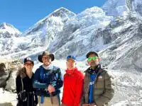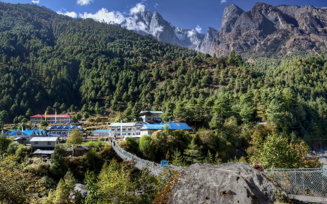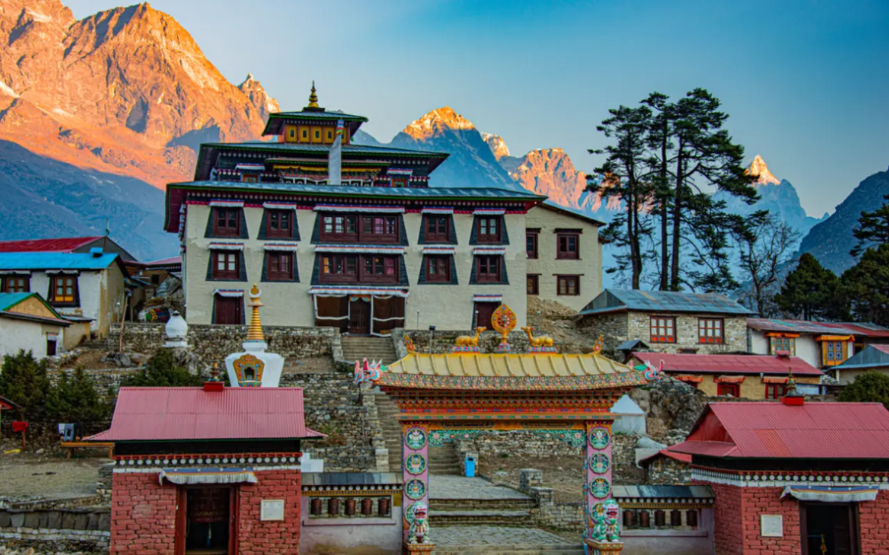
On the mountains of the Himalaya, the voices of chanting travel with the breeze. As you walk along the Everest Base Camp trail, you will be greeted by a huge monastery that is surrounded by bright white mountains. This is Tengboche Monastery, where mountain adventure and spiritual peace come together
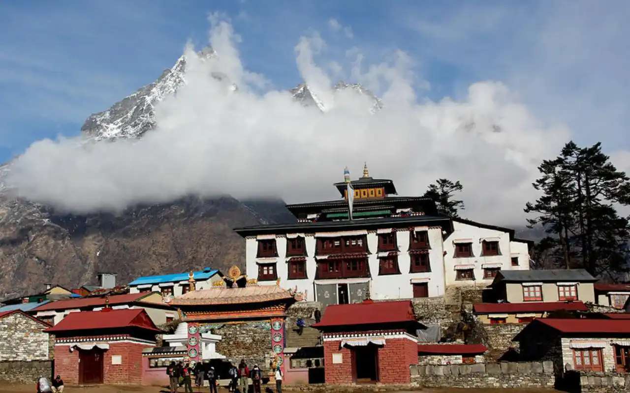
Tengboche Monastery (also known as Thyangboche) is a Tibetan Buddhist gompa at an elevation of about 3,867 meters (12,687 ft). It stands on a ridge of a hill at the confluence of the Dudh Koshi and Imja Khola rivers, with the iconic Mt. Ama Dablam standing as a beautiful backdrop.
Strategically situated on the route to the Everest Base Camp, the monastery is both a sacred pilgrimage site and a spiritual stopover on the journey for trekkers and mountaineers to higher altitudes. For the people on the trail, this hilltop sanctuary is not only a place to see jaw-dropping mountain views, but also a place of peace to reflect and gain insight into the culture.
How to Get to Tengboche Monastery
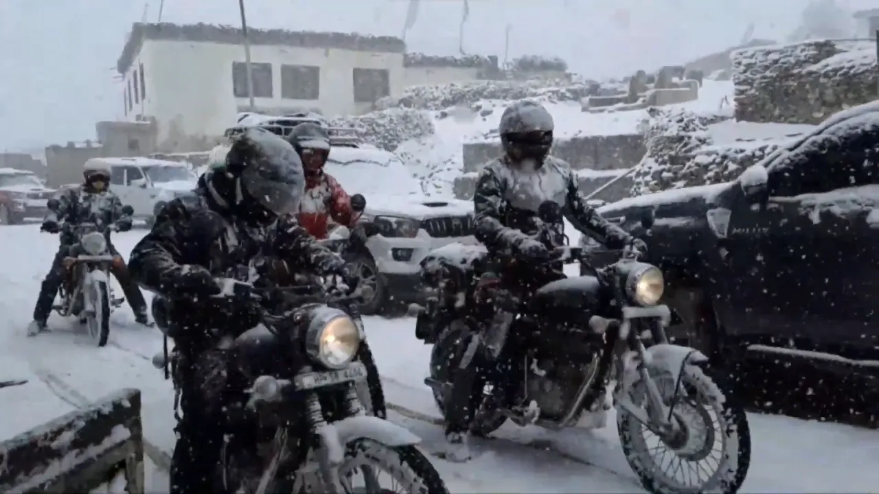
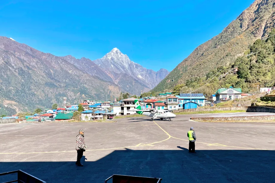
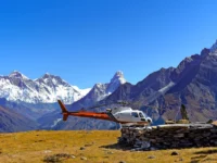
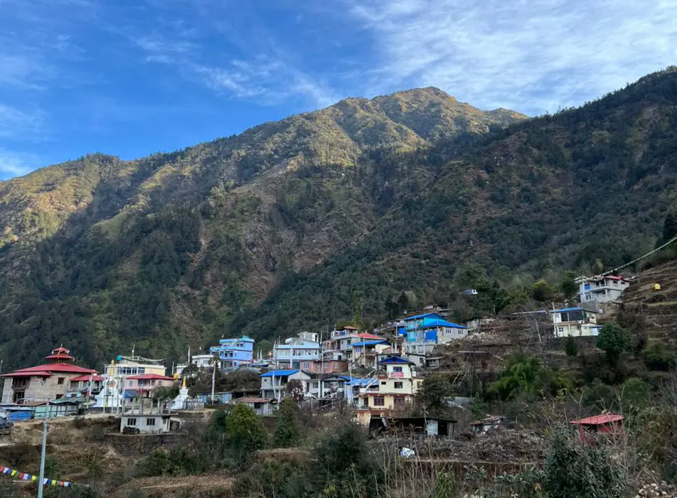
Reaching Tengboche Monastery is an adventure in itself, involving a short flight and a multi-day hike. Most trekkers take the initial scenic 25–30 minute flight from Kathmandu to Lukla (Tenzing-Hillary Airport), a legendary airstrip hugging the mountains at 2,860m. From Lukla, it will normally take two to three days trekking to reach Tengboche, with an important acclimatisation stop in Namche Bazaar, on the way.
The route is Lukla – Phakding – Namche – Tengboche. Trekkers cross high suspension bridges draped with prayer flags and climb steep trail sections such as the “Namche Hill” and later the Tengboche Hill climb that gains over 600 m of height from the valley of the Dudh Koshi River.
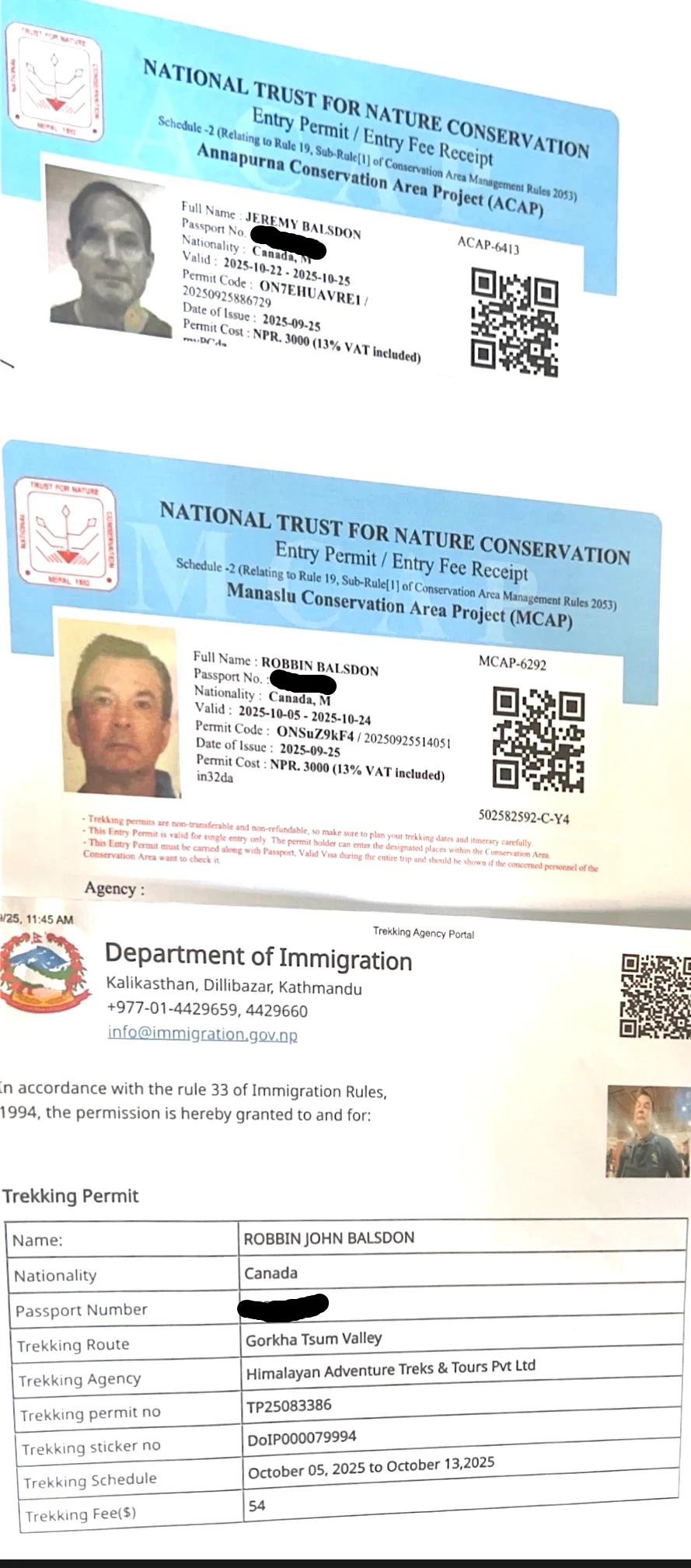
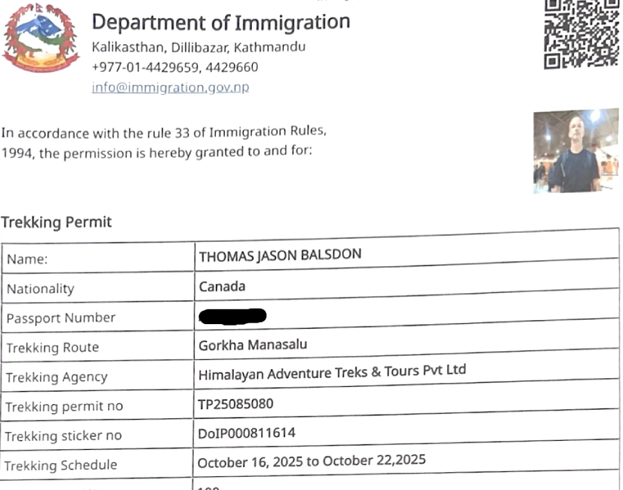
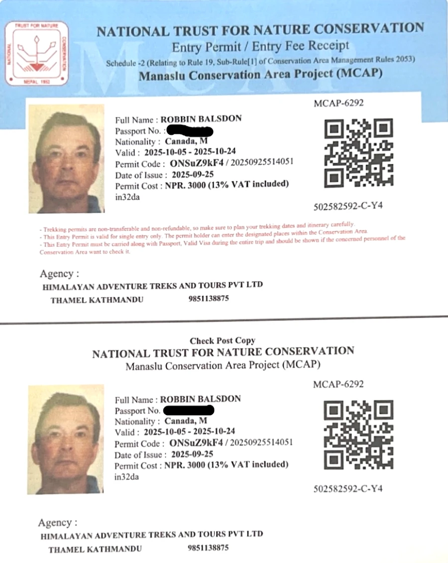
Permits: In order to trek in the Everest region, you have to acquire two types of permits: the Sagarmatha National Park entry permit and the Khumbu Pasang Lhamu Rural Municipality entry permit. These can be acquired in Kathmandu or at checkpoints (Lukla or Monjo) on the trail.
As of recent years, the Sagarmatha National Park permit is NPR 3000 per person, and the local permit Khumbu is NPR 2000 (around $30 and $20 USD, respectively).
Be sure to carry these documents as they will be checked at park gates. While hiring a guide or a porter is not compulsory for the Everest Base Camp Trek route but it is highly recommended for the purpose of safety and to gain a rich understanding of local culture.
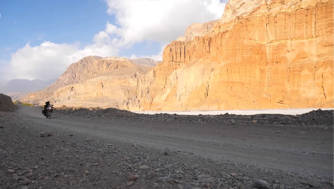
Alternate routes: For the really adventurous, you can also trek to Khumbu from roadheads such as Jiri or Phaplu, which was the classic approach before the Lukla airport. This adds a week or more walking through hill villages, and is rarely chosen today, but does give a taste of traditional trekking life. Most of the travelers are now preferring to fly to Lukla to save time.
History and Cultural Significance of Tengboche
Tengboche Monastery has a rich history intertwined with the Sherpa culture of Khumbu. Lama Gulu, who was a staunch Nyingma Buddhist monk, established it in 1916, after a prophecy, revealing that this would be a holy place.
In fact, according to a local legend, Lama Sangwa Dorje in the 17th century meditated on this ridge and is believed to have left his footprints on rocks in the future, predicting the establishment of the monastery.
Tengboche soon became the spiritual center of the Sherpa people, and monks of the neighboring villages began congregating there and got their religious education as well as the community ceremonies.
Moreover, Tengboche has also been subjected to a lot of suffering over the years. Earthquakes in 1934 and fire in 1989 both destroyed the monastery, which was each time restored by Sherpa people and foreign volunteers (such as the Himalayan Trust of Sir Edmund Hillary).
The modern building, including complex wood carving, a colorful prayer hall, and a big Buddha statue, can be regarded as living evidence of the power and belief. Culturally, Tengboche Monastery remains the heart of Sherpa Buddhism in the Everest region.
It is based on the old Nyingma tradition of Tibetan Buddhism and is even spiritually connected with the famous Rongbuk Monastery located on the Tibetan side of the Everest.
These days, there are approximately 50–60 monks (including young beginners) who live and train here. Several Sherpa families visit Tengboche to enjoy blessings, and monks with this gompa also tend to preside over spiritual rituals and festivals in Khumbu.
Notably, one of the first Everest summiteers, Tenzing Norgay Sherpa, spent part of his youth studying at Tengboche Monastery – highlighting the deep connection between this site and Sherpa heritage.
A visit to Tengboche is not merely a step into the realm of living history, but also an opportunity to have a glimpse of the religious-centered culture, which forms the backbone of life in these mountains.
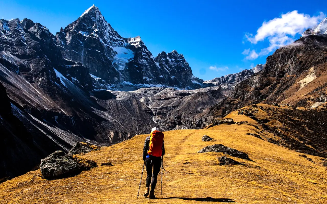
Scenic Splendor on the Everest Trail
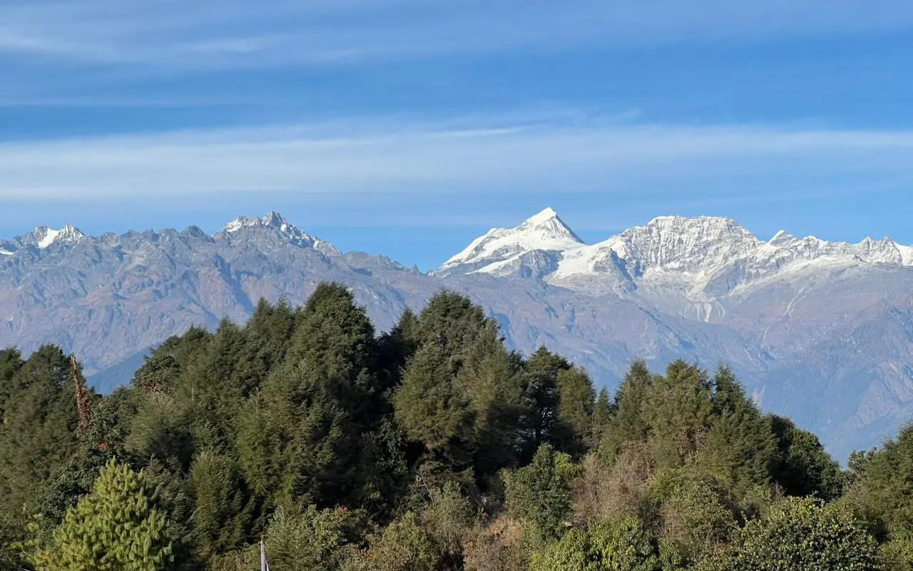
The location of Tengboche is far more spectacular than. This monastery is located on a high ridge within the Sagarmatha National Park, which is a UNESCO World Heritage because of its awe-inspiring views and biodiversity. Those who have trekked around the monastery are provided with a 360-degree view of the Himalayan peaks.
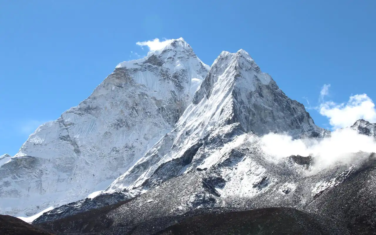
The pyramid of ice of Ama Dablam (6,812 m) stands tall above Tengboche, and this is among the most photographed Nepalese mountains. You will even be able to see the tip of the mountain Everest itself sticking out of the Nuptse ridge in the distance, which is quite an exciting sight for a trekker.
Lhotse, Nuptse, Thamserku, Kangtega, and others are other giants that can be seen on clear days. These mountains are painted by the sunset and sunrise with bright colors, which is why it is better to wake up early or stay during the night in the cold air to see the alpenglow.
Tengboche is as spellbound by the natural environment. The hillsides to the monastery are lined with Lush rhododendron and pine forests (particularly in spring when the rhododendrons bloom).
There is wildlife here, and trekkers occasionally see musk deer or Himalayan tahr (mountain goats) grazing on the slopes, and colourful pheasants (the Danphe, the national bird of Nepal) rustling in the undergrowth.
Eagles and lammergeyer vultures fly overhead on the thermals. Prayer flags fly around, and the wind blowing off the mountains often fills the air, promoting the feeling of tranquility and holiness.
Tengboche is a relief destination on the main Everest Base Camp (EBC) trail for the trekkers who are going further up. It has a large open area where trekkers can stretch out, relax, and acclimatize with breathtaking views.
Tengboche is regarded by countless expeditions and trekkers as a spiritual gateway, a place to rest and to prepare mentally for the things to come. Actually, the practice of climbers on their way to Everest or other mountains visiting Tengboche to burn incense or be blessed by a monk to have good luck and a safe journey is usually common. When you are surrounded by the grandeur of nature and the devotional ambiance, a sense of pilgrimage is certain here.
Festivals and Spiritual Events at Tengboche
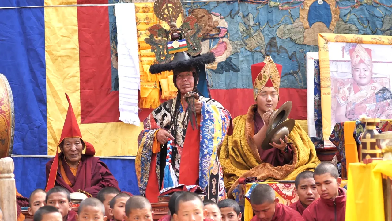
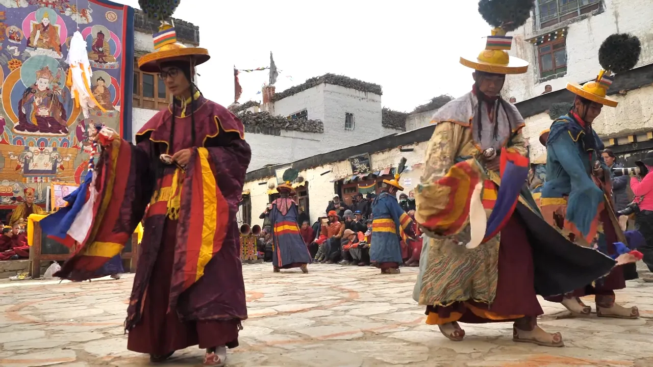
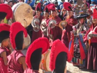
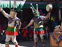
Each autumn, Tengboche Monastery bursts into color and song during the famous Mani Rimdu Festival. This is a rich Buddhist festival performed in October or November (dates are observable according to the Tibetan lunar calendar) and lasts 19 days, with three days of open celebrations.
To recreate ancient myths and the victory of the Buddhist religion over the evil spirits, monks engage in sacred Cham dance in full gear, costumes, and masks in the monastery yard.
The Tibetan horns, cymbals, and the chanting are heard against the mountain when the local Sherpa villagers and the curious trekkers flock to see the show. Tengboche is a cultural meeting point of Mani Rimdu: not only do visitors get an opportunity to observe Sherpa and Tibetan rituals close up, but locals are also given vital blessings.
It can be most rewarding to plan your trek to fall on the Mani Rimdu. The festival is usually held in the late month of October or early November when the post-monsoon trekking season is at its peak due to the excellent weather and sights.
Note that at this time lodge becomes very busy. In case you want to go there, you can reserve your hotel room, or you can always keep in mind to camp or stay in the villages nearby (Deboche or Pangboche) during the festival.
Aside from Mani Rimdu, Tengboche Monastery holds smaller ceremonies and daily prayers year-round. Those who come later in the afternoon may even silently watch the evening puja (prayer ritual) in the main hall, as deep-throated chants and drumming provide a hypnotic effect. Viewing these religious practices in such a location is usually the highlight of the whole walk.
Visiting the Monastery: Etiquette and What to Expect
Visiting Tengboche Monastery is a special experience, and a few simple guidelines will help ensure it remains respectful and peaceful for everyone. Visitors are normally allowed to visit the monastery at any given time during the daytime, except when the monastery is closed due to some personal ceremonies.
The entry fee is not high because no fee is paid, and the trekkers are free to get inside and view the courtyard and prayer hall of the monastery. It should be remembered that it is a living and breathing place of worship and is home to monks, hence one should be aware of the local practices.
Respectful Etiquette Tips:
- Dress Modestly: Wear clothing that covers your shoulders and knees. Keep in mind that it is a religious place, rather than a tourist attraction.
- Take off Shoes: Shoes or boots should not be worn inside the temple, as all shoes should be left at the doorstep. And take off any hats, that is a sign of respect.
- Stay Quiet: Arrive unobtrusively and do not talk loudly or cause a commotion. Unless a prayer ceremony is in progress, sit or stand silently at the back.
- No Photography Inside: Photography is typically not permitted in the interior of the prayer hall, particularly during services. Never point a camera at monks or religious objects; do so only with permission and never use a flash.
- Hands Off Holy Objects: Do not touch statues, altars, musical instruments, or any other ritual objects. Not even the turning of prayer wheels within the monastery should be done without seeing locals.
- Clockwise Circulation: As one goes round stupas or mani stone walls on grounds, one should do so in a clockwise fashion. This is based on the Buddhist tradition and is regarded as a respectful one.
In the central prayer hall (gompa), you may look forward to a big golden statue of Buddha calmly over the rows of cushions on which the monks sit in prayer. Colorful thangkas (holy paintings) and elaborate mandala murals are painted on the walls. Butter lamps are flickering before the altars, and the air usually has the vaguely burning smell of incense.
You can be fortunate enough to attend one of their prayer sessions and hear the monks reading and chanting Buddhist scriptures or playing traditional instruments such as long horns, drums a sort of goosebump-inducing noise in the quiet high mountain air.
These rituals are normally permitted such that a visitor can sit either to the side or back of the hall and quietly observe them. When nobody is praying, the atmosphere of the hall is still calm and allows one to meditate.
Among the special artifacts to observe right at the entrance to the monastery is the stone footprint that is supposed to have been left behind by Lama Sangwa Dorje centuries ago in a state of meditation. The monks are proud of this relic that was preserved through the 1989 fire (the crack in the rock is still visible as a result of the extreme heat).
A short stay in this sanctuary – in gawking at the painting, or rotating some prayer wheels outside, or merely taking in the quietness – may be a heartrending experience to a trekker.
You may drop by the little shop of the monastery, which sells prayer flags, beads, and a book; the proceeds go to the maintenance of the monastery. And there is usually a donation box in case you want to give something (completely optional).
Accommodation and Food in Tengboche
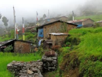
Although Tengboche is a small hamlet, trekkers will be able to find a few lodges and teahouses in this hamlet to stay. The accommodation is simple but comfortable for tired hikers. The teahouses usually have twin share rooms with bare beds (you will have to bring your sleeping bag to keep you warm) and a shared eating hall which is heated by a central yak-dung stove at night.
A comfortable option here is The Himalayan Luxury Lodges in Tyangboche and Phakding. These lodges offer warm rooms, ensuite bathrooms, and peaceful common areas where trekkers can relax. The Tyangboche lodge sits close to the monastery with beautiful mountain views, while the Phakding lodge has cozy riverside cottages. They provide a calm and comfortable rest before or after visiting the monastery.
One of the popular ones is Tengboche Guest House, and two other lodges are also available, all within one or two minutes of the monastery. Even a little bakery at Tengboche has let you indulge in surprisingly good apple pie and coffee at 12,000 feet! Spending days on trail food, it is pleasant to treat oneself to a pastry with an Everest view.
Remember that there are very few facilities. It does not heat bedrooms, and toilets are usually shared (voile squat or western), and hot showers (where possible) are also charged an extra fee. Electric power is most often solar-powered and utilized; charging units or Wi-Fi (assuming its availability) may carry a fee, and may not be reliable. Dining is in the dining room and off of an average teahouse menu – anticipate dal bhat (rice and lentils), noodle or potato dishes, momos (dumplings), soups, and lots of hot tea/coffee.
The food is nutritious and high in carbohydrates to restore energy to the trekkers, and food costs increase with the altitude, as it is challenging to carry food this high. Also, be sure that you have plenty of Nepali rupees because you will not find any ATMs past Namche Bazaar.
The lodges in Tengboche may be filled in the afternoons quite quickly during the high seasons of trekking, particularly in autumn. Big guided groups have a tendency to make advance reservations. In case you get there and no rooms, do not panic; but you can walk 20-30 minutes down the mountain to Deboche, which is a lower altitude village (3,820 m) that has other lodges and a serene nunnery.
The teahouses of Deboche (e.g., the Rivendell Lodge) have rooms in a remote forest environment. Also, when trekking around at the Mani Rimdu festival, it is always a good idea to book in advance since the number of lodges in Tengboche is small and could be occupied with monks, locals, and visitors attending the festival.
Best Times to Visit Tengboche
The selection of the season is sure to make your Tengboche experience enjoyable. A brief summary of what each season is like is as follows:
- Spring (March-May): Spring is one of the most appropriate seasons to hike. It is mostly pleasant, the skies are clear, and the hills are alive with blooming rhododendrons in April and May. Spring is a wonderful season of pleasant weather and bright landscape, but towards the end of May, the climate may begin to get smoky due to the increase in pre-monsoon humidity.
- Autumn (September-November): The high season of trekking – and with reason. Following the monsoon season, the atmosphere is clean and clear. Days are hot (but cold at night), and the paths are swarmed with foreign tourists. The Mani Rimdu festival is also held here during autumn (typically during the month of October/November), and this comes as a bonus to the culture. It will be busy in the most part, particularly in October, but the sight of Everest and Ama Dablam with spotless blue skies is unrivalled.
- Winter (December-February): This is the off-season that is very cold (there is snow and nights are below zero), and some of the teahouses are closed. Nevertheless, the skies are exceptionally clear, and the trails are deserted; hence, adventurous trekkers will have the pleasure of being alone and enjoying the views without another soul in sight.
- Monsoon (June-August): The undesirable period. The trails are slippery, and they are obscured by heavy rain and cloud cover. The weather also causes delays in flights to Lukla. The number of trekkers that visit during the summer is very limited, and those who visit should be prepared to walk muddy lanes and bring proper rainwear. The negatives are, on the positive side, the valleys are very green, and the waterfalls are very loud with rain, a different form of beauty, although difficult to capture the clear mountain scenes.
In most cases, late September to November and March to mid-May are said to be the best times to enjoy Tengboche. This is because these months present the most favorable weather conditions coupled with manageable conditions.
Assuming that you want to be in the Mani Rimdu festival to witness or take part, aim for the fall season. To see flowers blooming and have a somewhat warmer walk, target spring. Always check the weather before you go and have the right equipment.

Blending Spirituality with Adventure
Tengboche Monastery provides a chance for trekkers to nurture the spirit even as they challenge the body. The following are some of the tips that will assist you in carrying out spiritual exploration alongside your trekking adventure:
• Puja Ceremony: Attend a Puja service (prayer service) in the monastery and hope to arrive in time in the morning or evening when the monks are performing their puja. A quiet moment of standing somewhere in the corner when the horns are bellowing hard, and monks are loudly singing, can be an excellent experience, a moment of calmness in your physical process. As a visitor, you are welcome provided that you are respectful and a good listener. A resident lama might even take some time to bless you or pray to you during or after the ceremony.
• Meditate in Nature: Spend some minutes meditating or contemplating at Tengboche. Sit somewhere quiet on the edge of the valley or sit on the monastery steps at sunrise. The flapping prayer flags combined with the mountain silence and the chanting in the distance make an ideal mindfulness environment. A brief thoughtfulness on this side can be an indelible impression of calmness that you will take along the path.
• Ask a Blessing: Assuming you are on a big climb, or even just wish to have a special memory, ask a monk (or, hopefully, the Tengboche Rinpoche) to give you a blessing. A good deal of climbers who pass by Tengboche on their way to Everest and Ama Dablam make a stop in Tengboche to perform a ceremony or be given a sacred bracelet in the form of a string. A basic blessing can be given to calm your mind and have a stronger attachment to the mountains that you are going to tackle.
• Adopt Sherpa Culture: Spend your time in Tengboche to get familiar with the people and their culture of Sherpas and their religion. Talk to your guide/lodge owners about the significance of the prayers and festivals. Stroll in the monk yard and note the ways Buddhism is incorporated into daily life. Through the culture, you will not only be making it a walk, but you will be making it a richer experience in terms of spirituality.
Conclusion
Tengboche Monastery is far more than a scenic photo-stop on the way to Everest – it is often described as the spiritual heart of the Khumbu. Its rich history, the ability to rebuild after every disaster, and serving as the icon of Sherpa Buddhist culture make it a place to visit. Tengboche is a two-hour break with inspiring views where nature and Himalayan culture come together to delight adventure seekers.
Seeing the first light of the sun shining on Everest, almost to the monastery, or hearing the chants of the monks in the mountain wind, are things that linger with the travelers throughout their whole life.
Including Tengboche Monastery in your itinerary adds a layer of meaning to the trek. It serves as a reminder that the Himalayas are not only about standing on taller heights, but also about raising our level of awareness about other lifestyles.
The spinning prayer wheels and panorama of the Tengboche mountains will, perhaps, be among the most memorable moments of your adventure as you go on with your journey towards the Everest Base Camp or down to Namche.
Tengboche Monastery invites you to be not only a trekker conquering trails, but also a pilgrim discovering the quiet joy and inspiration found in these sacred heights.